A non-walking day today. Instead we visited the archaeological excavation/museum at Akrotiri. Like the site at the top of the hill near Kamari, this town dates back to the Bronze age. It was destroyed by the volcanic eruption in 1600-something BC and the excavation has been in progress for some fifty-odd years.
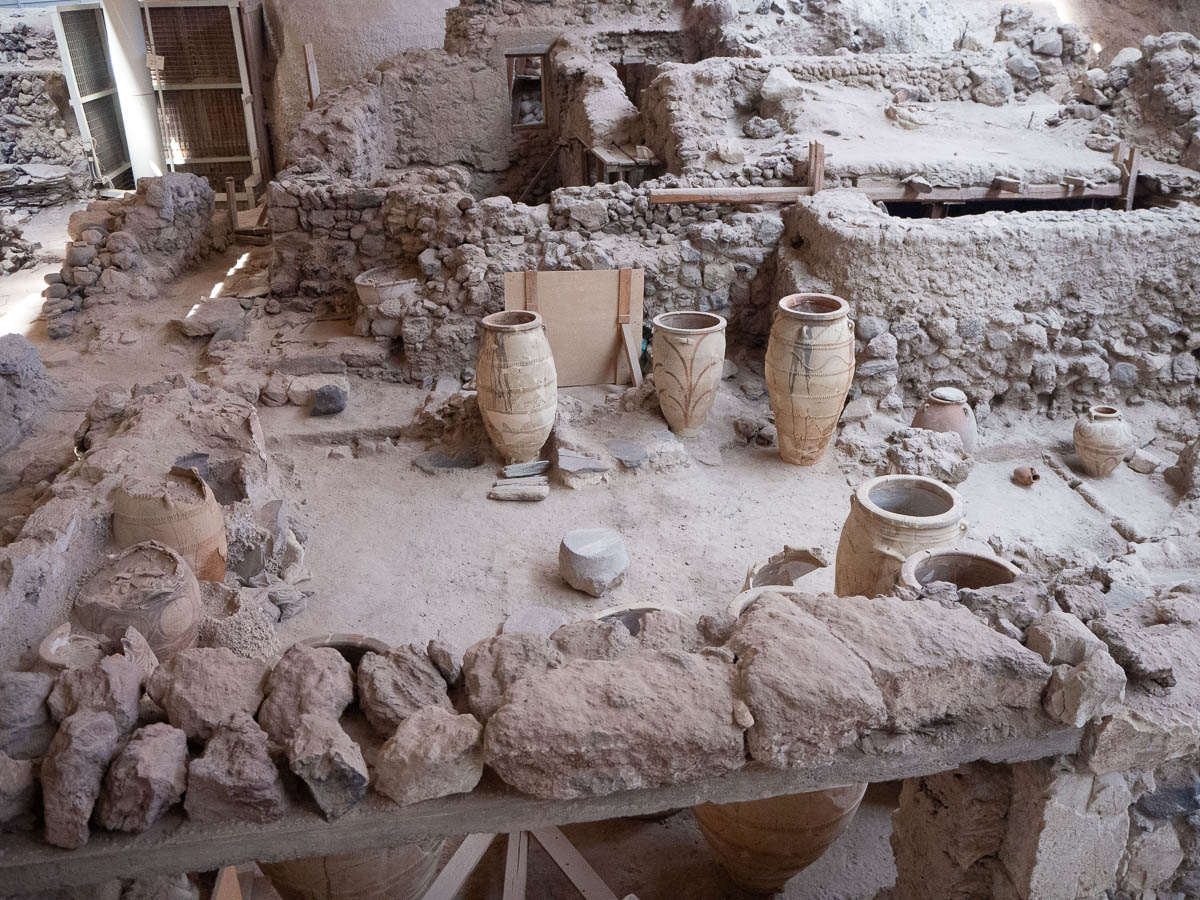
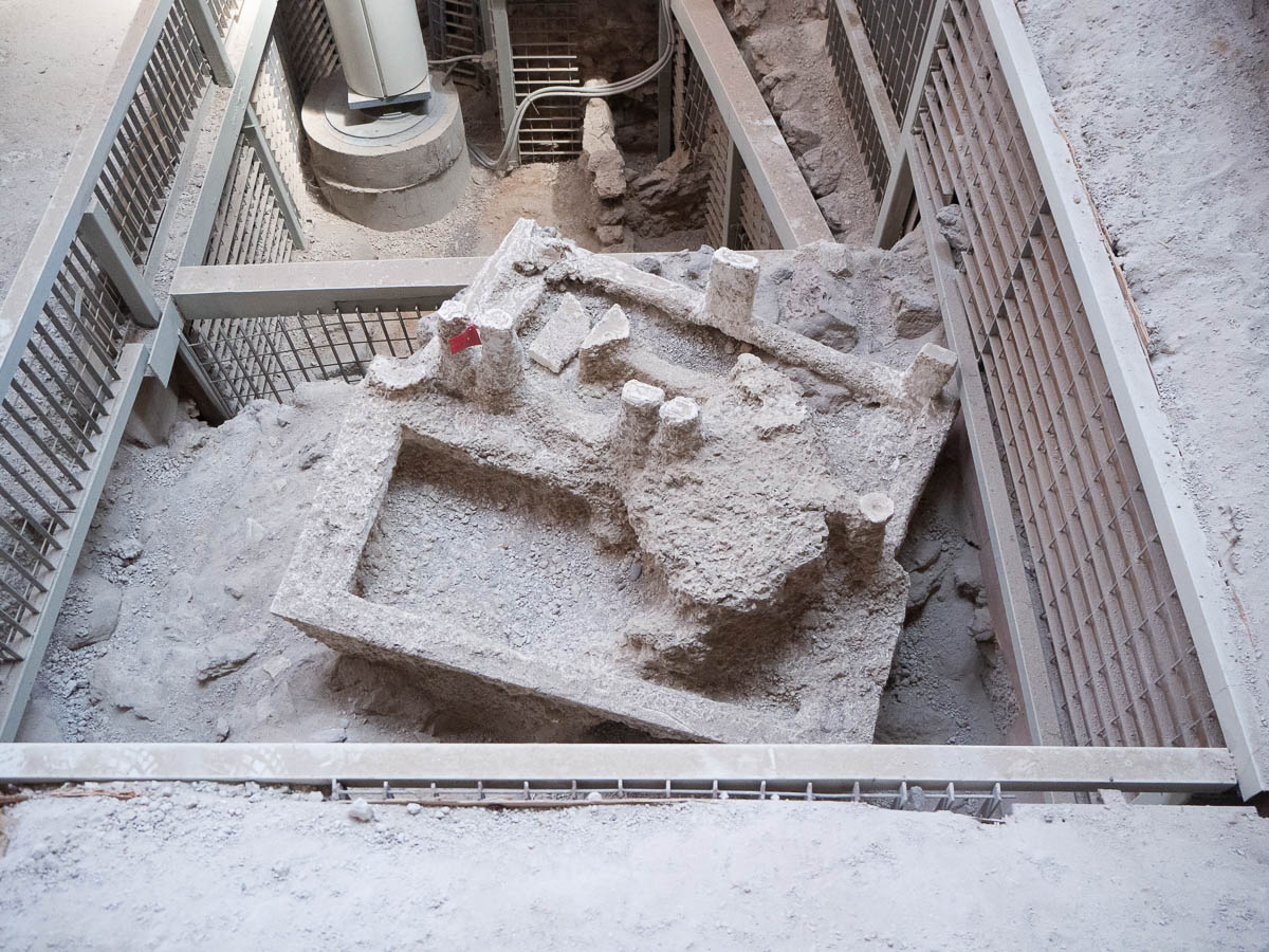
The site was interesting to see, but I was disappointed to find out that absolutely everything they’ve found – tools, household objects, frescoes – has been carted off to museums in either Fira or all the way to Athens. Only the walls and stairs and streets themselves are left here, as well as a few token clay vases, and castings of bed frames, for some reason. (Wooden objects rotted over the centuries, and left behind hollow spaces in the volcanic ash, so when any hollows were found, the archaeologists made casts of them all.) They haven’t even put up replicas or projections or even posters with images.
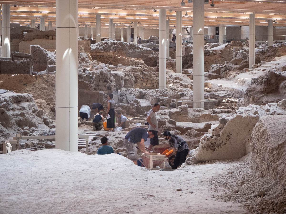
On the other hand, it was interesting to see archaeologists actually at work, with their brushes and sieves and wheelbarrows.
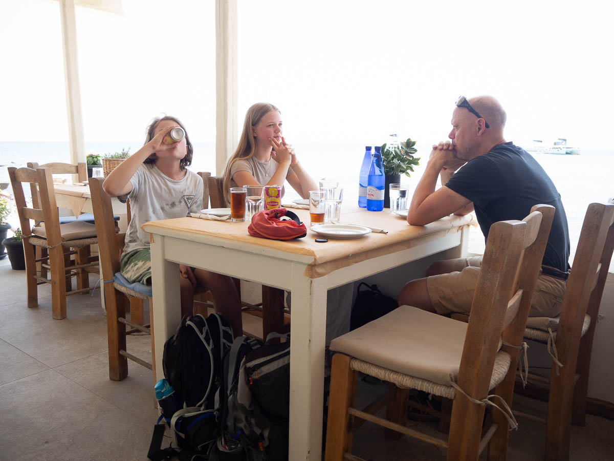
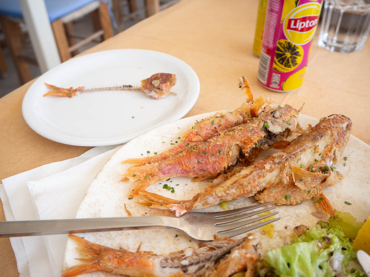
We had lunch at the beach in Akrotiri, which was a much calmer experience than the crowds in Kamari. I wanted to try something local so I ordered red mullet. My plate did indeed contain a bunch of red fish. I was informed that even the fins were usually eaten and would taste like chips/crisps, which indeed they did.
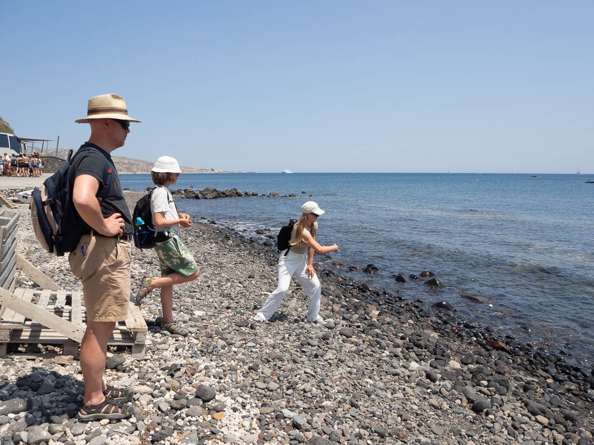
Then we looked at pretty black rocks on the beach, and threw some into the sea.
Fira to Oia is the top item on all “walking on Santorini” lists and articles. So that’s what we did today.
Fira is the main town on Santorini, and also shares its name with the island. Santorini used to be called Thera or Thira, which after a while became Fira. Like many other towns on the island, it’s a cluster of small, white buildings clinging on to the cliff top.
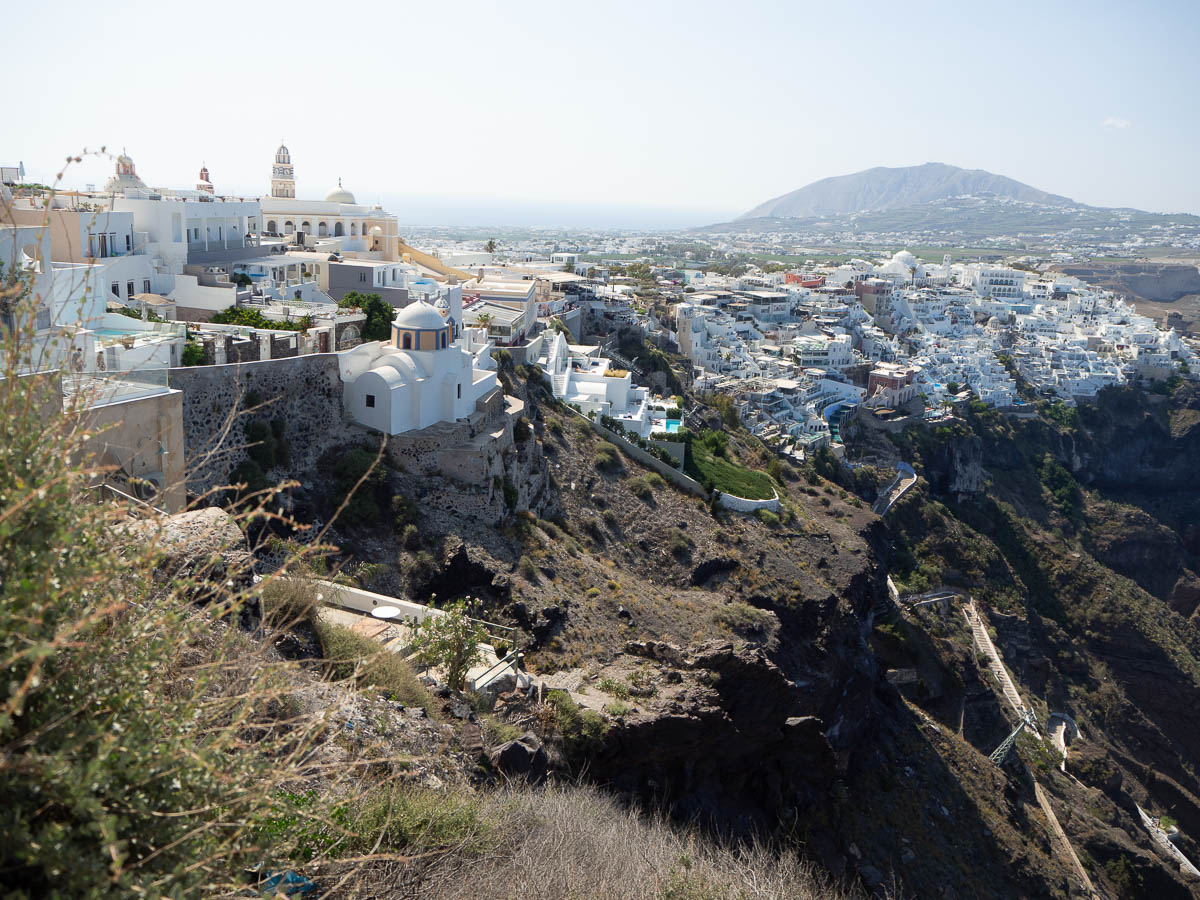
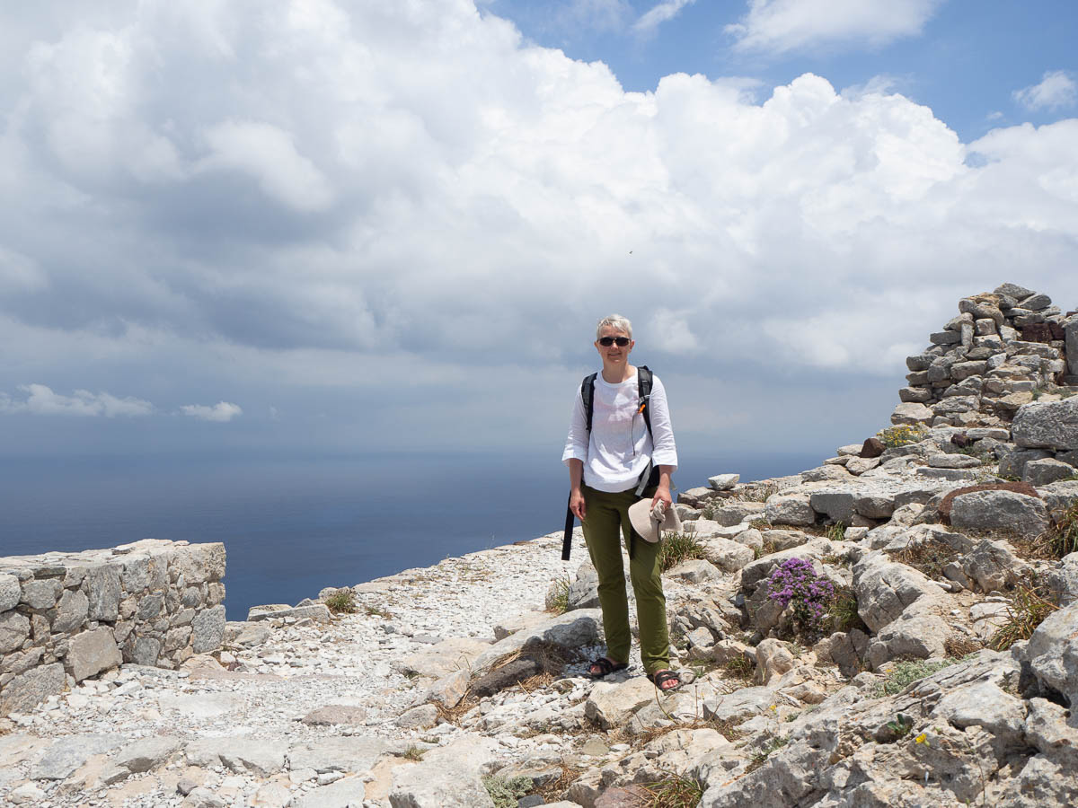
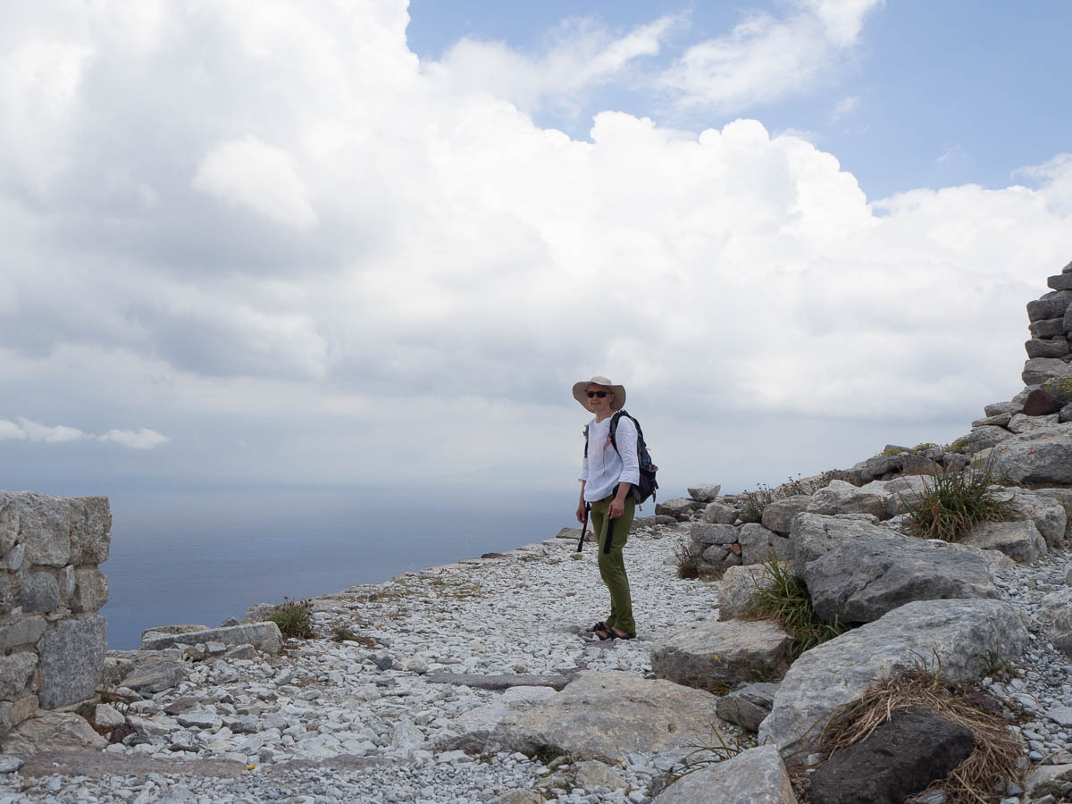
A few kilometres from Fira we came to Skaros Rock, which looks like nothing but a strange rock outcropping from the distance, but turns out to hold the ruins of a Venetian fortification.
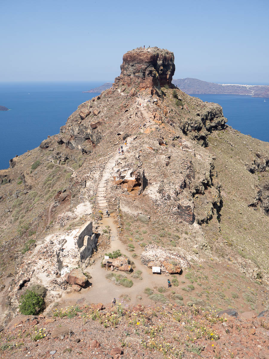
Right next to the ruins there was a loud sign proclaiming the area to be dangerous and forbidden and off-limits, even while there were paths and stairs leading into them. I’m guessing the paths weren’t up to some safety standard so the local authorities were forced to put up a sign to comply with regulations, but clearly they’d realized that actually trying to keep tourists out would lead to more danger of serious accidents than giving them safe paths to walk on.
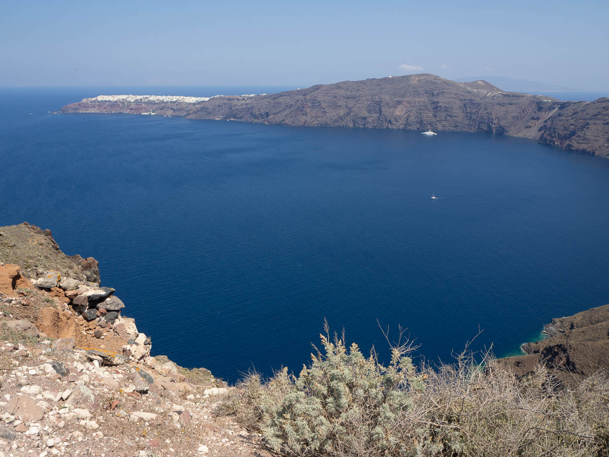
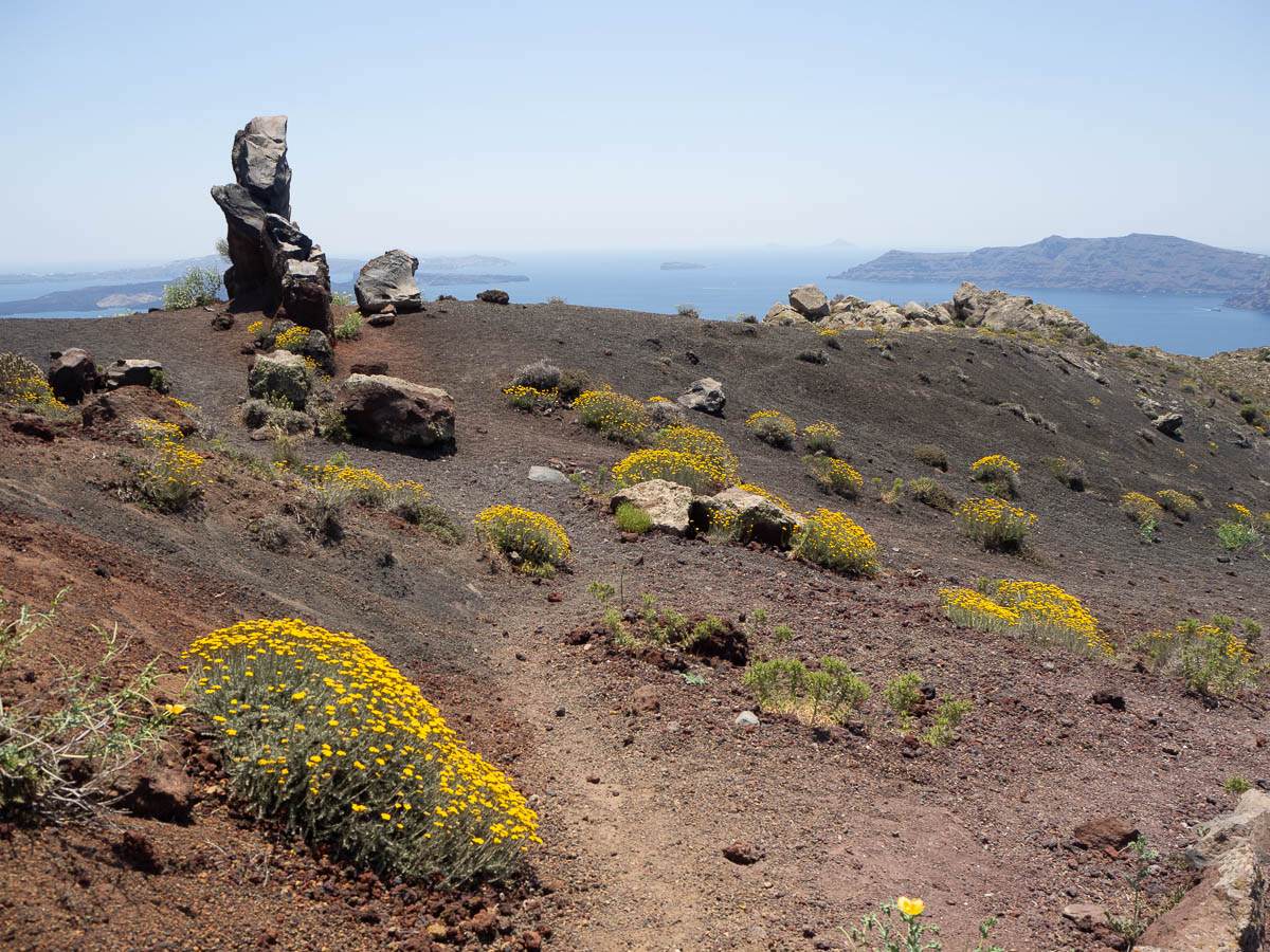
The views from here made the crescent shape of the island and its volcanic origin very obvious.
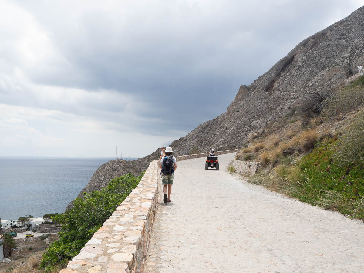
The landscape between Fira and Oia was mostly volcanic semi-desert, occasionally interrupted by tourist accommodation in one shape or another. This island truly has a lot of hotels. Then again, I can’t think of anything else they could do if they didn’t have any tourists, because it’s not like you could grow anything much here.
Tufts of this one plant with yellow flowers seem to be the first ones to take root in the dry volcanic ground.
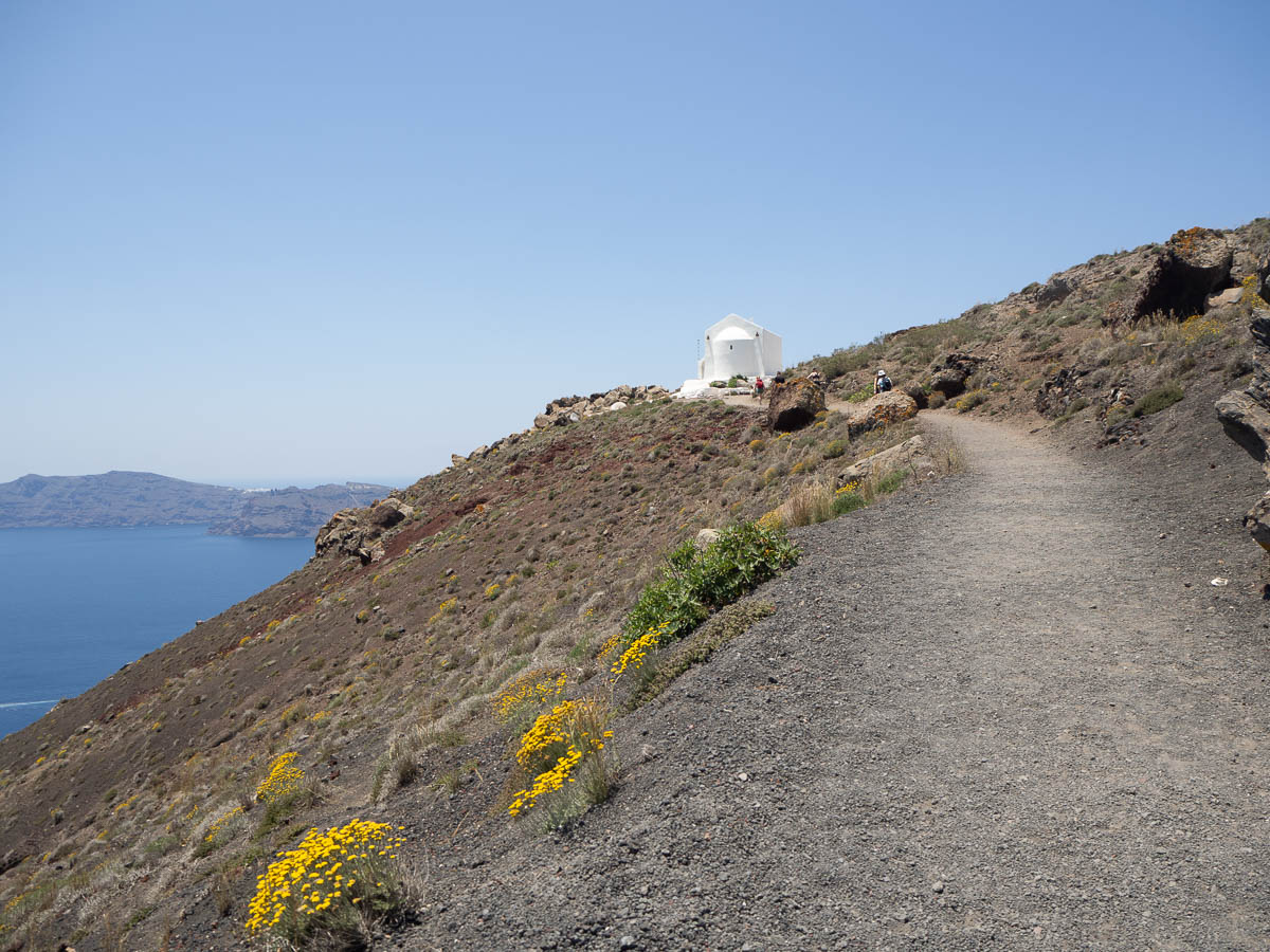
Today there were no clouds and no real shade anywhere. When we finally spotted a sliver of shade along a small chapel in the middle of nowhere, we could finally take a longer break without feeling like we were melting. When we made ourselves small and pulled our legs in close, we could all fit into the shade.
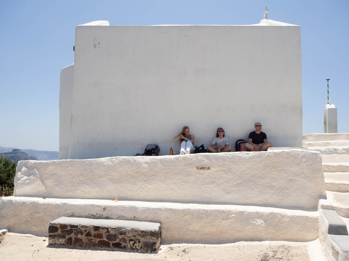
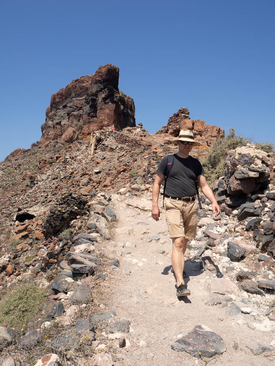
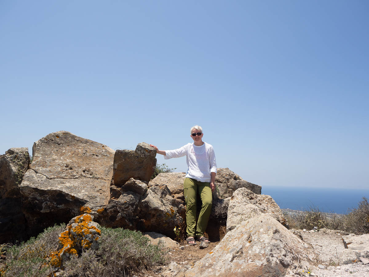
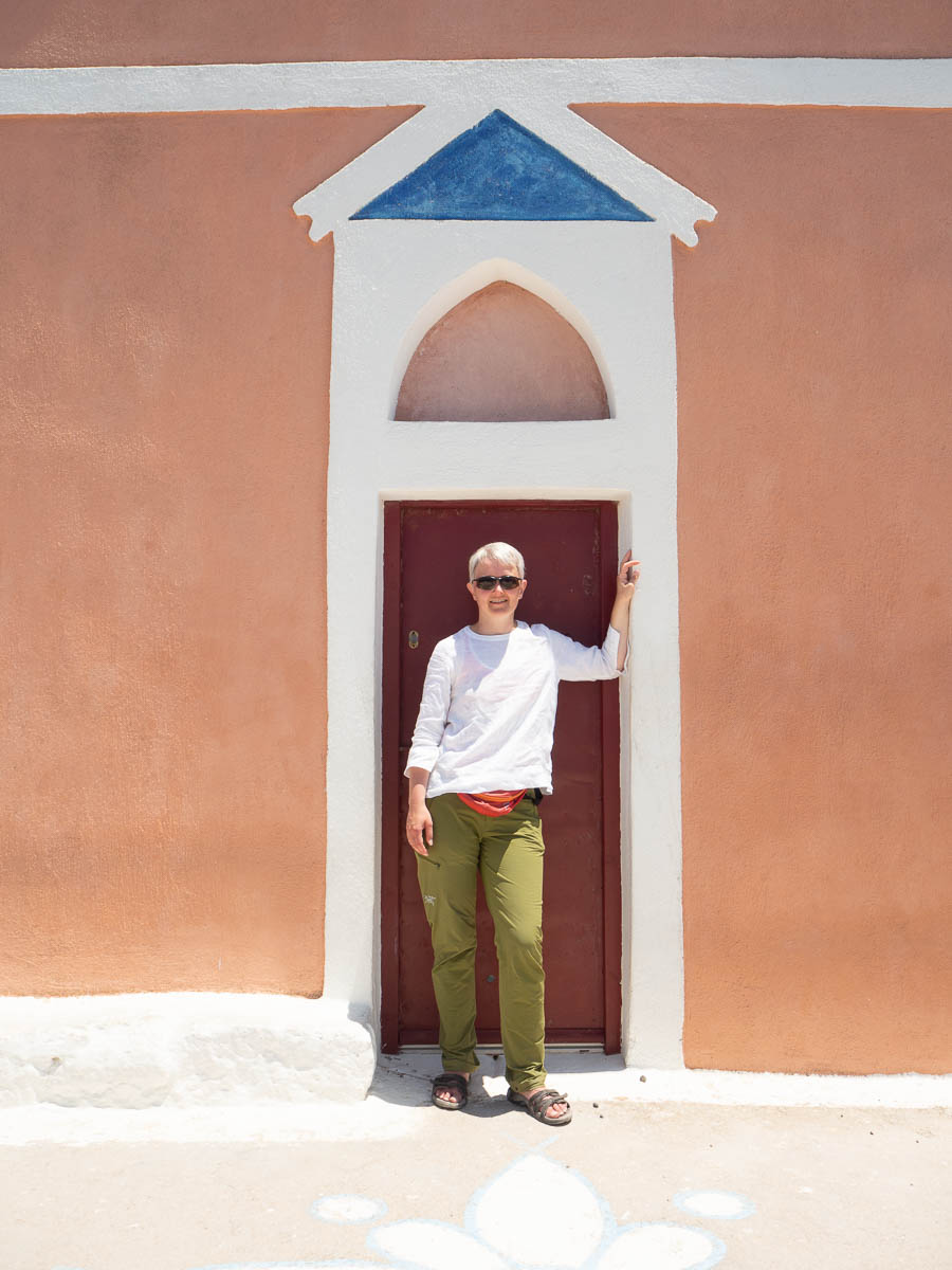
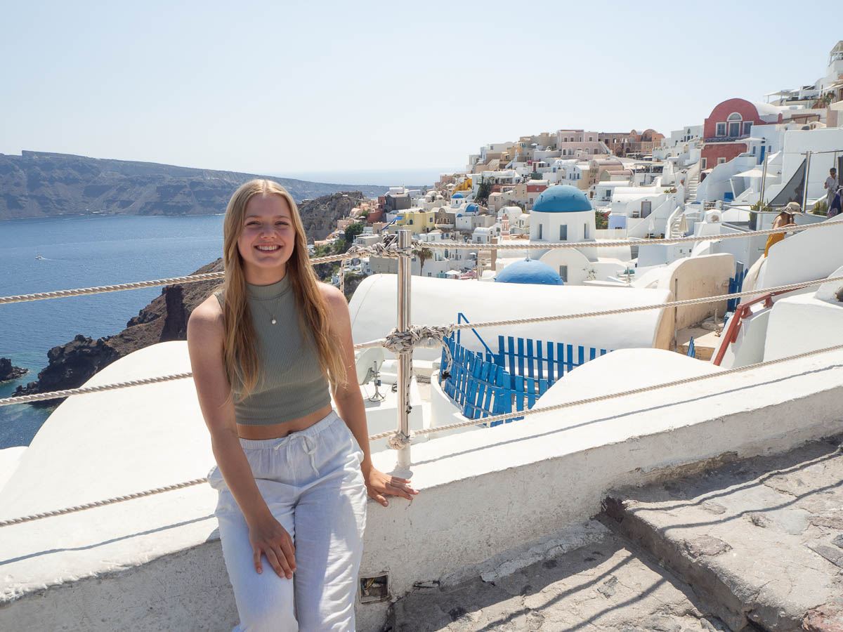
Ingrid kindly took photos of me today again.
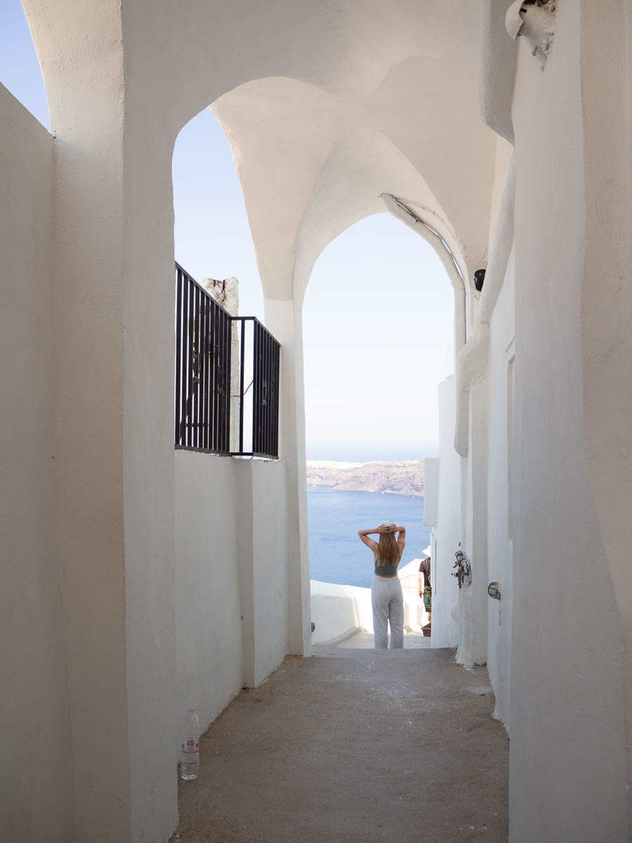
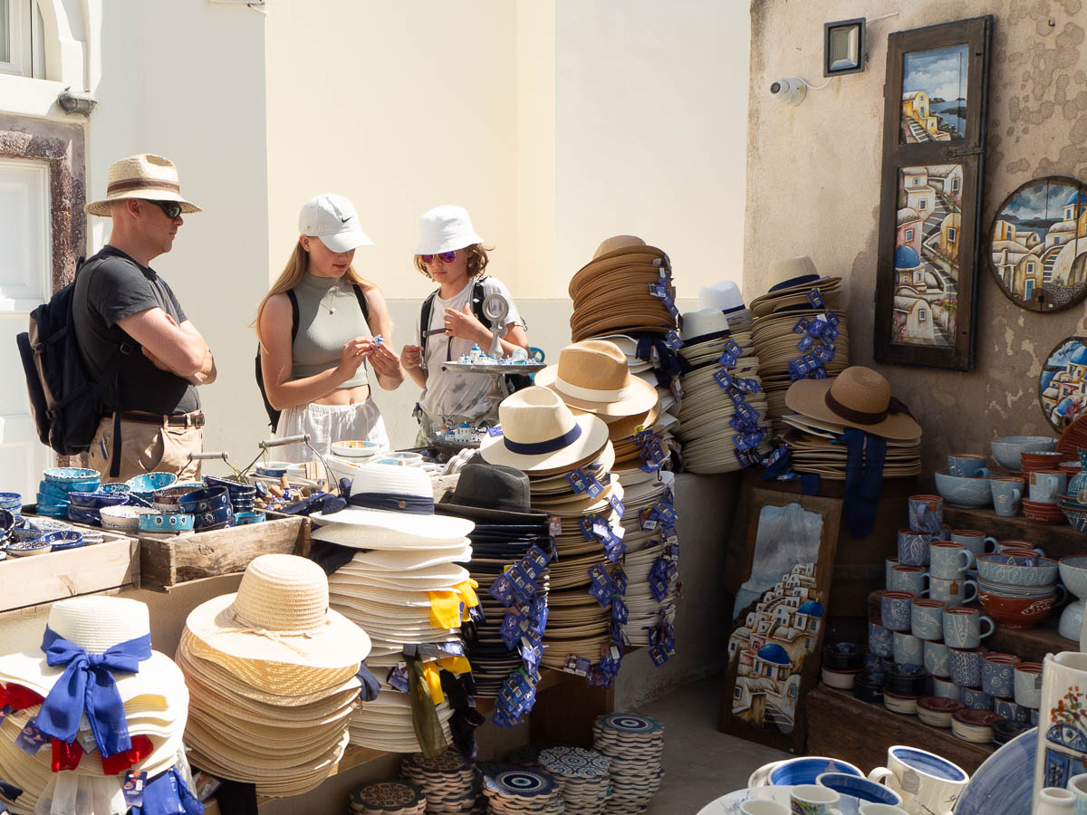
Oia was even more tourist-focused than Fira. Everything was either a hotel, a restaurant, or a tourist shop.
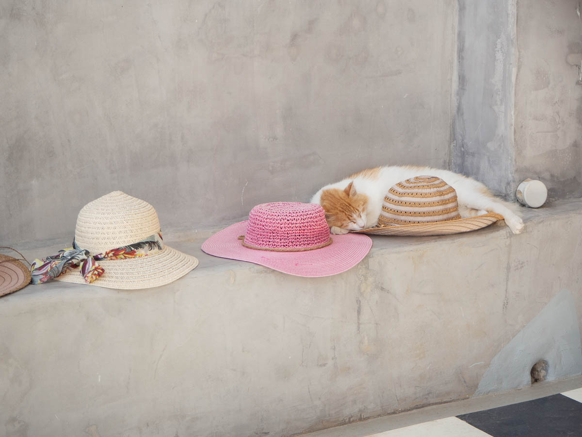
Santorini has a fair number of stray cats, that seem to be tolerated most everywhere. There is one who visits our hotel every morning at breakfast time, whom we already recognize, and we’ve seen others feel at home at cafés and restaurants.
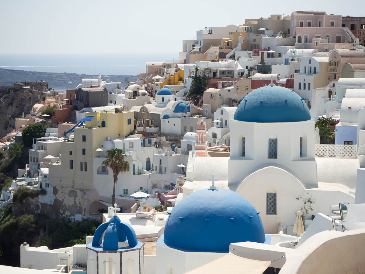
Oia is the town where the most famous photos of Santorini tend to be taken, with its blue-domed white buildings.
Today was the only day of this week for which the weather forecast promised a splash of rain in the morning. It seemed reasonable, looking at the sky, so we hung around at the hotel for a couple of hours before going out. This is our view from the hotel towards our planned walk for the day – that somewhat wooded area on the hills, between the two peaks.
But the rain kept not happening and we kept getting more and more restless, so in the end we just left anyway. Some rain won’t kill us.
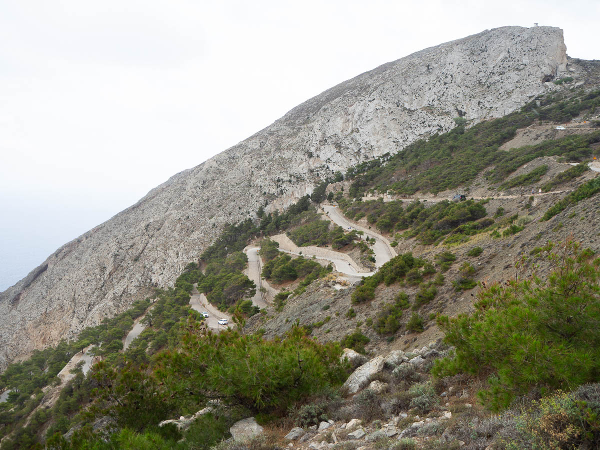
The walking took us up, and up, and up some more. First in zigzags along the road, and, after the pass, along paths and stairs.
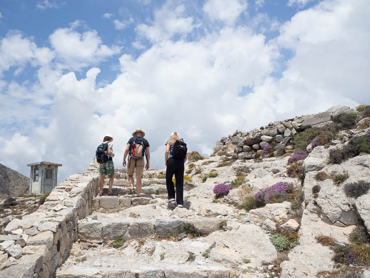
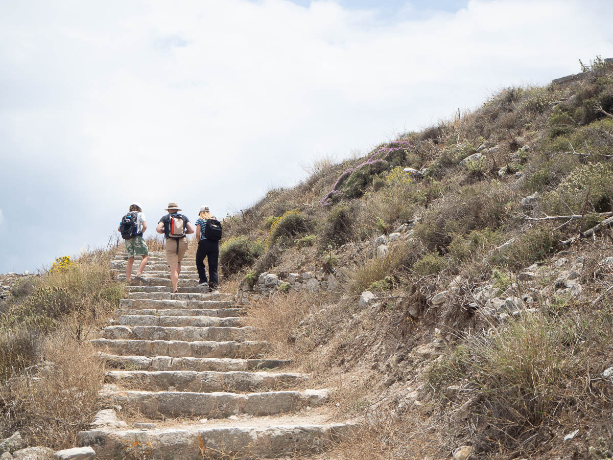
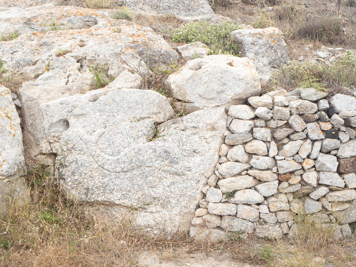
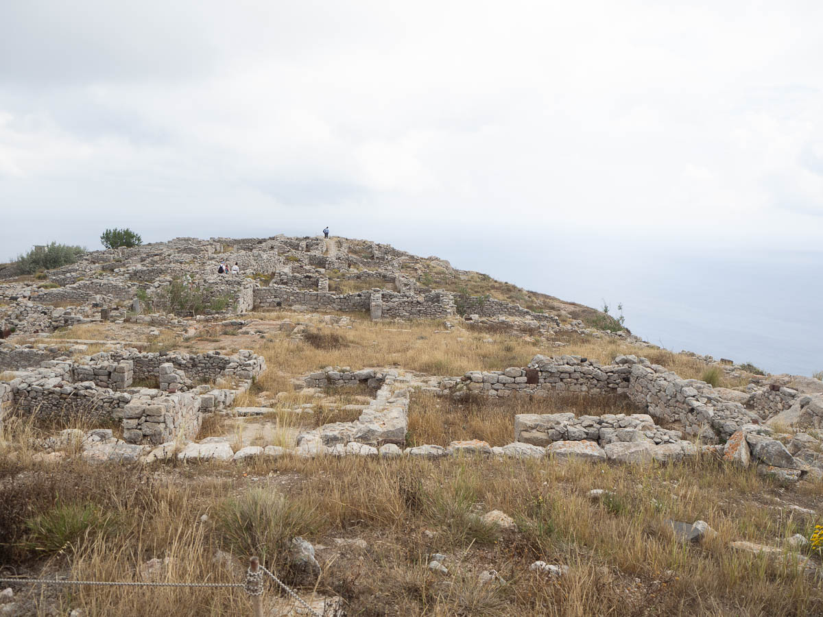
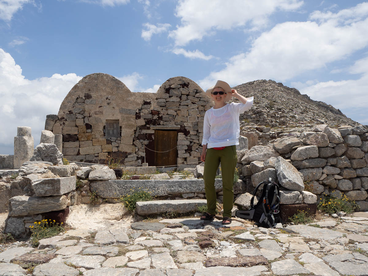
At the top of the hills, we came to the site of ancient Thera, a Bronze Age town destroyed in the volcanic eruption that destroyed most of Santorini and ended the Minoan civilization. It was amazingly well preserved – paths, walls, pillared halls, carved reliefs still fully visible.
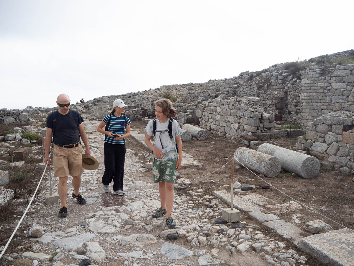
Ingrid kindly took some photos of me. I was there, too! (Holding hard on to my hat because it was very windy up at the top.)
We took a different path down, which gave us a nice view of the road we previously walked to get up the hill.
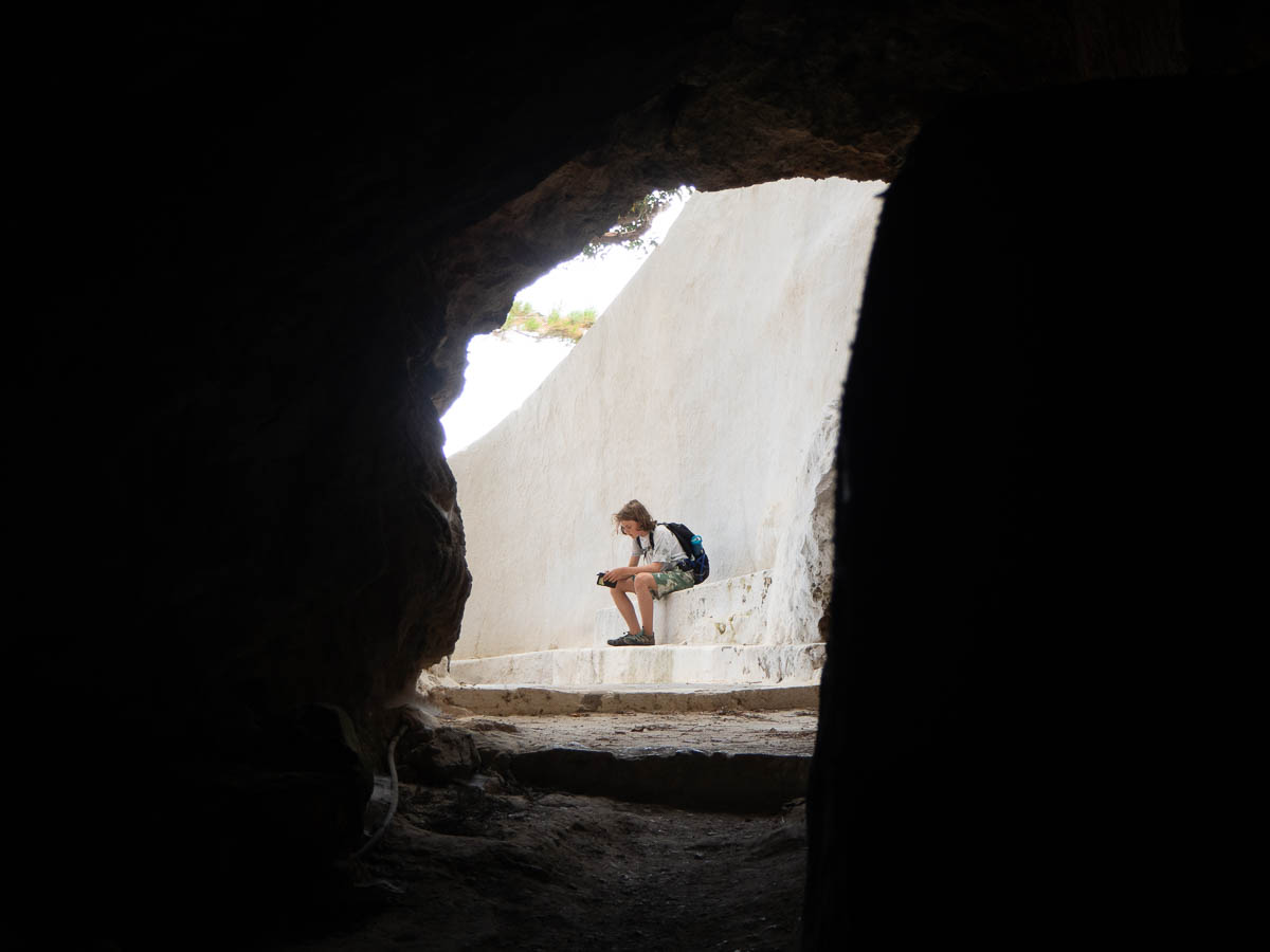
Halfway down there was a cave with a natural spring.
We’d been wondering before why anyone would build a town at the top of the hill where there is no water, but at that time, pre-volcano, the hill was much taller so the town wasn’t at the top. So perhaps they had similar springs there.
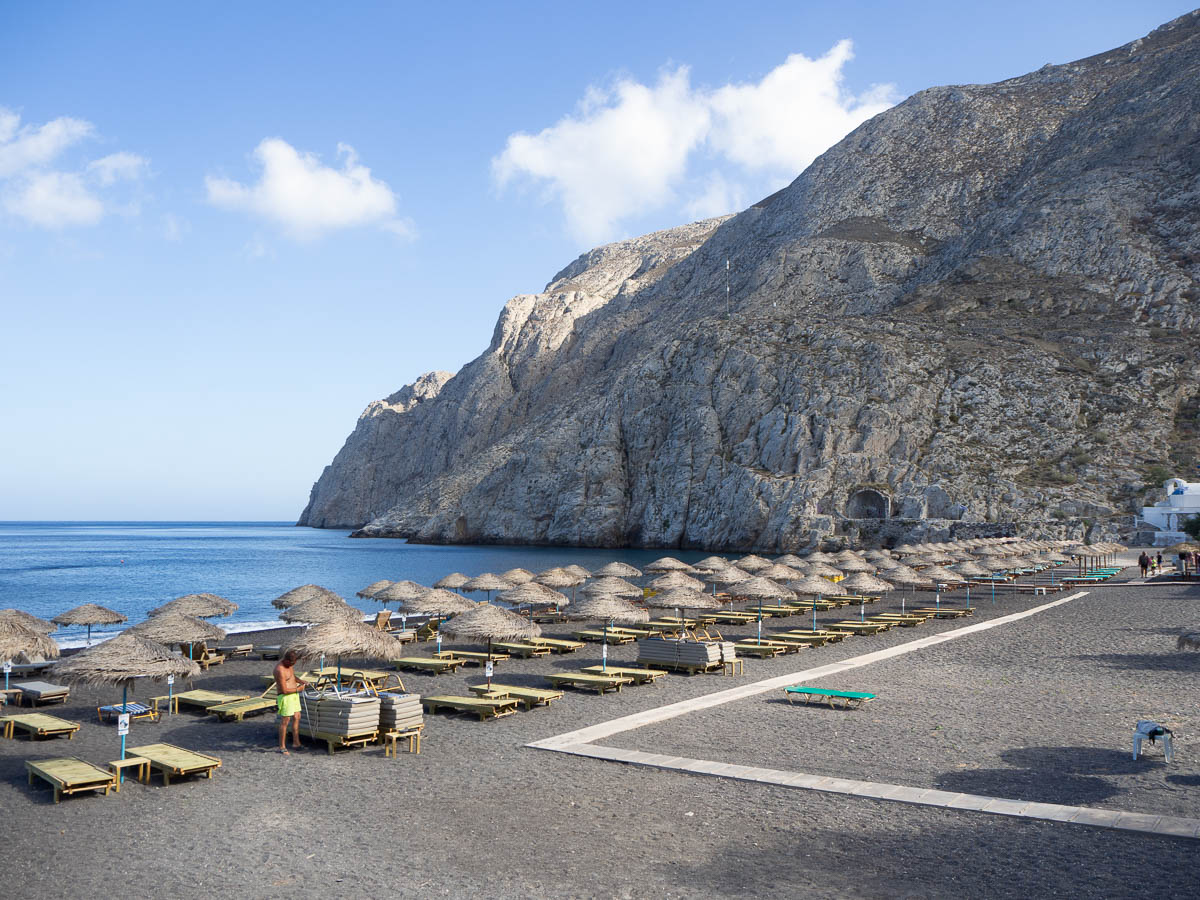
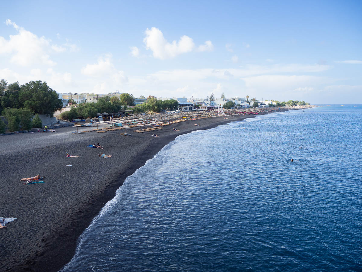
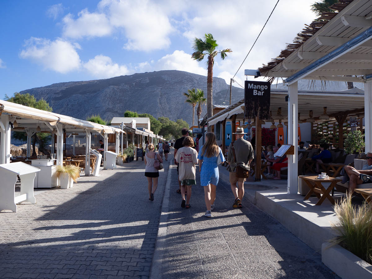
We’re on a week’s vacation on Santorini. Today was mostly travelling, although we had some time in the evening to explore Kamari, the village where we’re staying, and its black pebble beach, and the long beach promenade.
Hoping to not get caught by another heat wave to make hiking difficult, we booked this trip for as early in the season as possible, as soon as school ended. It’s hot, but not unbearably so.
Coming here in June is also good to avoid the crowds that are sure to be here in peak season in July and August – now the restaurants are more than half empty, and there is plenty of room both on the beach and in the streets.
Many hours on a bus, some time on a train, many hours at Oslo Sentralstasjon, and many hours on another train.
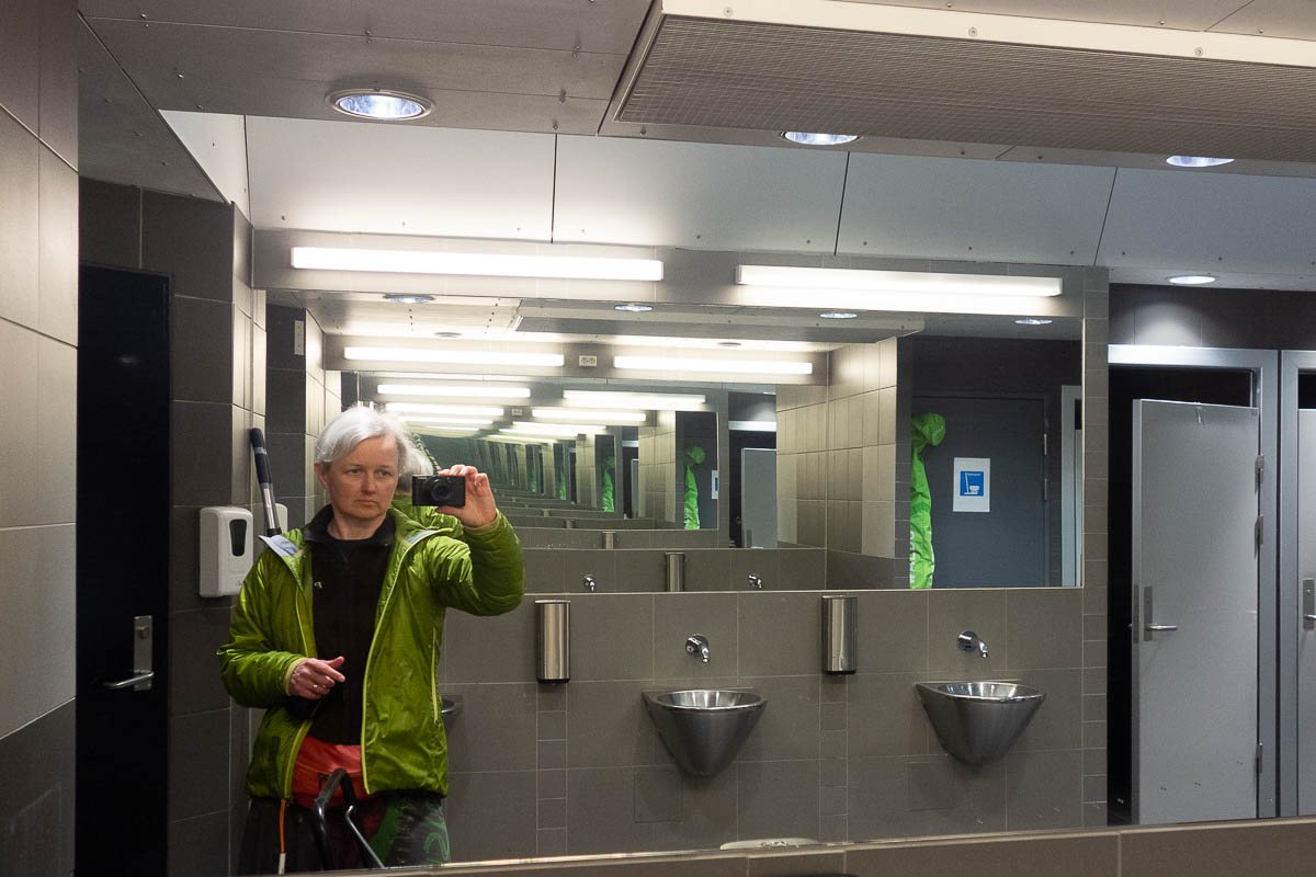
Oslo Sentralstasjon has a bathroom with endless mirrors.
Mårbu to Solheimstulen. Not sure about the distance as I forgot to take notes, maybe 15 km?
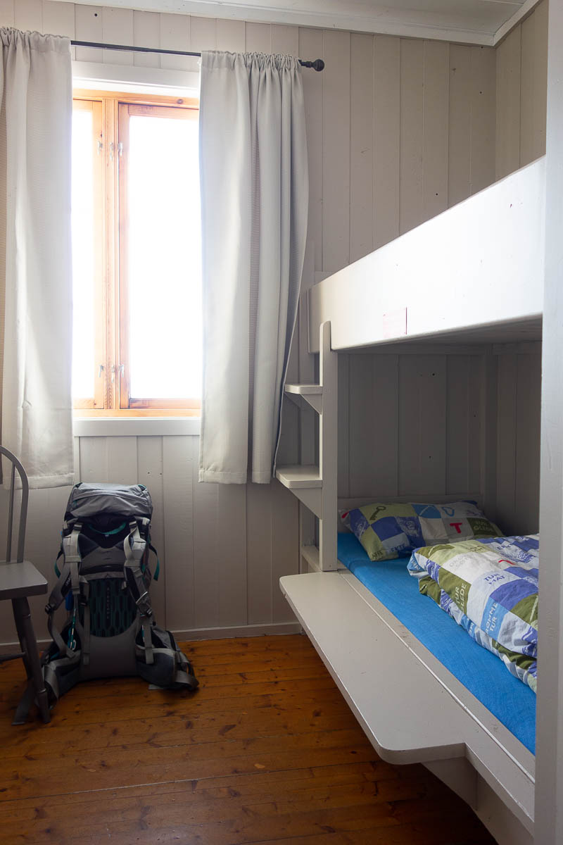
After my trips, skiing or other, I always realize that I’ve only taken photos of the main “attraction” and have few or none of the things around it. The huts, the meals, the breaks, the equipment. And I’ve fallen into the same trap this time.
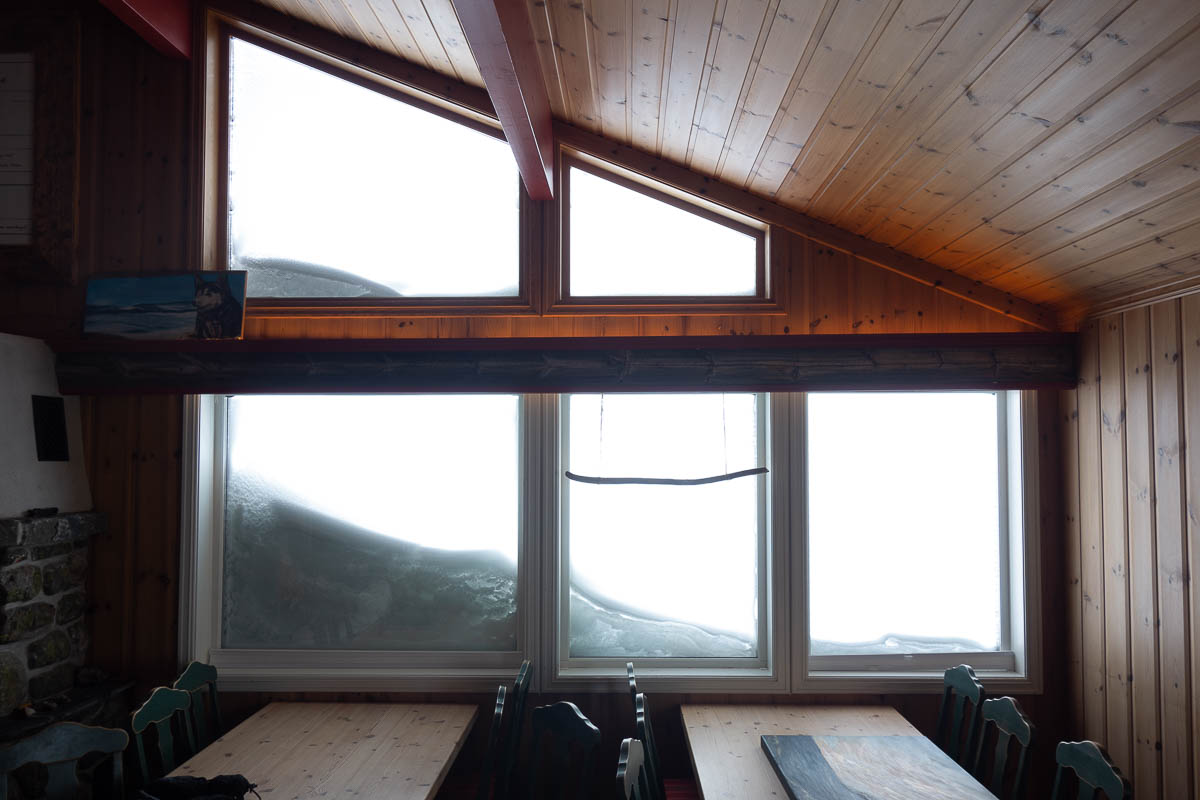
At least I have this one of our room at the Mårbu hut. It’s reasonably typical of what the rooms in the DNT huts look like. Solidly built bunk beds, pine floors, maybe a chair or a small table. Hooks on the wall. Possibly a small stove for heating. Pillow and duvet covered in DNT fabric.
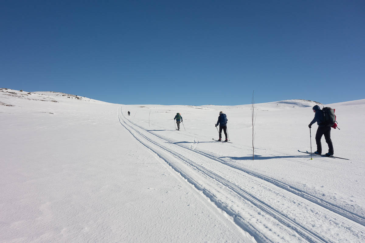
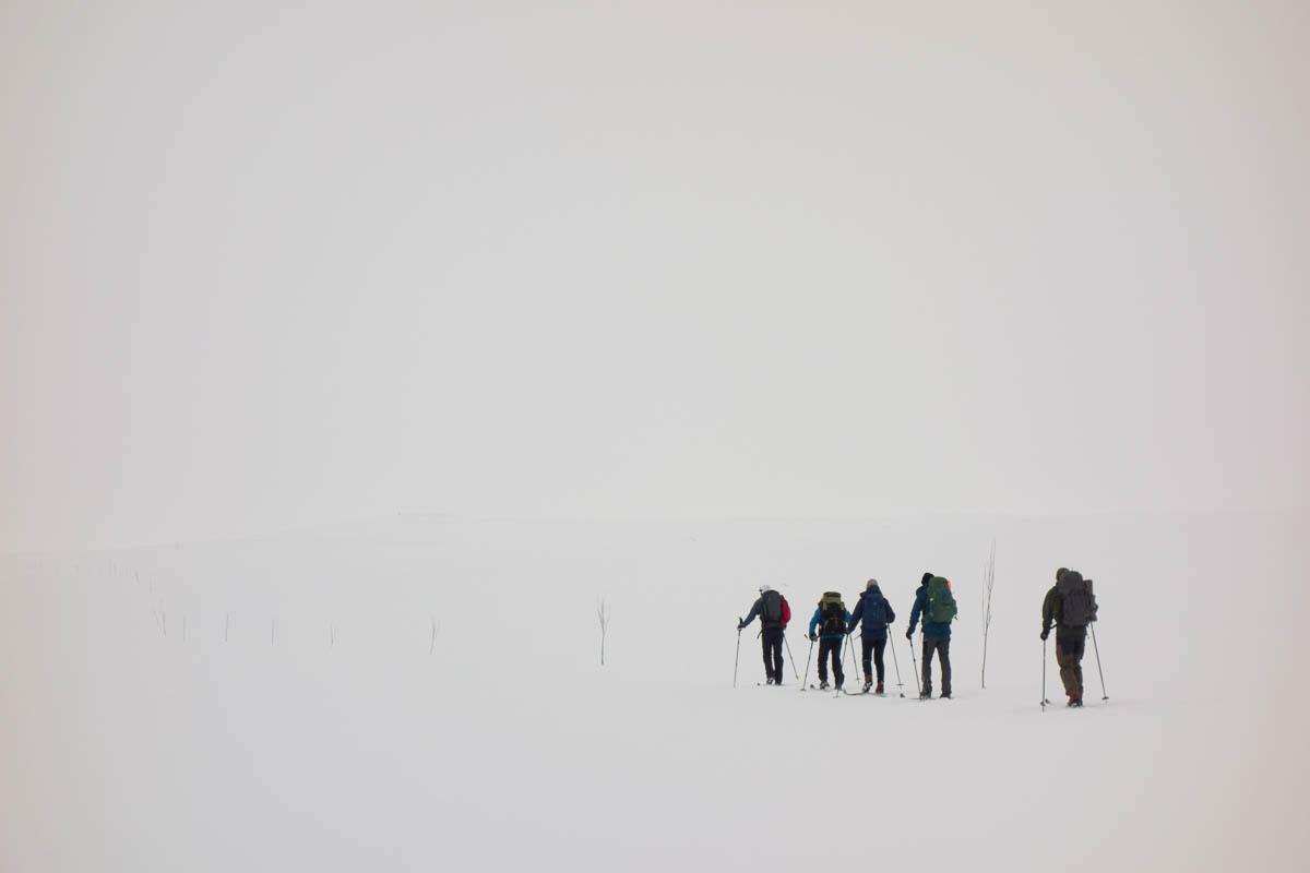
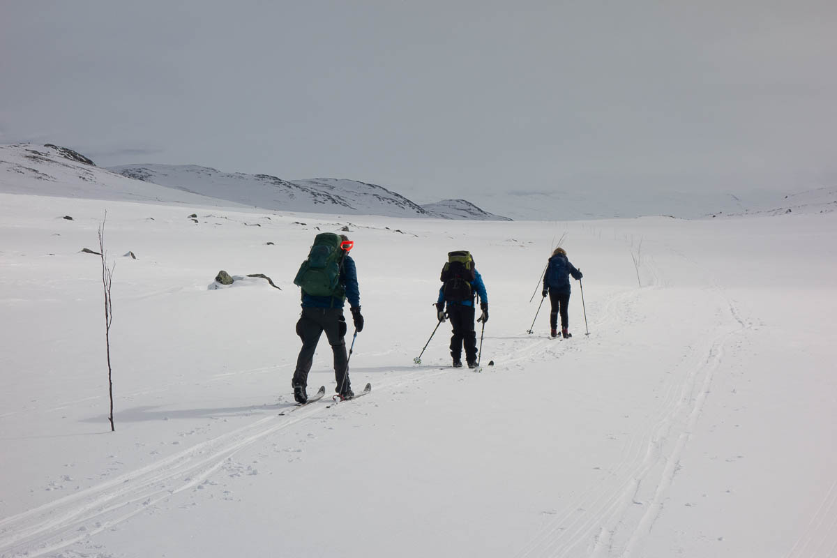
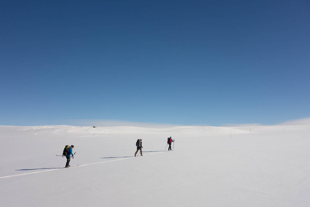
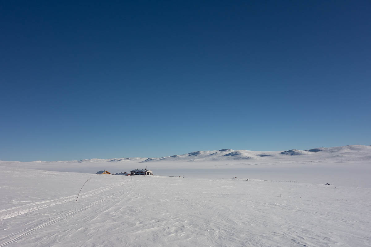
There was no doubt that we were getting closer to civilization today. No more untracked trails – now we had snowmobile tracks to follow. Which can be convenient at times, but they can also be icy and uneven, and more work than they’re worth, so we ski next to them.
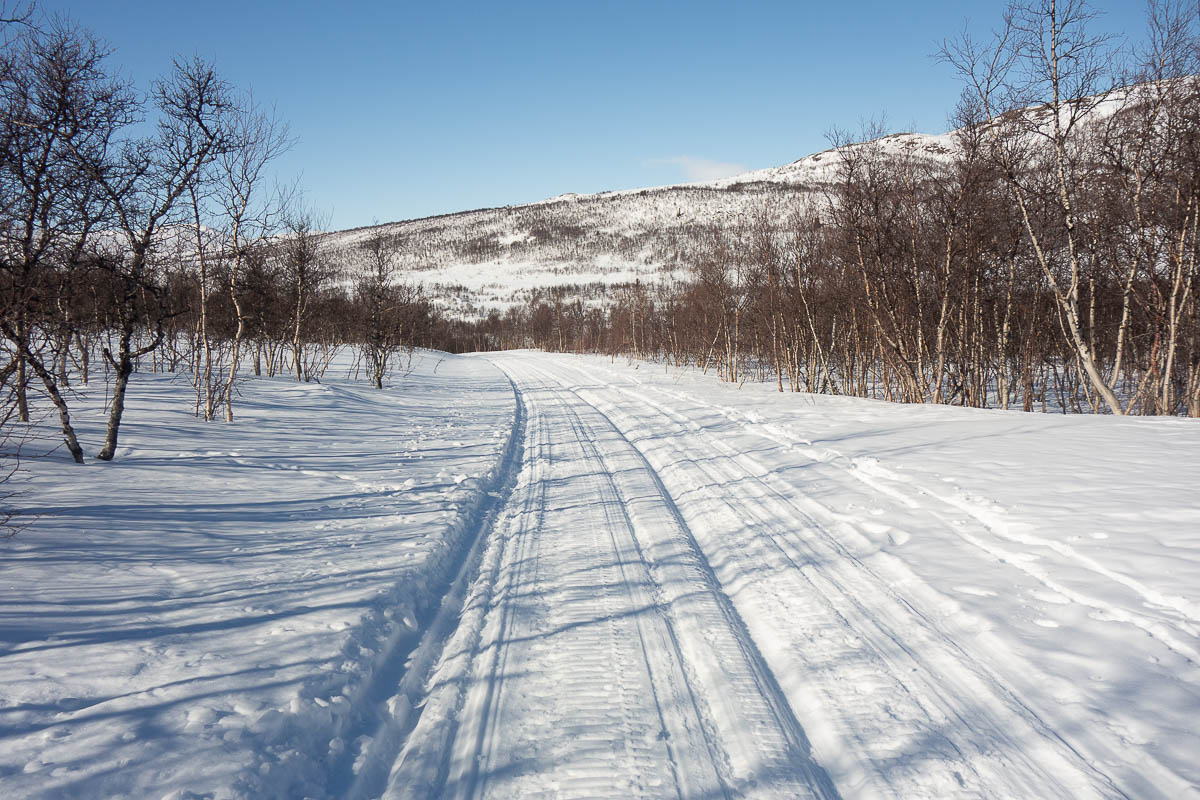
As we came further down the mountain, trees appeared and then filled up the valleys. After a while the snowmobile tracks were the only open ground where we could ski. Once your skis get into the snowmobile groove, there’s no way to control your descent, though. As the descent got steeper and steeper, and the tracks deeper and deeper, we had to get off our skis and walk down.
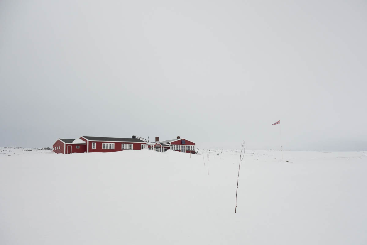
Then we had a few hours’ wait at Solheimstulen hut for a taxi to take us to Geilo. In Geilo we were staying at an actual hotel (that had seen better days but was still pretty grand) and ate dinner on a white tablecloth. Something of a shock after the mountain huts.
The food on this trip was mostly quite uninspired, and they really did not know how to handle vegetables. I think three of our dinners included boiled carrots with absolutely no flavouring. I guess it’s a Norwegian thing. The dinner at Geiterygghytta was a rare exception.
Rauhelleren to Mårbu, 20 km.
The day was overcast, windy and warm. The snow was warm and squeaky, sticking to my skis until I applied glide wax. Glide wax is one of those things that I make sure to pack every time, but don’t know if I will actually use, and then sometimes think that maybe I should just leave it at home – until the moment when I need it and realize that doing without would have been really, really inconvenient. Just like climbing skins, which we also only used on a single hour-long occasion during this trip, but which were absolutely necessary at that time.
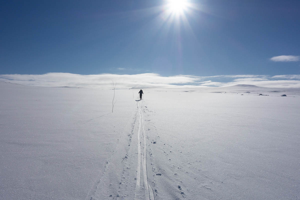
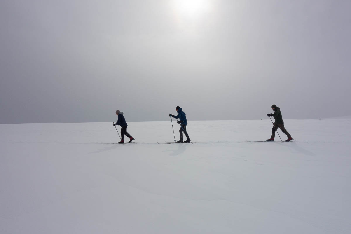
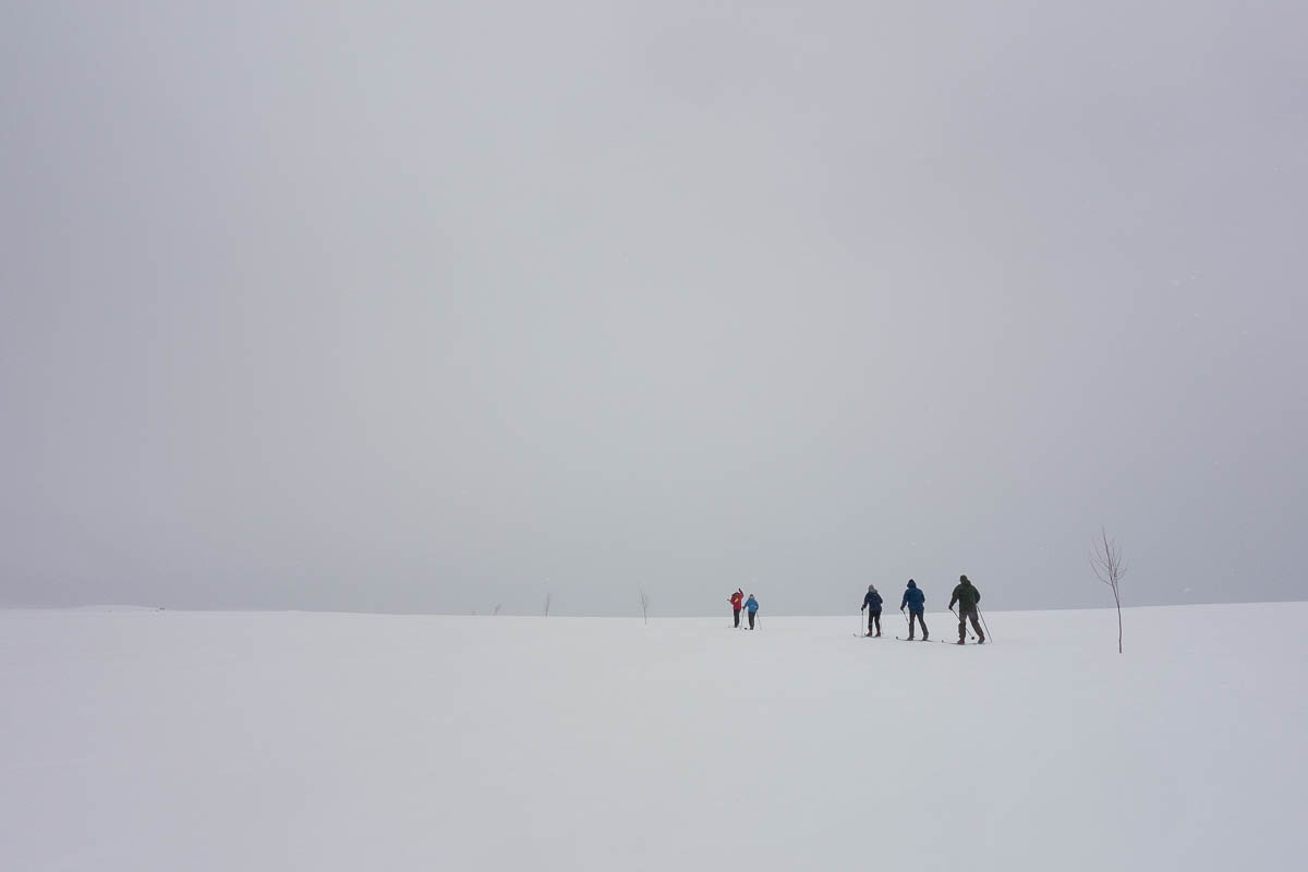
Back-country skiing in the mountains is a monotonous activity. Not much changes around me from one minute to another. It’s not like hiking, where there are new trees or streams or mushrooms or flowers with every step that you can pay attention to.
Instead I can be mindful of two simple things: myself, and the snow around me.
I make sure to pay attention to how my body feels. Are any parts too cold or too warm? Am I distributing the work well – should I take it easy with the poles for a while to let my upper body rest? How do my feet feel – am I moving them in a way that causes pressure from the boots at any point? Is the pack well-balanced? Do I need to drink more water? How is my blood sugar level?
The ski tours I go on are not extreme (especially when compared to the people skiing across Antarctica and whatnot) but the temperatures and distances are still such that small misses can compound into large problems. People get blisters, pull muscles, get dehydrated or hypothermic – sometimes just enough to cause problems for themselves, other times so much that they affect the whole group. I’ve managed to avoid all of those issues, and I like to believe that it’s not just down to luck but also to awareness.
I pay attention to the snow because it is everywhere around me, and – apart from myself – the only thing nearby that I can pay attention to. Theoretically I could pay attention to the other people, but they are often not close enough for that. Also, the snow is more interesting.
The snow can be soft or hard, icy or glidy or grippy. With practice you can see the difference at some distance, and avoid the soft drifts that suddenly stop your smooth descent – or the icy patches where you lose all grip. The weather can make all the difference: if the sky is overcast then sometimes instead you lose all depth perception and can’t even see whether you’re going uphill or down.
The winds in the open landscape smooth everything out on the large scale. Where the ground is uneven in the summer with rocks and bushes, in the winter it’s a mostly featureless plain. But the on the small scale, the snow blows into dune-like shapes called zastrugi. Sometimes they’re just millimetres in height and you can barely see them except when the sun is low; sometimes they measure in decimetres and you have to watch where you aim your skis. If I was doing this on my own, I’d want to stop a lot to to take close-up photos of all the snow and ice formations.
And then there are all the sounds that the snow makes. It can squeak and creak; it can crackle when icy; it can shush when you sink into soft snow. It can hum when you go across it at speed. The poles make a particular sharp sound when they go through the crust of ice on top of older snow, and then a different one when they cut through the crust as they tilt with my forward movement. Today at one point when I was going downhill through really wet snow it vibrated so strongly that I felt it through all my bones.
We had an early start again today to get the best weather we could, and reached the hut by lunchtime. Lunch on Norwegian ski tours, by the way, is sandwiches that you make yourself with materials from the breakfast buffet. I am getting just a little bit tired of cheese sandwiches by now. Boiled eggs are a good complement when I know we’ll eat lunch at a hut, like today, but harder to manage en route.
In the afternoon the weather got even warmer, until the eaves were all dripping and it was raining outside. This hut had a lovely seating nook by the entrance where we established ourselves for the rest of the day. There was no network connection, not even a paid one supplied by the hut like at the previous place. But they did serve waffles and I had books downloaded, so it was pleasant.
We’re back on track, skiing to the next hut. Well… we’re back on a track, but not the planned one. Having lost a day and a half, we can’t get to where we were supposed to be. So our guide Keith has done a lot of re-planning and re-re-planning to give us as much skiing as possible for the days remaining, while also getting us in range of public transport so that we can all get back to Oslo somehow in time for our trains and flights.
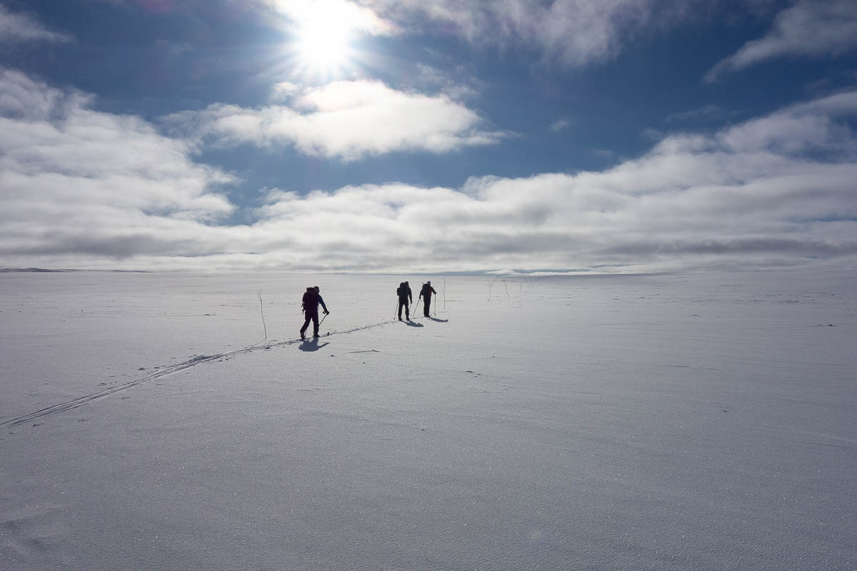
Today we skied from Dyranut via Stigstuv to Rauhelleren. Maps and other information sources claimed the distance to be 19 km. After the first day’s surprise, Keith carefully re-measured the distance on his map to 21 km. We still joked that he’d “find another few kilometres for us in his back pocket during the day” and indeed – when we arrived, we had done 25 km.
The first half of the day we had brilliant sunshine and no wind. And there was plenty of fresh snow after the storm, so the skiing was about as perfect as it can get. This is what we came here for, and we felt pretty lucky to get to experience this day.
Stigstuv hut was about halfway. We saw it in the distance when we were still maybe 15–20 minutes away, and were looking forward to a picnic in the sun on their porch or picnic table or whatever they might have.
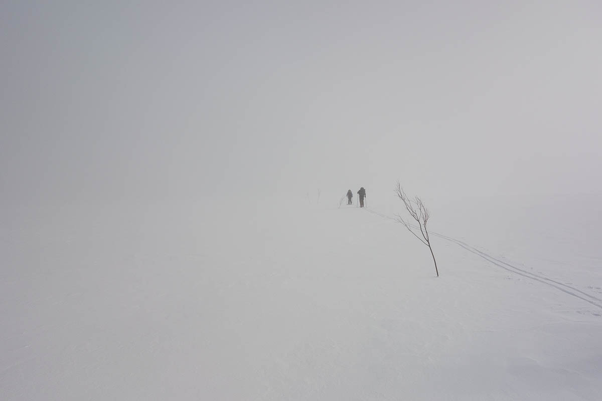
Minutes later a cloud descended, or maybe it was a fog that the wind blew up the slope. Either way, we were suddenly enveloped in water vapour. No more warm sunshine, and no more stunning views. The hut just disappeared.
When we finally stumbled upon the hut, the hut porch held a somewhat angry dog (and his owner) who was not inclined to share it with us.
For the first half of the day, the tracks of a fox criss-crossed the ski trail were were following. When we got to the hut, it turned out that the man with the dog had shot the fox and hung it on the wall of the hut. Trails of blood in front of the hut. Once we saw that, we didn’t much want to share the porch with them anyway.
Luckily the hut had a picnic table where we could sit instead. But the fog was still there and none of us wanted to sit around for a long lunch with no sun to warm us.
Later on we got clear skies again and more fresh snow on gently undulating terrain, for a near-perfect ski experience.
The weather was still pretty awful the first half of the day, but then gradually improved. Not in time for us to undertake a longer ski and move on to the next hut, but enough to allow us to go out and stretch our legs on a little circuit near the hut.
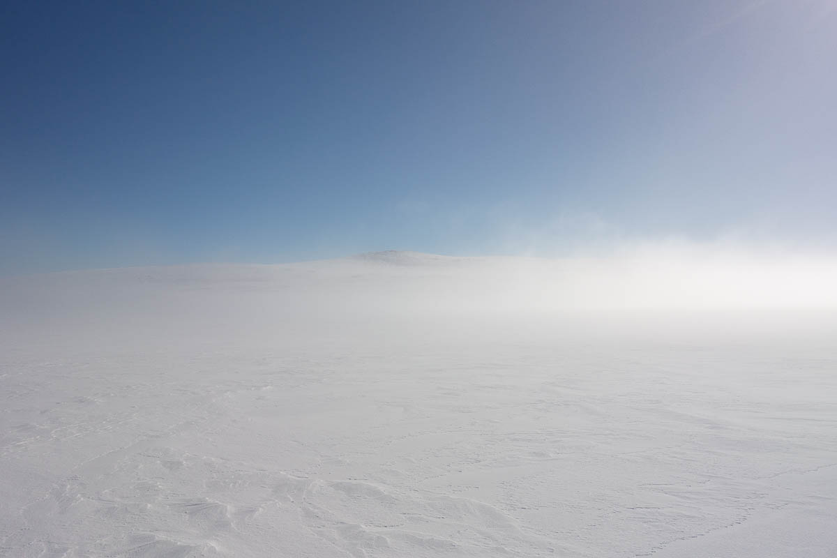
Bright white skies and white snow made photography difficult today, plus I had my ski goggles on to protect against the wind. Most of the time I couldn’t see anything on the camera LCD screen. I almost thought the camera was broken, but I could just barely make out some of the indicators in the corners. I just set the camera to Auto mode, pointed it roughly in the right direction, clicked and hoped for the best.
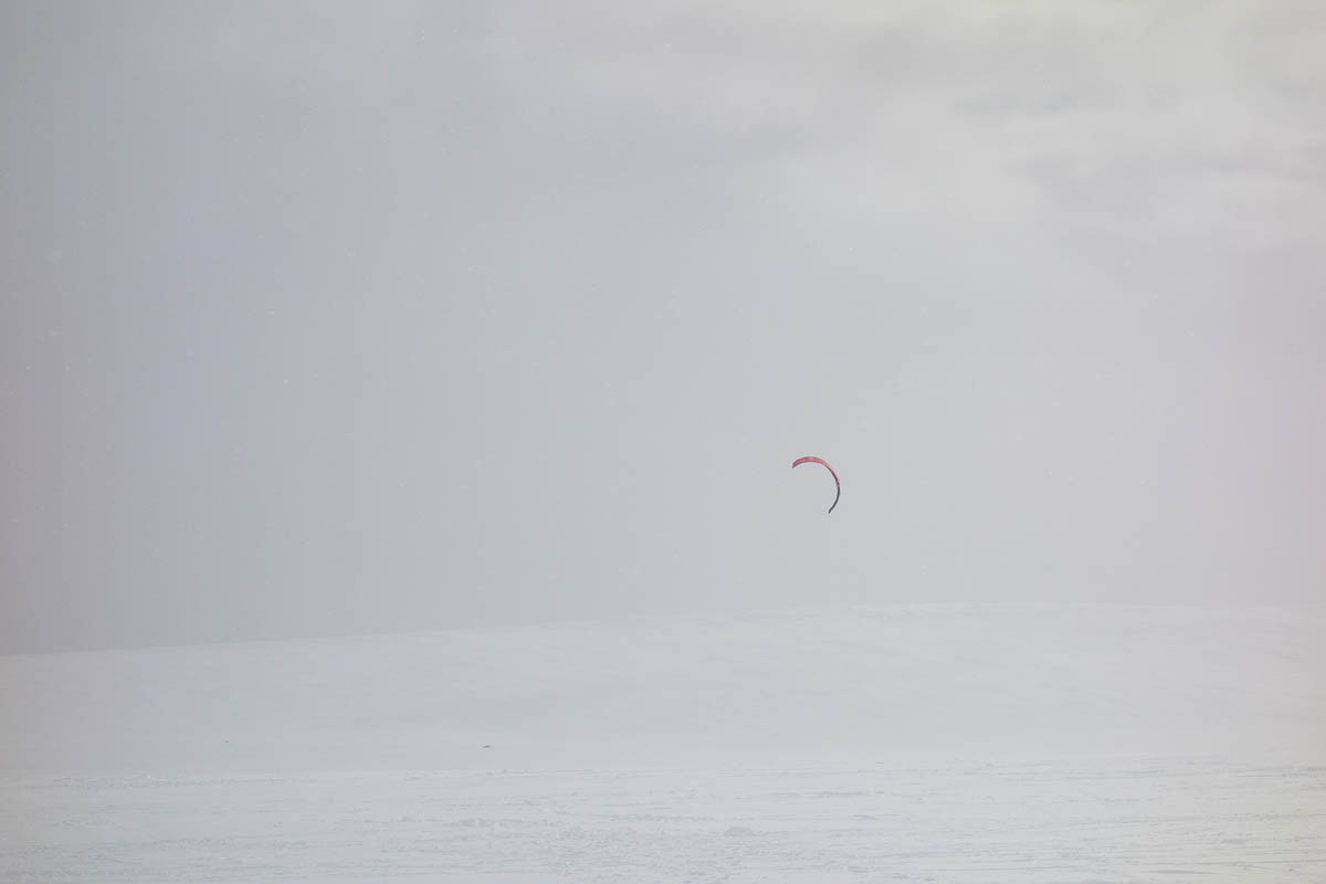
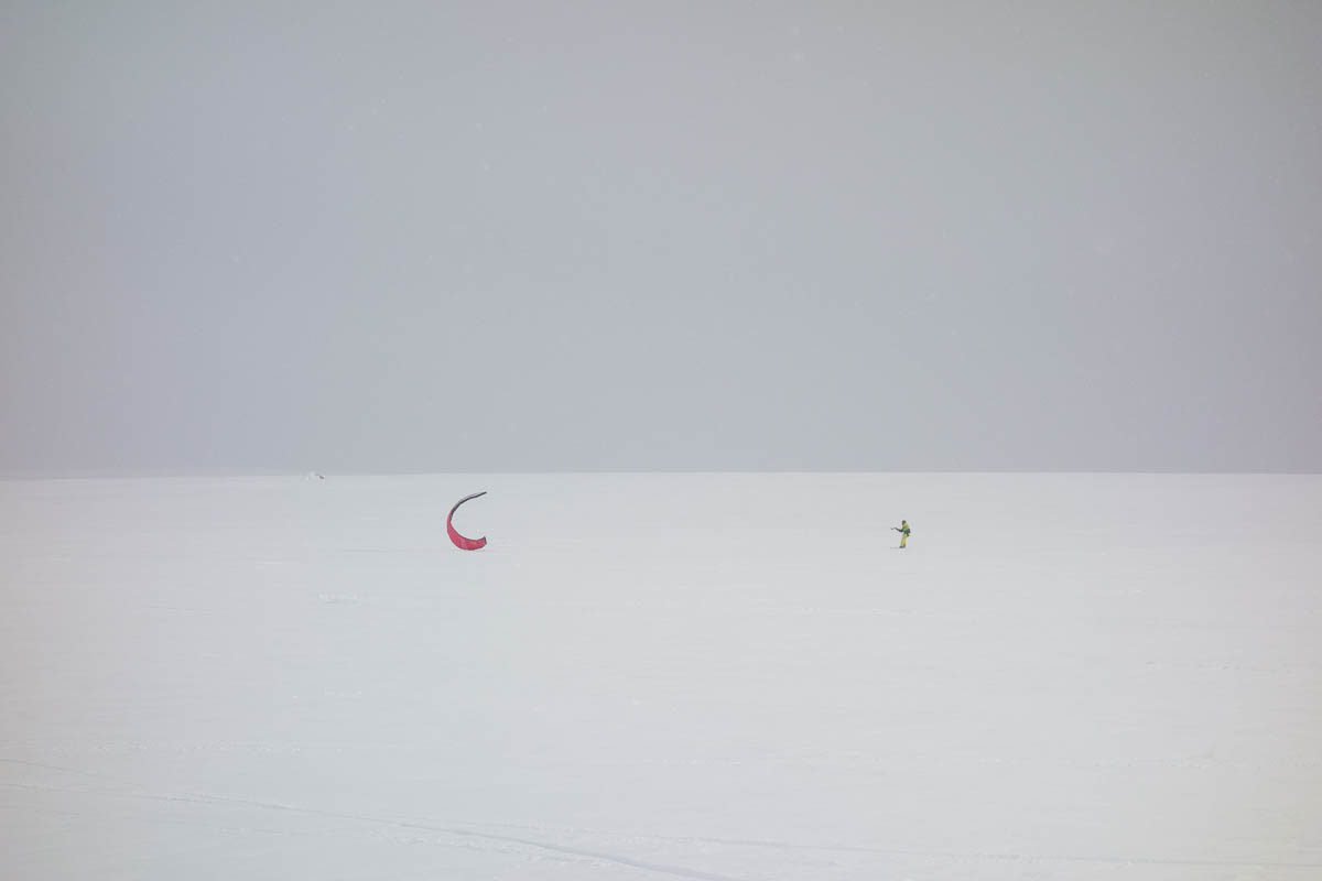
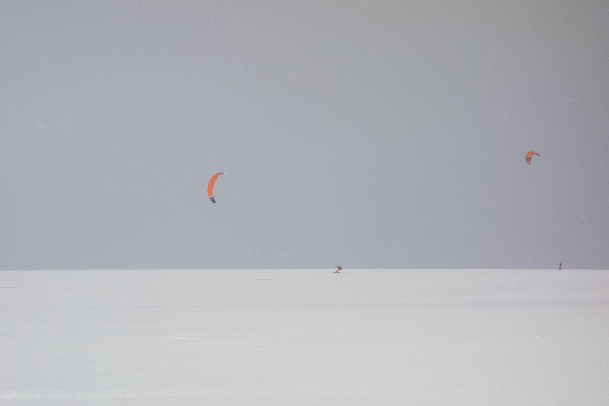
Dyranut seems to be a centre for kite skiing. We saw numerous kite skiers and kite snowboarders both yesterday before the storm, and today after it. Yesterday’s winds were strong enough, even well before the storm, to lift the skiers in to air – I literally saw some of them flying. Flying among icy rocks with your skis on seems like a dangerous idea, but on the other hand they seemed to be fully in control, so I guess they know what they’re doing.
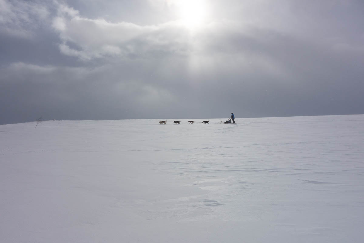
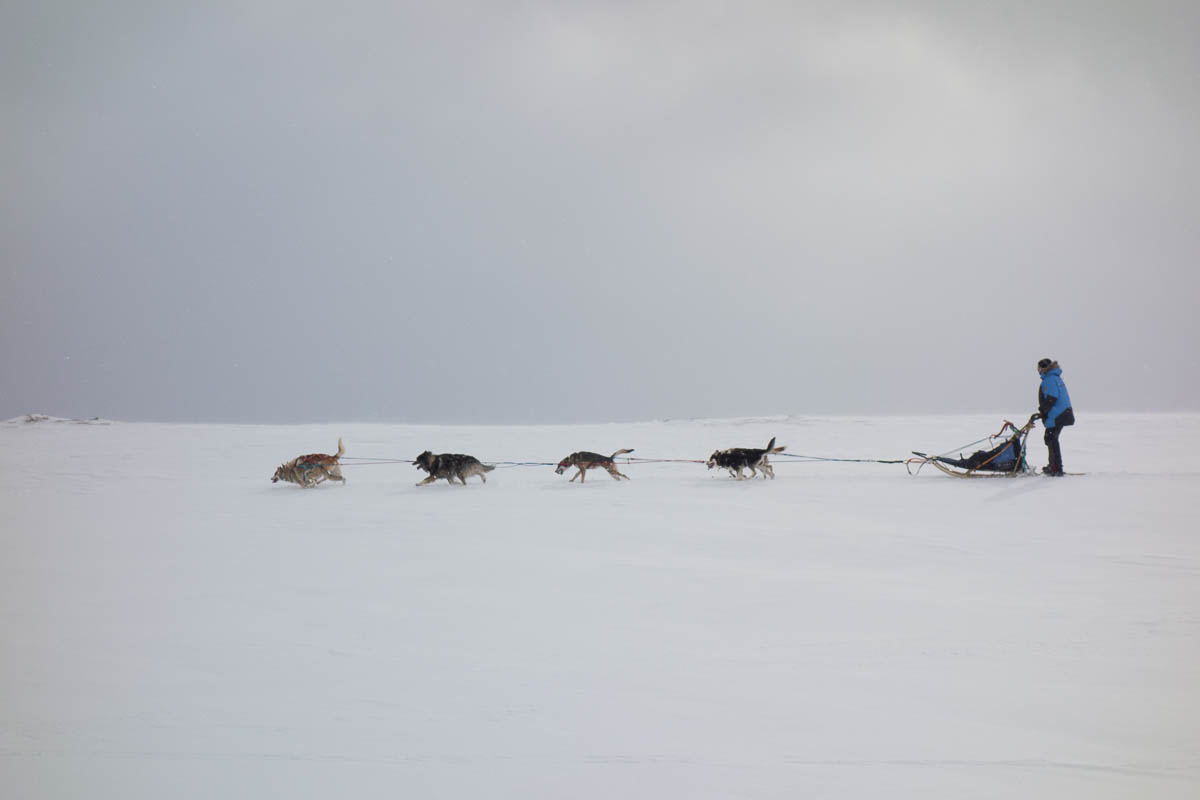
There were a couple of dog sled teams here overnight. I wonder if the dogs stayed out in the storm all night.
Yesterday on the trail we also passed groups who were camping out in tents. One of the groups was training for a trip across the South Pole, if I caught the conversation correctly. I guess if that’s what you’re aiming for, then a night out in a snowstorm with temperatures no lower than –10°C is peanuts.
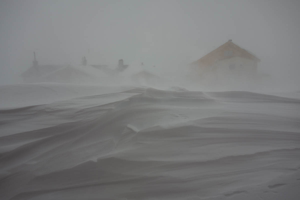
The plan for today was to ski from Kjeldebu to Rauhelleren, which should be about 25 km. Unfortunately the weather forecast promised very strong wind (gusting up to 100 km/h) together with plentiful snowfall. Planning for 8 hours of skiing in horrible conditions would be nothing short of reckless. But we also didn’t want to get snowed in at the small, chilly, unmanned hut with limited amenities.
So, plan B: we got up early to get ahead of the storm and skied just 8 km to Dyranut, the nearest manned hut, where we will wait out the storm.
We arrived at Dyranut already at 10 o’clock, after two-ish hours of skiing. It was windy already in the morning, but not exceptionally so.
Modern, accurate, high-precision weather forecasts are truly a miraculous boon to skiers. The weather gradually got worse, starting just an hour or two after our arrival. By the afternoon it was truly horrible. Had we gotten caught in this weather out in the open, it would have been life-threatening.
As it was, moving between the two buildings at Dyranut – one of which had all the common areas, including the toilets, and the other all the bedrooms – was very challenging. We avoided it as best we could, but still needed to make the trip a few times during the day and evening. It was just a 20-metre walk – but with steep banks of snow, piles of soft snow, no visibility due to the air being full of yet more snow, and gale-force winds. On my first trip there and back I think I fell over four times. For the next time, I brought a ski pole for help.
As an added bonus there was a fire alarm at one point in the building with the bedrooms, so we all had to fight our way there to check it out. It turned out to be something with the generator (running out of coolant I think). Imagining what would happen if the hut actually burned down, with all our warm clothes and equipment, in this weather, was pretty scary. And it does happen! Various STF huts have burned in 2000 at Rogen, in 2010 at Stensdalen, and in 2022 at Sälka. All those open fires are risky.
So the day was mostly quite boring but interspersed with moments of fear and tension.
| « Older posts | Newer posts » |