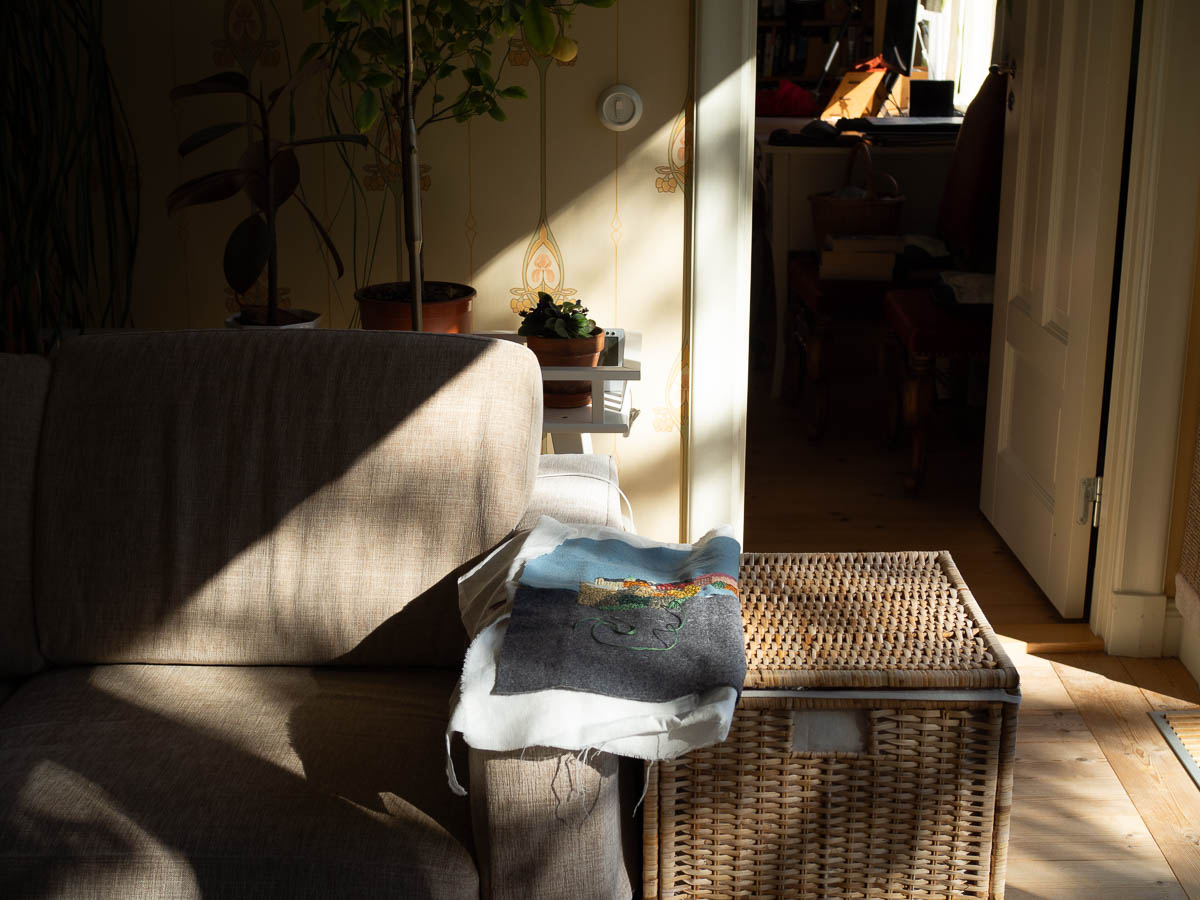
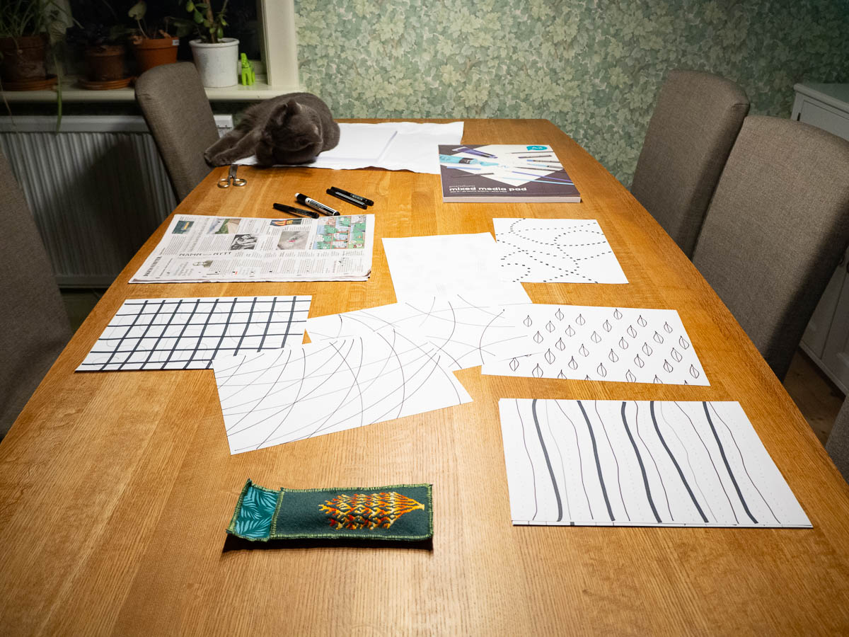
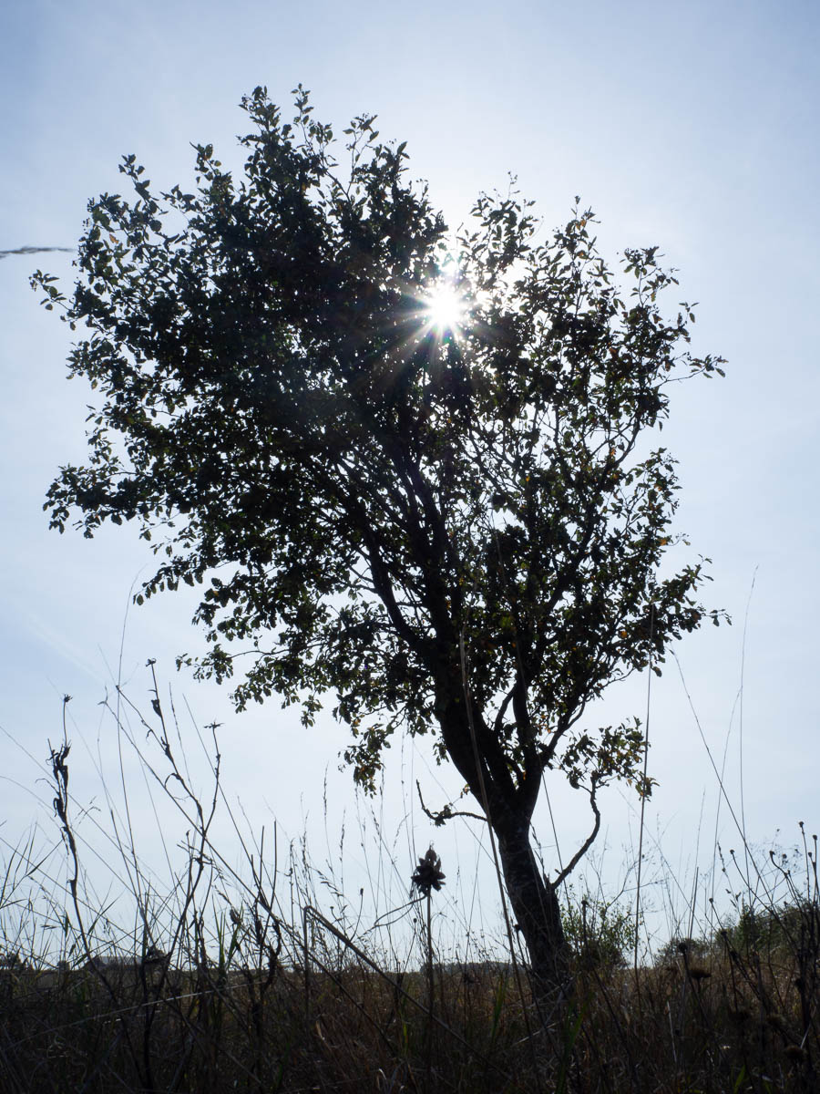
Catching the morning sun for some embroidery. Embroidering in sunlight feels a lot nicer than doing it in lamplight in the evening.
On this day...
1 year ago: Daily: 3706 – ant
3 years ago: Daily: 2999 – so much commuting
5 years ago: Daily: 2292 – the ivy has moved
10 years ago: More on aphantasia
20 years ago: In NY
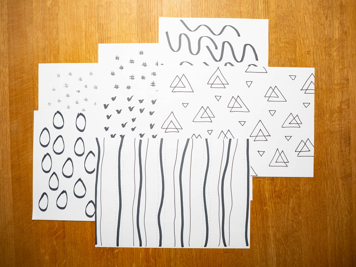
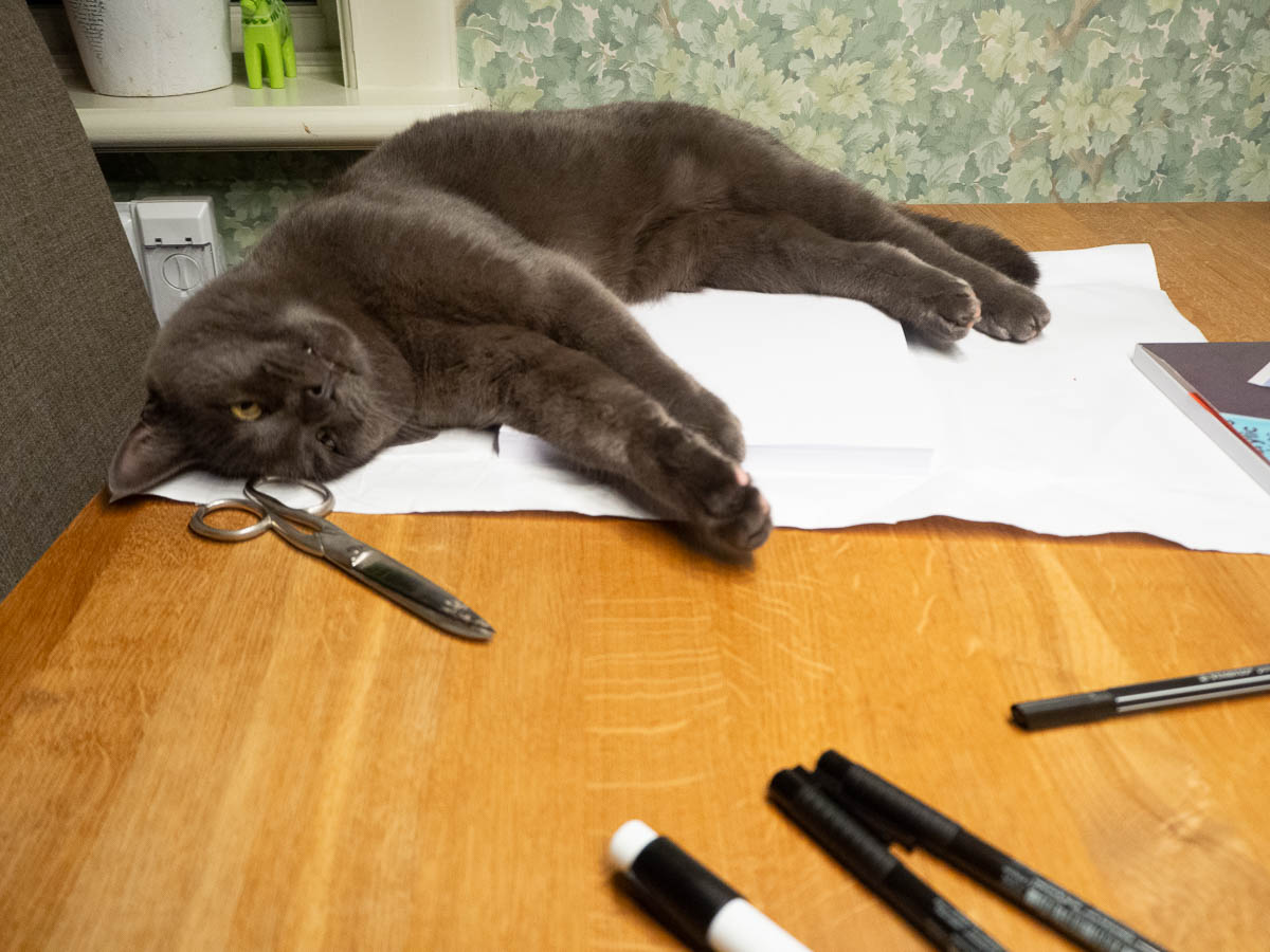
“Black, white and one colour” embroidery course. Step two of the first exercise. Cut out shapes from the patterns from the previous steps. Combine them with shapes in black, on an A3 piece of paper. Then frame a smaller (A5-ish) section of it, and that will be the design for an embroidered piece. An additional instruction was to not think about the embroidery aspect, but just play with the shapes and patterns.
This was such a new way for me of approaching embroidery design. Either I just make things up as I go – or I have some idea or concept of direction in mind, and tweak the details. This was in between. I am making a design before embroidering, but with no direction to aim for. Just whatever comes out.
Like yesterday’s pattern-drawing, this was a lot of fun. Playing around with paper and scissors and glue, and producing random things of no particular importance.
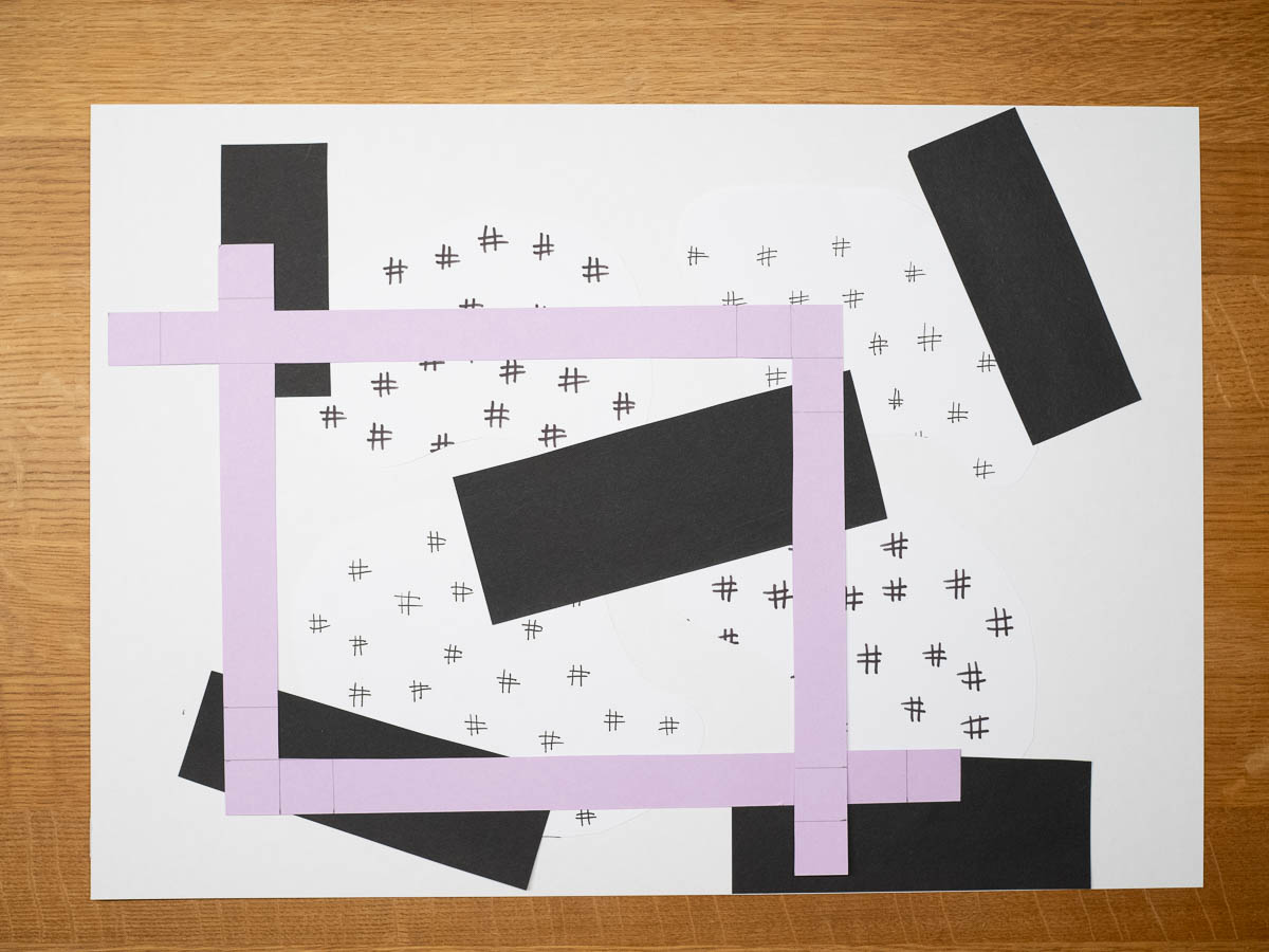
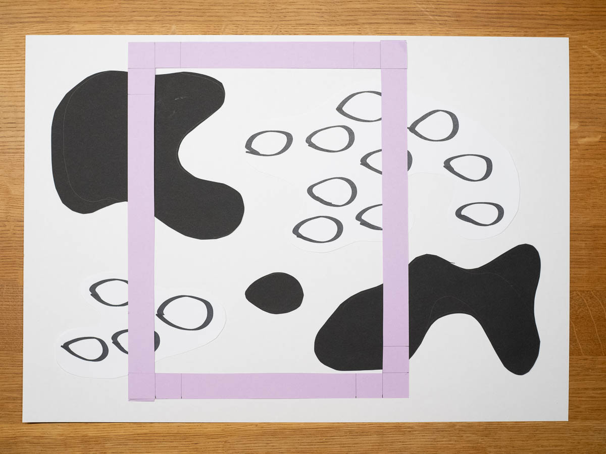
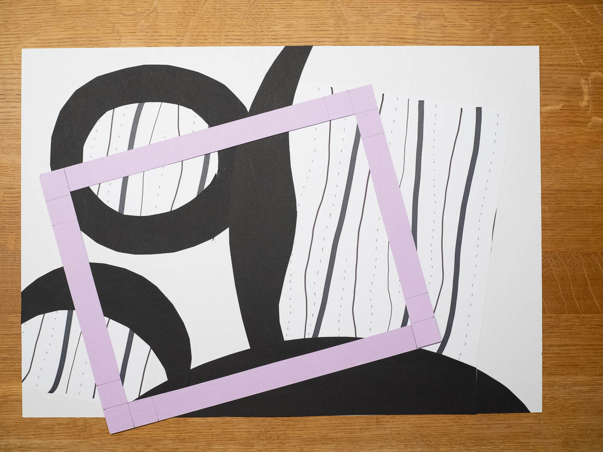
Some patterns that I liked in their original shape turned out to be mostly useless for this, because cutting them up would lose the whole thing that made them interesting. I still like them, so I might use them for an embroidery design as they are, at some later time.
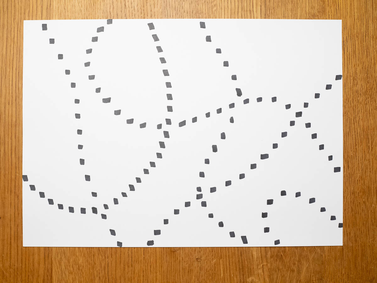
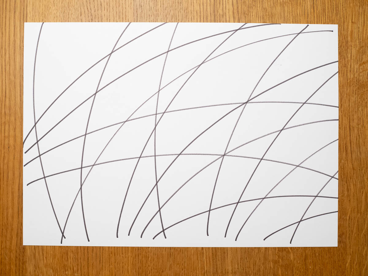
“Black, white and one colour” embroidery course. First part of first exercise: make patterns, black on white, using a variety of pens.
I found this very relaxing and enjoyable. Just… make marks. Of whatever kind. Then make different kinds of marks. No expectations, no rules. Like stepping back into being a child and just doodling.
I made a bunch of patterns, and could have made more, if someone hadn’t occupied my stash of paper. I took that as a sign to call it a night.

All my hiking socks become stiff after a while, despite thorough washing. The newest pair became stiff after a single two-day hike. I guess something in my sweat reacts with something else and results in salts that don’t dissolve easily. I’m soaking them in a vinegar solution now, hoping that that will make them soft again.
Woke up early again. The camping ground front desk, where I could pay for my stay and – more importantly – for a hot shower, wouldn’t open for another two hours. Rather than waiting, I made do with a cold shower and washed my hair in the sink (that dispensed hot water without any payment).
I made the rest of the time pass with a slow breakfast, and the usual slow drying of the tent, and watching the endless flights of geese pass overhead. At nine I paid for my stay and headed out.
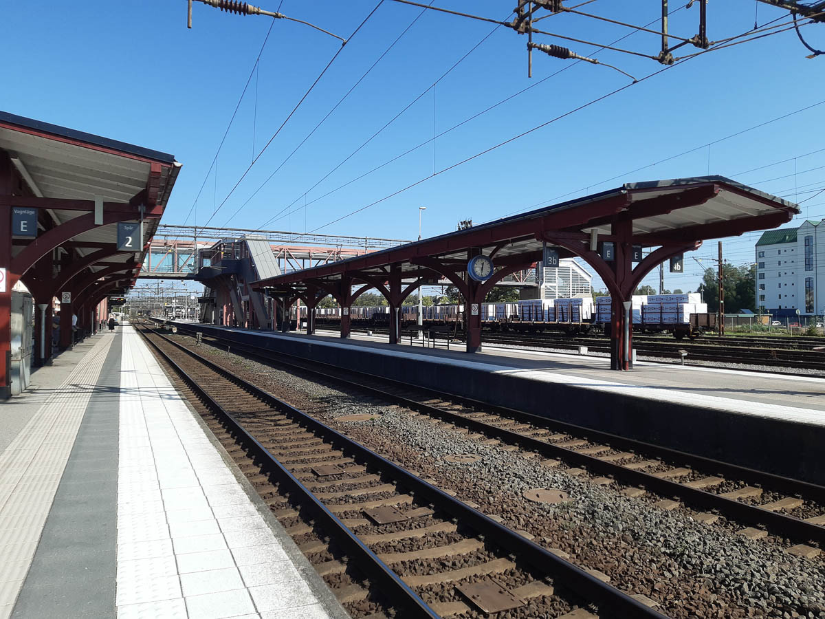
A bus and two trains took me back to Stockholm.
Skogsby to Färjestaden. 17-ish km.
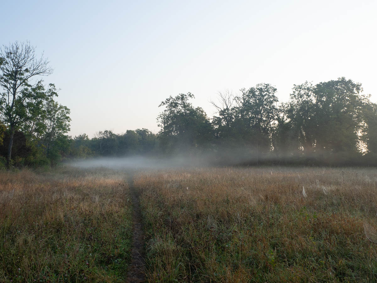
Woke up in a dripping wet tent, with slugs climbing up the netting of the door and flies everywhere between the two layers. The dripping part got its explanation the moment I got out of the tent – the entire meadow was wreathed in a thick mist.
I have, as usual, way more time than I need to walk the kilometres I have ahead of me. Today’s stage will take me closer and closer to civilisation, so I doubt there will be any interesting detours to take, and it might even be difficult to find secluded spots for breaks. So I might as well take my time and dry the tent and everything else here, and have a later start.
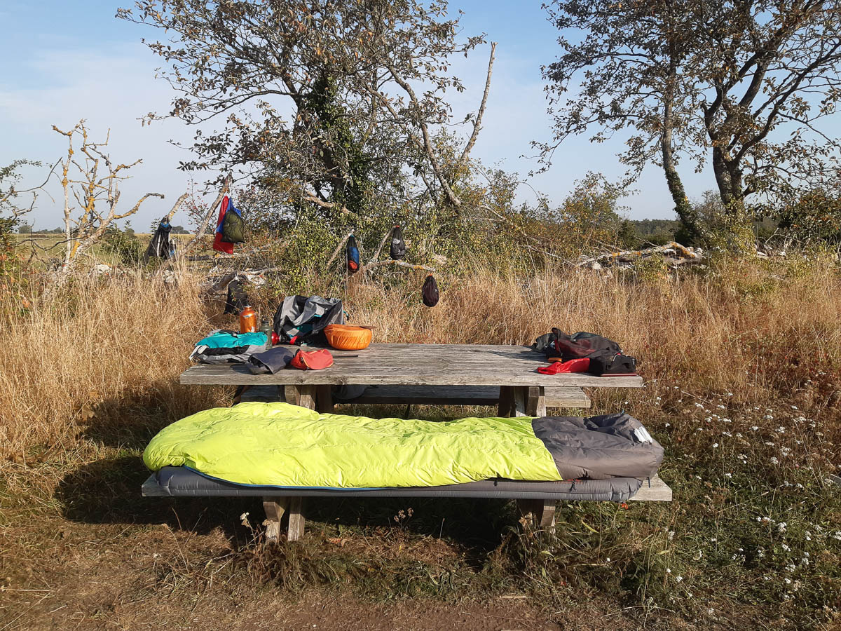
The grass on the ground was of course as wet as my tent, but I had the picnic table and bench at my disposal, and a dead tree behind it was as good as a wall organizer.
The tent itself I had to take apart and turn inside out to get all the flies out. Their only instinct when trapped was to try and fly higher up.
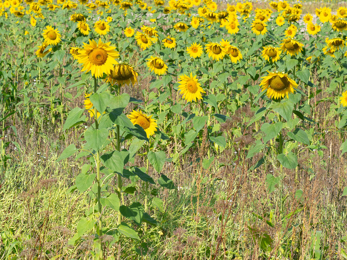
The trail continued among fields and farms. In addition to pumpkin and corn fields, there was also a sunflower field.
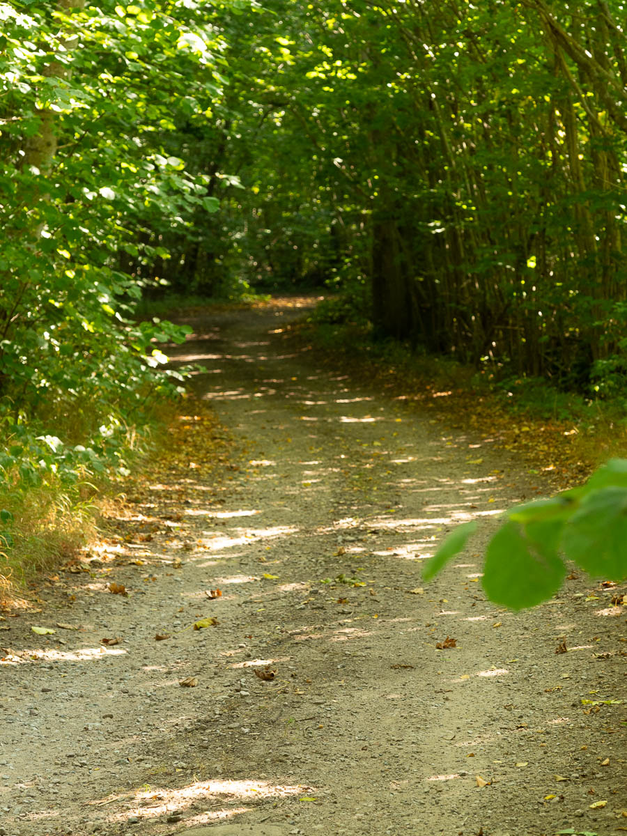
Otherwise my surroundings did indeed become more and more suburban. Small lanes at first, and then asphalt roads, and finally city streets. My feet were not happy about the latter.
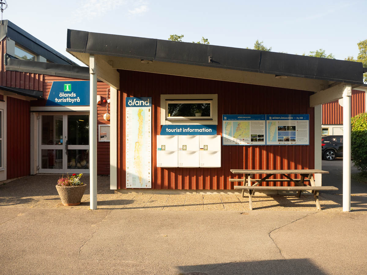
And then – the end of the trail, at the Öland tourist information centre. Or technically the beginning, since I walked it backwards. I understand why they market it the other way, but I would argue that mine was better. It’s always preferable to walk south to north instead of the opposite, so I get the sun at my back and not in my face. And I rather liked the gradual reintroduction of society and all its trappings. The official way would have me start in a city and then walk further and further away – and then come back to it all with a big bang. I always find the end of a hike jarring, going from peace and quiet in the wilderness to the noise and bustle of a train station or a motorway. This way I could resurface more gently.
I can’t just put up my tent in a park in the city, so I headed to the nearest camping ground, which was luckily right next door.
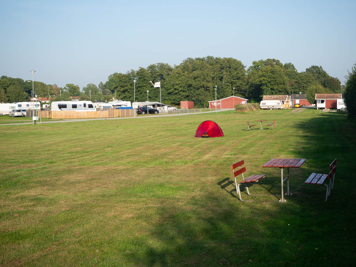
Mine was the only tent on the camping ground’s tent field. Around me were hundreds of camper vans and camping trailers.
Once again I couldn’t pay on arrival, because the front desk was only manned from nine to five, which struck me as very odd opening hours for a place like this. Seriously, aren’t those the hours when the guests are least likely to need to talk to anyone? Wouldn’t it make more sense to be there in the evening when people are likely to arrive? Then again, if most people are here for weeks on end with their camping trailers, the front desk probably rarely gets any people actually arriving or leaving, and are more of a service desk, handling clogged toilets or broken lawnmowers and selling snacks.
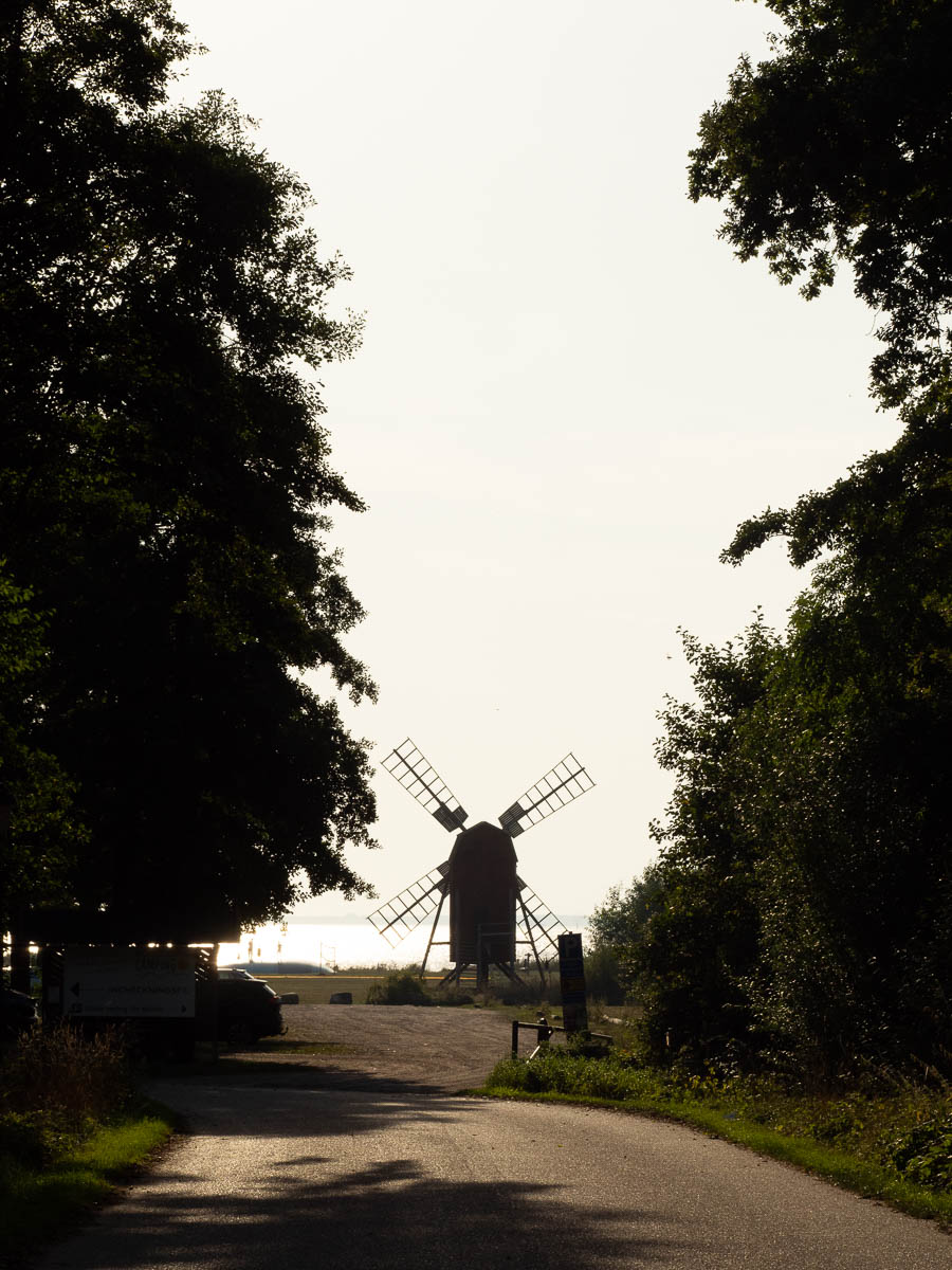
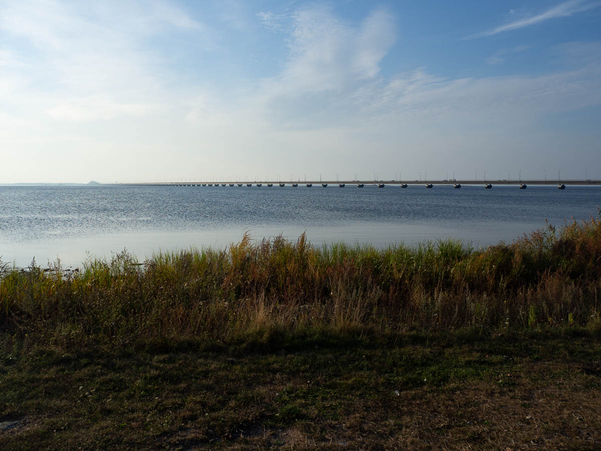
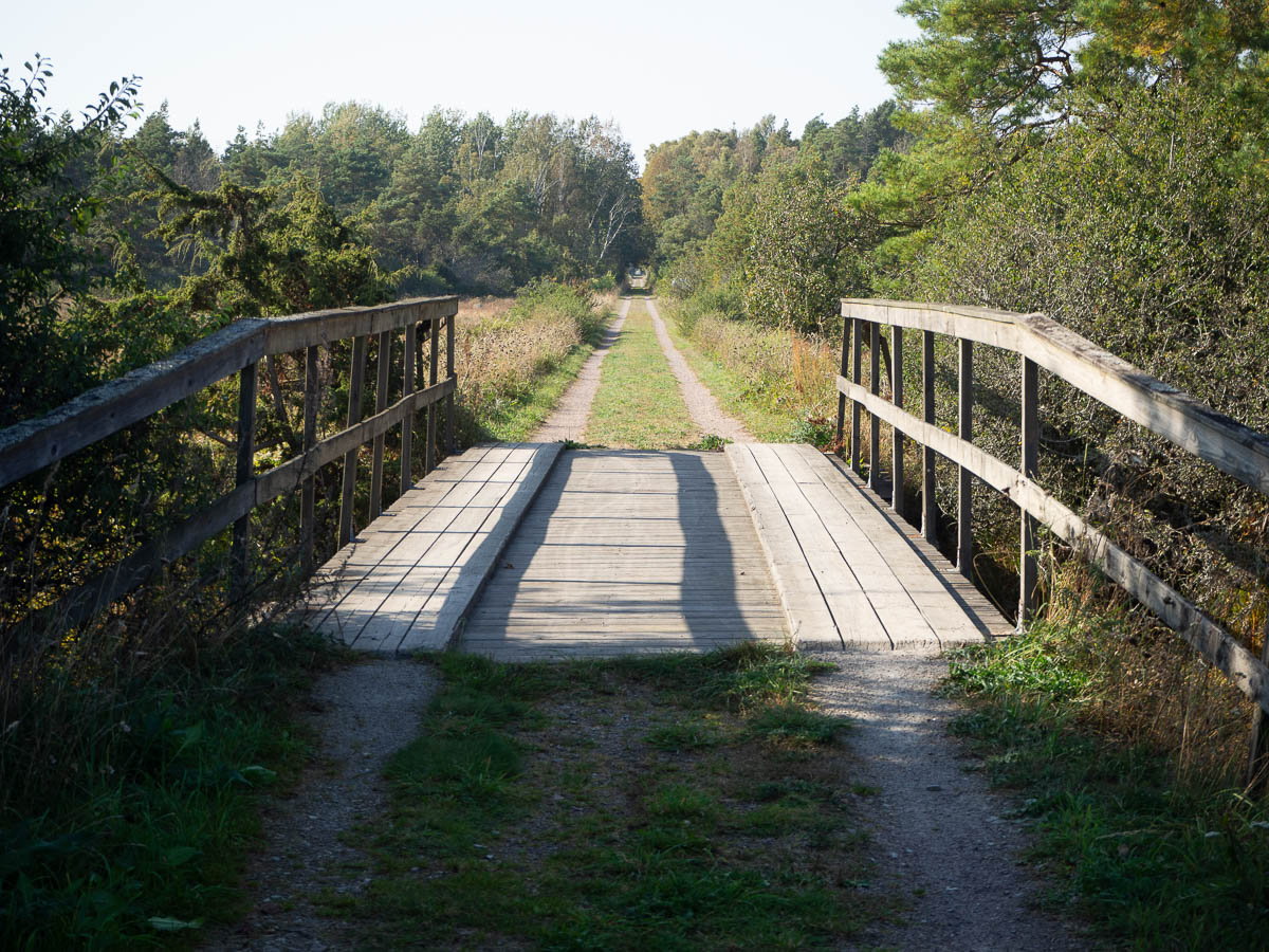
Here is the bridge to the mainland, that I will be crossing by bus tomorrow.
Mörbylånga to Skogsby, 20-ish km.
I haven’t been able to sleep very well during this trip, for no discernible reason. My body is tired by nine in the evening and all I want is to lie down, but it takes a long time for me to fall asleep, and I keep waking through the night. Most of the time, the best I achieve is a kind of half-slumber, and maybe a couple of hours of proper sleep at best.
This night I woke up at three and it was clear that there was no going back to sleep. I played sudoku on my phone and read on my Kindle and listened to the birds until the pre-dawn light was enough to move around in. Packed and ready to go by six, before the sun was fully up.
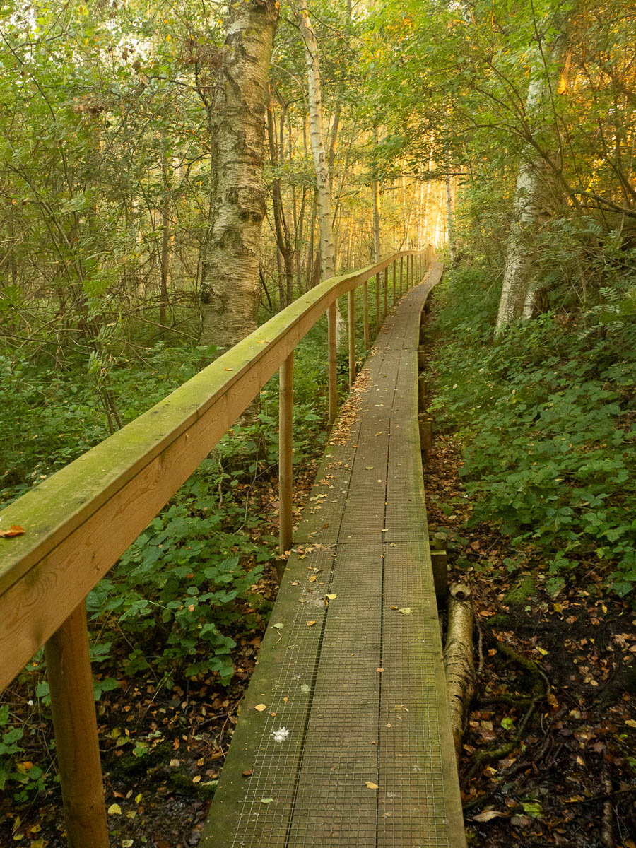
Fairy tale forest in golden dawn light with gentle birdsong and a babbling brook:
18 km of walking on mostly flat and even ground only takes me 6 hours, breaks included, so I have a whole lot of time today that I need to spend somehow. Getting there too early is no good. The walking is already so meditative that I don’t need more hours of sitting around and doing nothing in the evening. And there is only so much reading and sudoku I can do. So: lots of photo breaks and exploring random things.
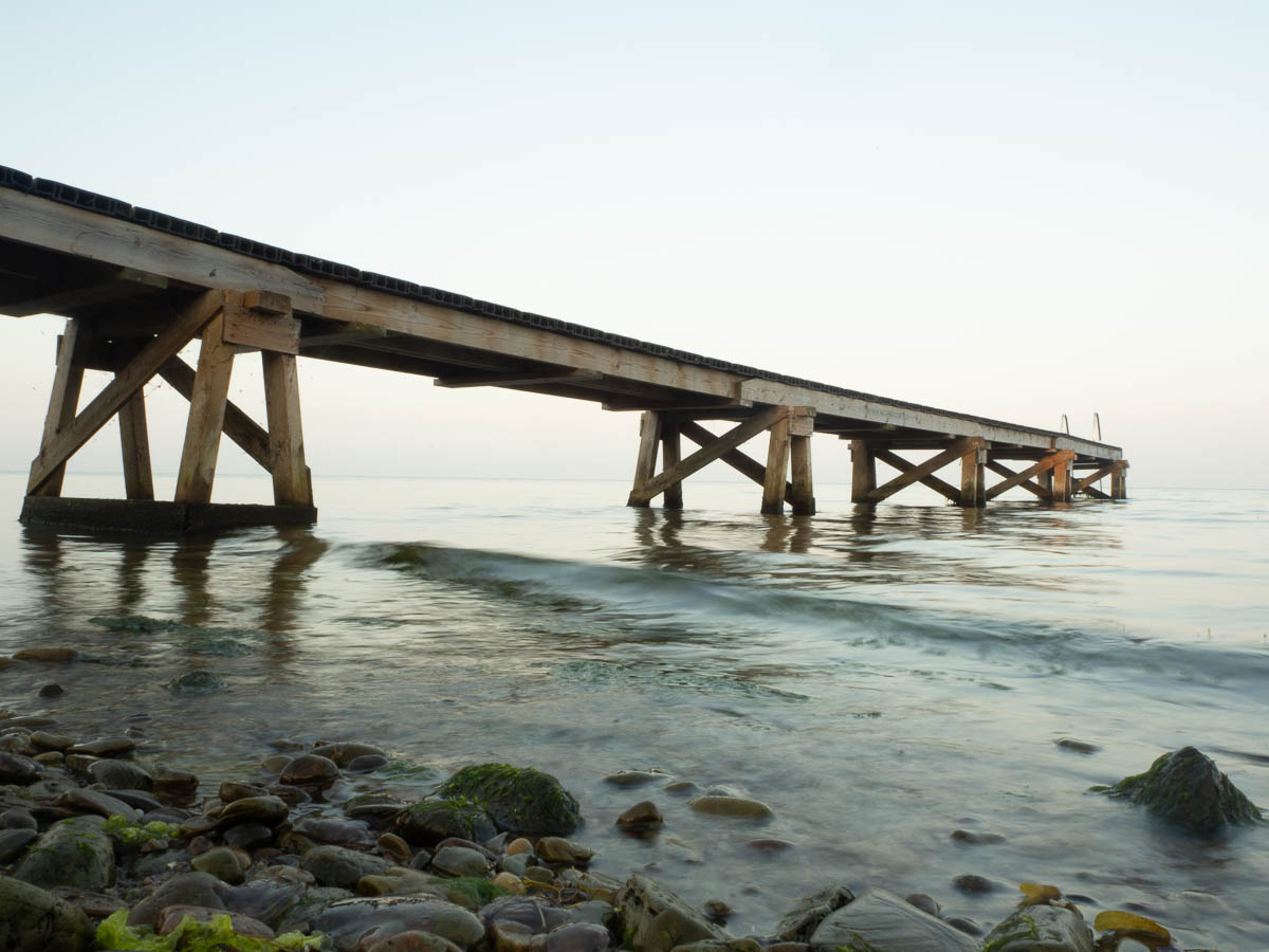
Here’s a bathing jetty.
I was having thoughts of breakfast by half past seven, but there was the usual question of water to be solved first. (I do keep enough of a reserve to have drinking water for at least half a day extra, but cooking porridge takes a lot of water.) I can’t go knocking on people’s doors at half past seven in the morning, though! Luckily there was a plumber’s van parked outside one of the houses I passed, with a plumber just leaving the house. It wasn’t his house, as I’d first guessed, but his presence meant there were people awake and around.
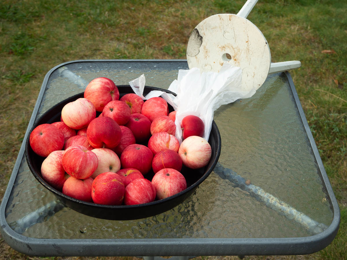
I got not only fresh water but also some of their home-grown apples. Better than the store-bought ones from yesterday, even those were also Swedish.
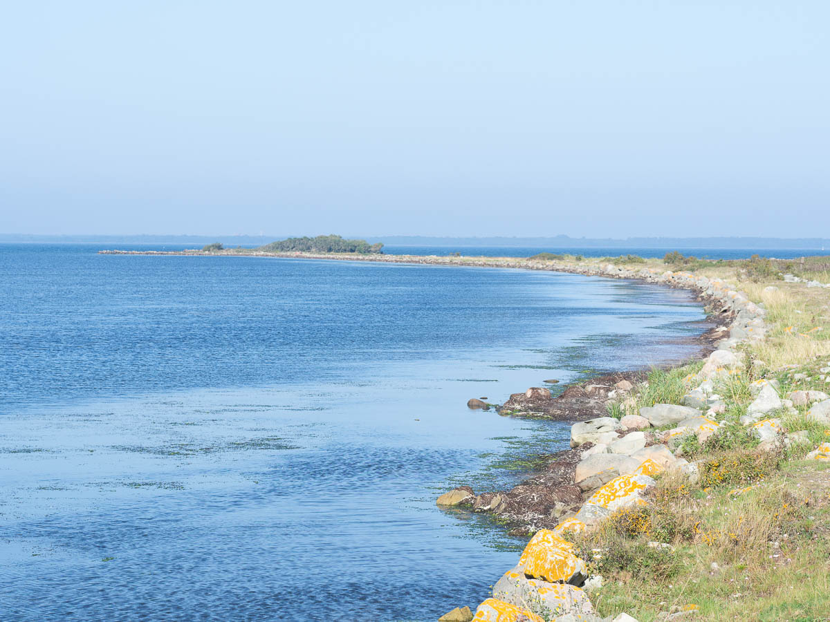
This stage of the Mörbylångaleden trail passes through the Beijershamn nature reserve. There was an attempt to establish a harbour here in the 1850s, and a 2 km long pier was built. The harbour failed because the sea streams deposited silt and mud until it became unnavigable. The pier remained, and the silted-up areas around it became a paradise for birds.
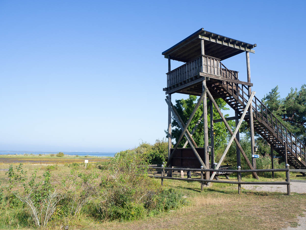
The area is a patchwork of nature reserves now, with boardwalks and platforms and viewing towers.
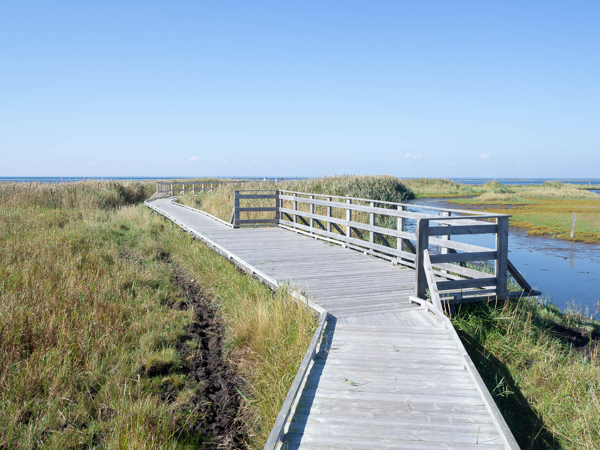
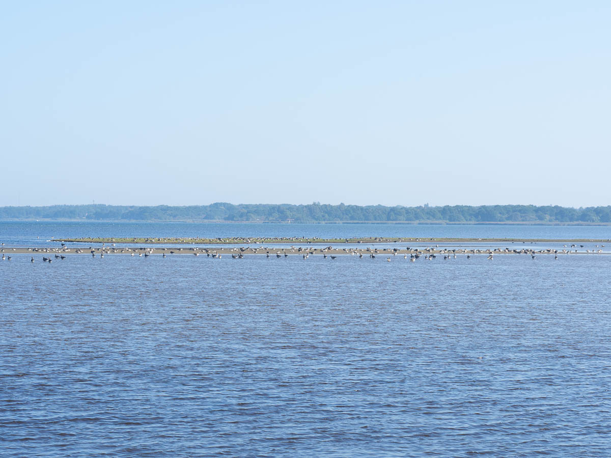
This was roughly the midpoint of my planned walk for today – and it was only ten o’clock in the morning. Time for a detour. I put my pack down just after the first cow stile and the last picnic table on the old pier, and walked most of the way to the end and back. It’s an odd feeling to walk on such a long and narrow strip of land, with the sea in touching distance on both sides.
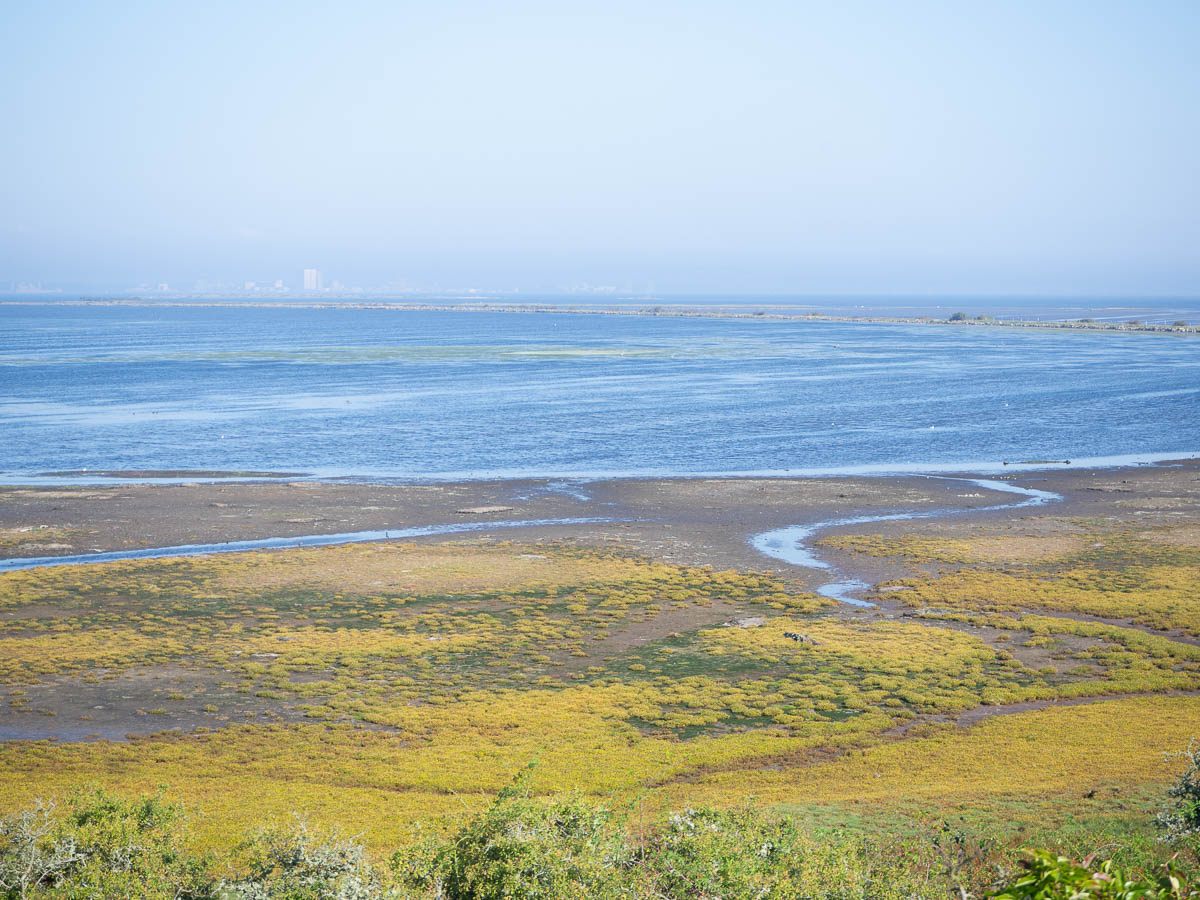
The shallows on both sides were like bird soup. Waders and geese and ducks and the occasional swan, gulls and terns, and endless noise.
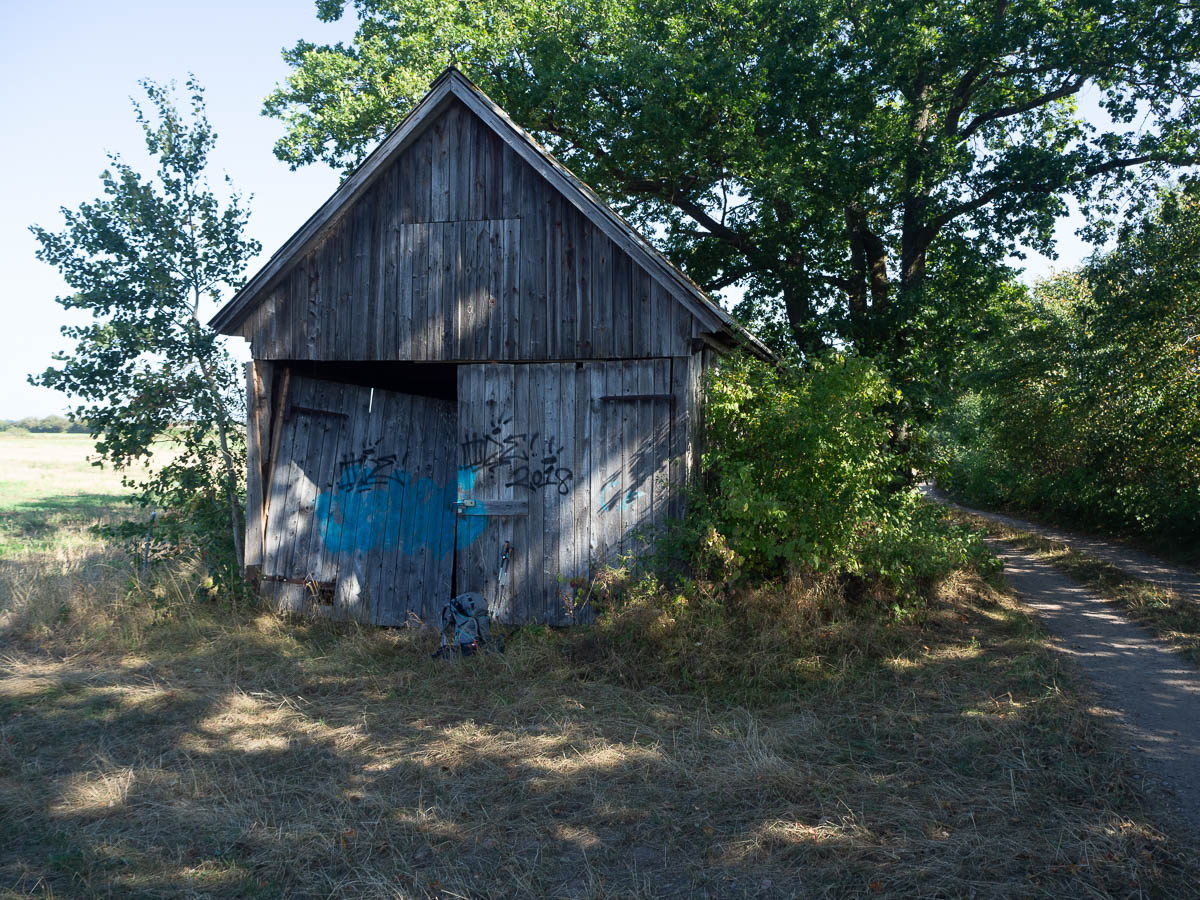
After Beijershamn the trail swung back inland, between fields. Lunchtime brought the usual challenge of trying to find shade. I ended up sitting in the shade of an oak tree, which sounds more scenic than it was, because on my other side was a derelict barn with a saggy door and bird droppings everywhere inside. Matched my backpack in colour scheme, though.
I deviated from the trail again to go through the little village of Eriksöre, with its old houses and barns.
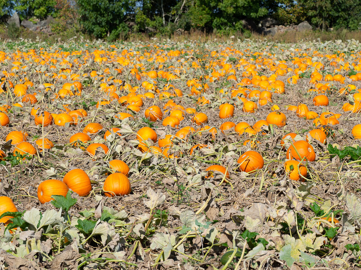
Eriksöre is one of the many villages participating in Öland’s annual harvest festival, and its signature contribution seems to be pumpkins. There were pumpkin fields in all directions, with Halloween pumpkins, small decorative pumpkins, and eating pumpkins.
The stage ends at a hostel and biology research centre just south of Skogsby. I was hoping to set up camp in some meadow or yard near the hostel and use their facilities. But the hostel reception was closed due to the single member of staff being ill, and everything was locked up, so I didn’t get to use the bathrooms after all. They had a nice garden and a pretty meadow, which looked quite appealing – flat and newly mown. But as I was sitting there, contemplating my life, a literal busload of hockey players arrived. Dalen Hockey had apparently booked the main building of the hostel for some kind of team-building thing. They were all behaving in a very civilized manner and had adult minders and everything, but they were inevitably loud. So I waved good-bye to the rose garden and went onwards.
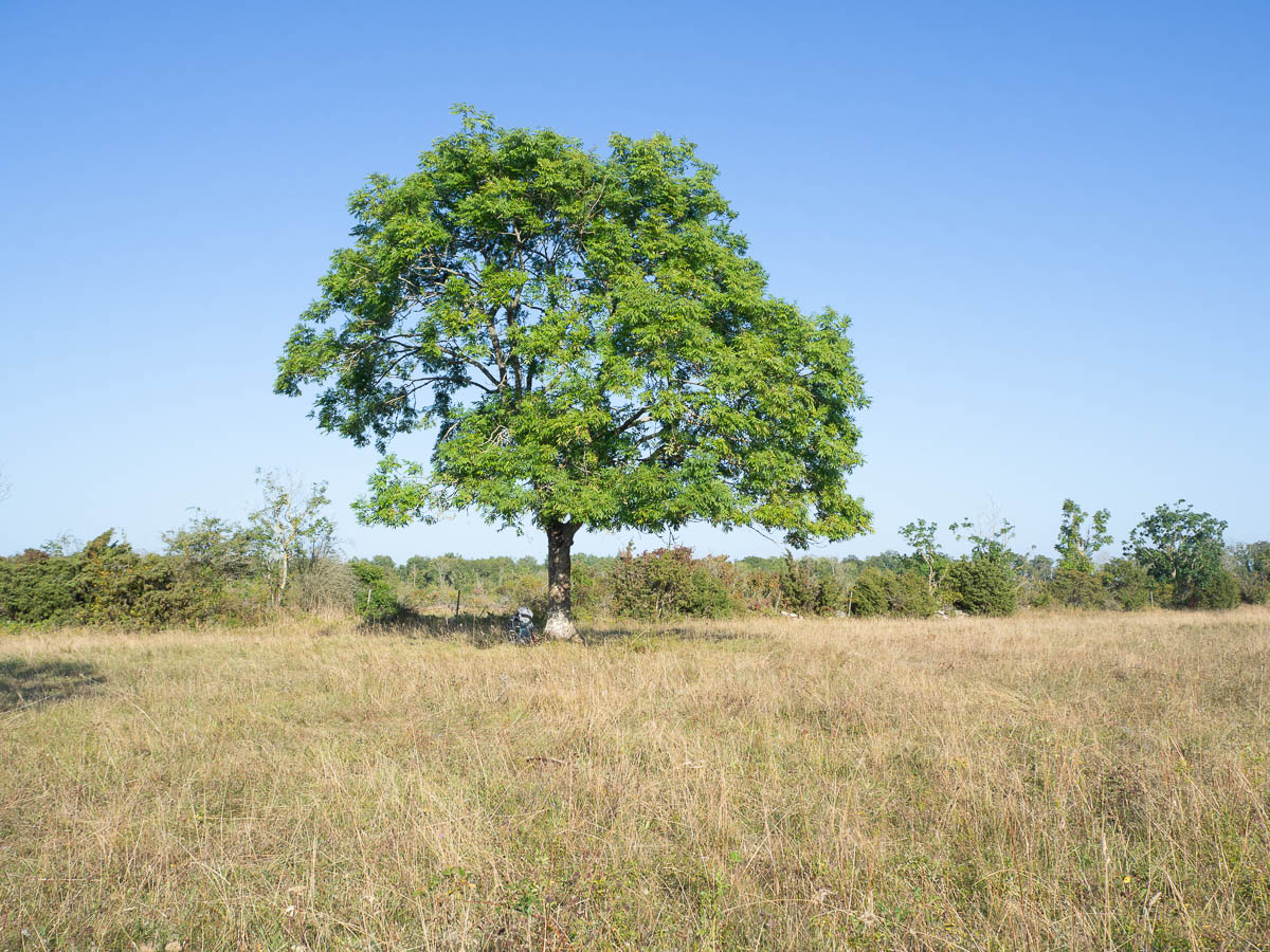
The first pasture, a kilometre later, looked very nice. Mostly flat and open, and with a large tree that I could sit and read under, and no smell or sign of recent cattle activity. I had put down my pack under the tree and was looking for the best tent spot when I found day-fresh cow pats instead. Where there’s cow pats, there’s bound to be cows, and I don’t want to wake up to a cow trying to get into my tent.
Onwards again.
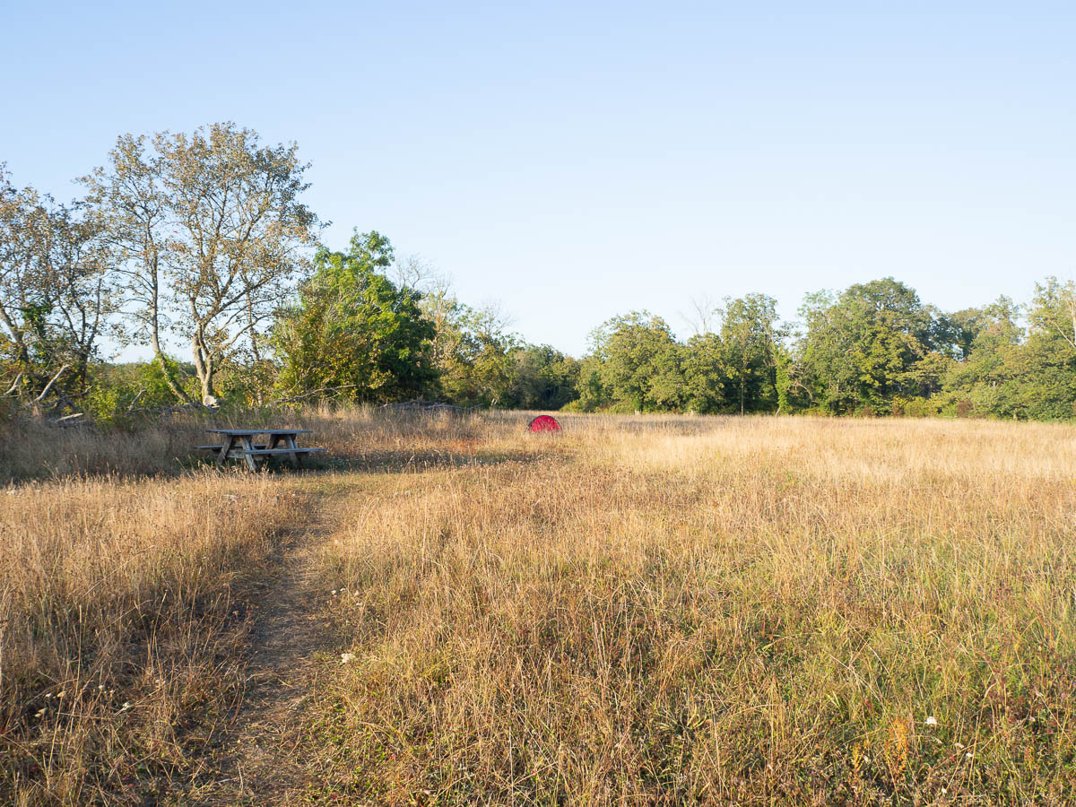
The next meadow had a picnic table and an information plaque, and no cow pats. And it had lots of tall, uneaten sweet grasses like clover, which surely must mean that there will be no cows here. This is where I will stay.
Kastlösa to Mörbylånga, around 15 km. Hot.
As usual, the first order of business is topping up my water bottles. Kastlösa is a large enough village to have a small hotel, so I snuck into their bathroom and got fresh water, and also a chance to wash my hands and face with running water. There has been a significant shortage of washing opportunities on this trail.
Kastlösa also has small crafts workshops and antiquities shops that would probably be fun to visit, but as with most places I pass, they’re all closed.
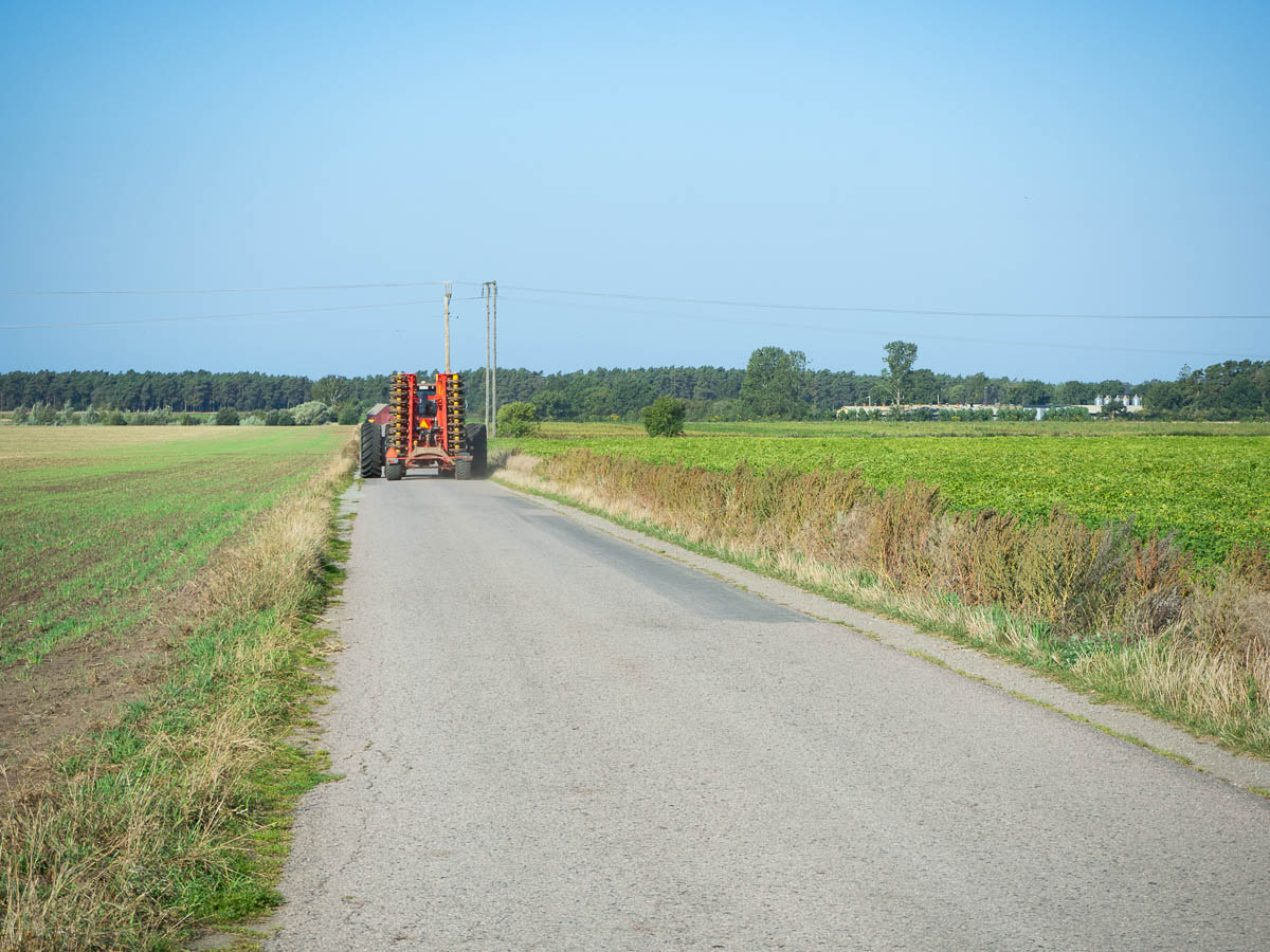
From Kastlösa the trail follows small roads towards the western coast of Öland. On these roads you need to keep a lookout for tractors and farm machinery and trucks transporting produce, more than cars.
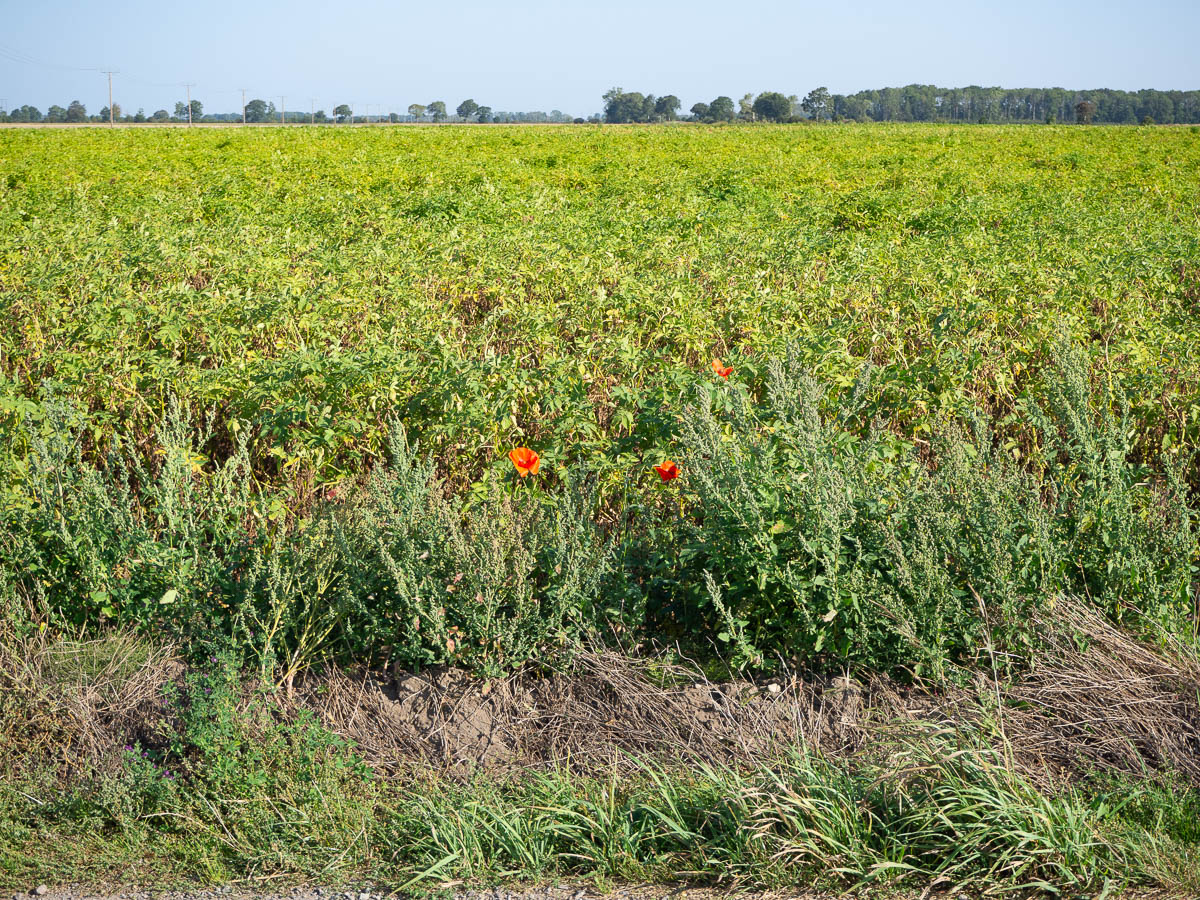
It’s harvest season. Some fields were already bare, others were being harvested as I passed them, still others were green and growing yet.
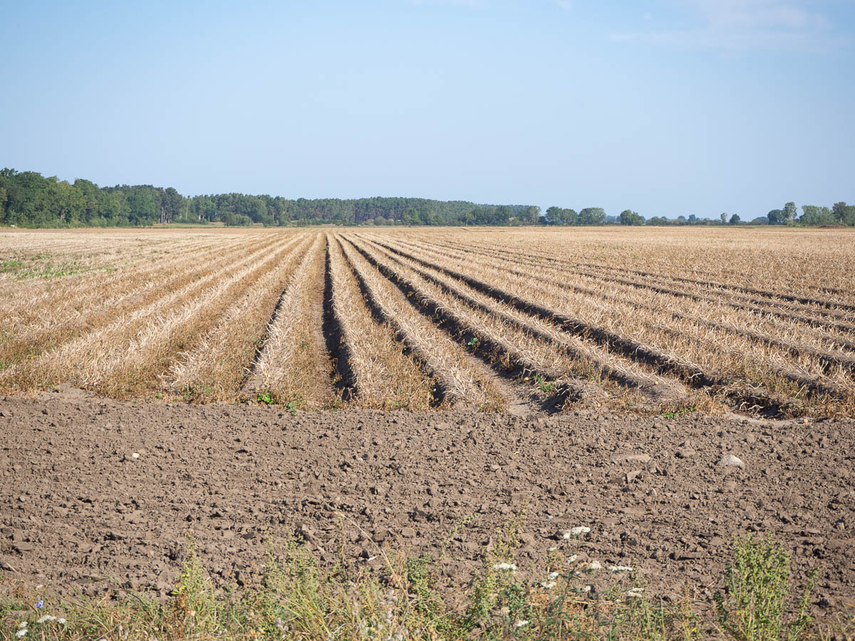
The fields were nice, even when bare, like the potato field above. Less nice was the chicken factory of Ölands kyckling. I’m sure they live up to the minimum levels of environmental regulation, but passing a large windowless barn that smells of nothing but chicken shit was depressing.
Same with cattle. Cattle roaming on the alvar or the seaside meadows do not smell noticeably, and neither do their cow pats. When the air is saturated with a smell of cow dung, it’s because I’m passing directly downwind of a barn – a large number of cattle in a small space.
Anyway, after a few kilometres I reached the sea shore and that was much nicer. As is becoming habit, I took a brunch break and dried my tent. The days can be as hot and dry as anything, but the nights and mornings are cool, and by morning, my tent is always dripping with condensation. In the cool morning air, it takes forever for the tent to dry, so I just roll it up as wet as it is and strap it on the outside of my backpack and start walking, and dry it later when the sun is high.
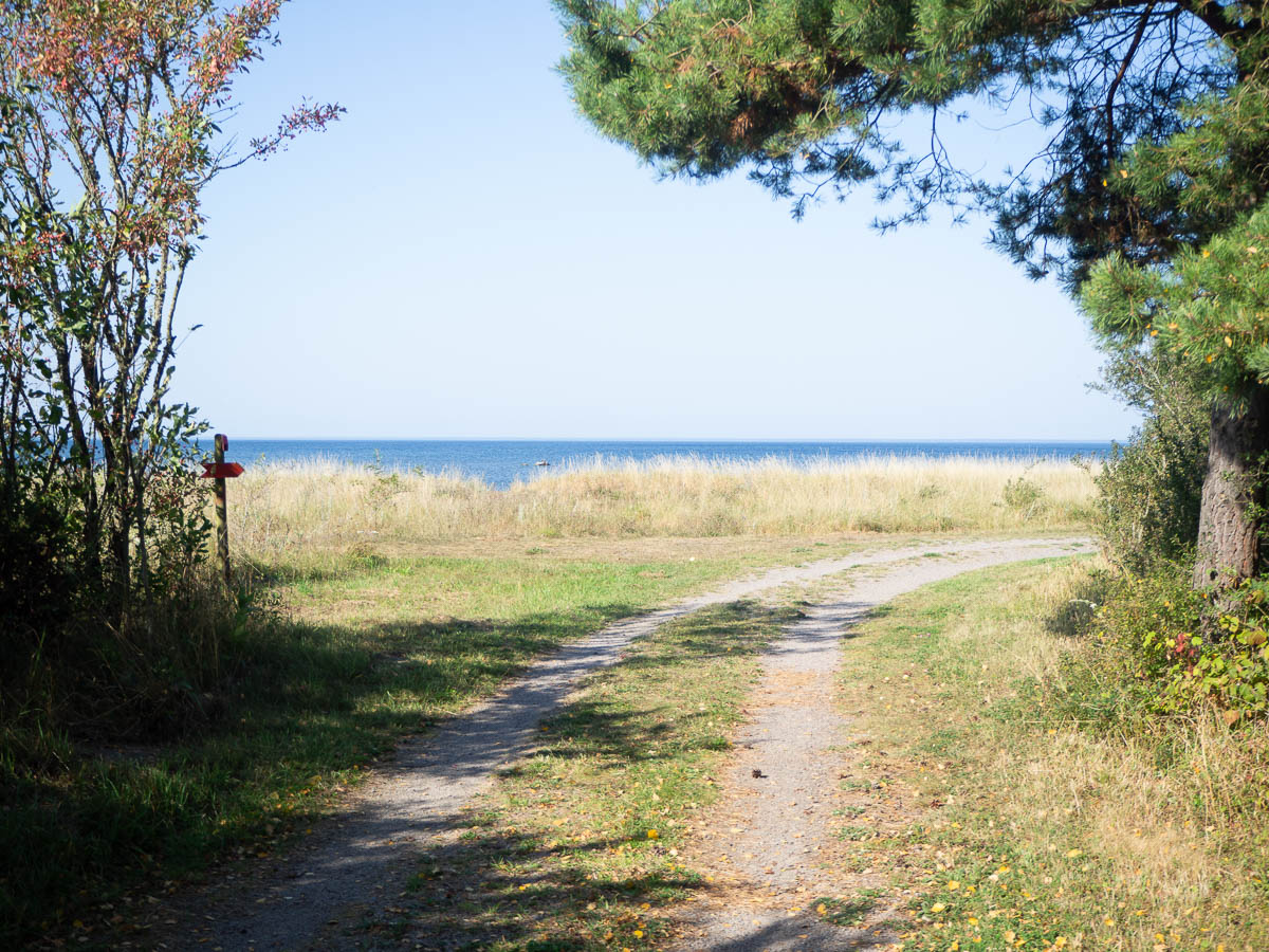
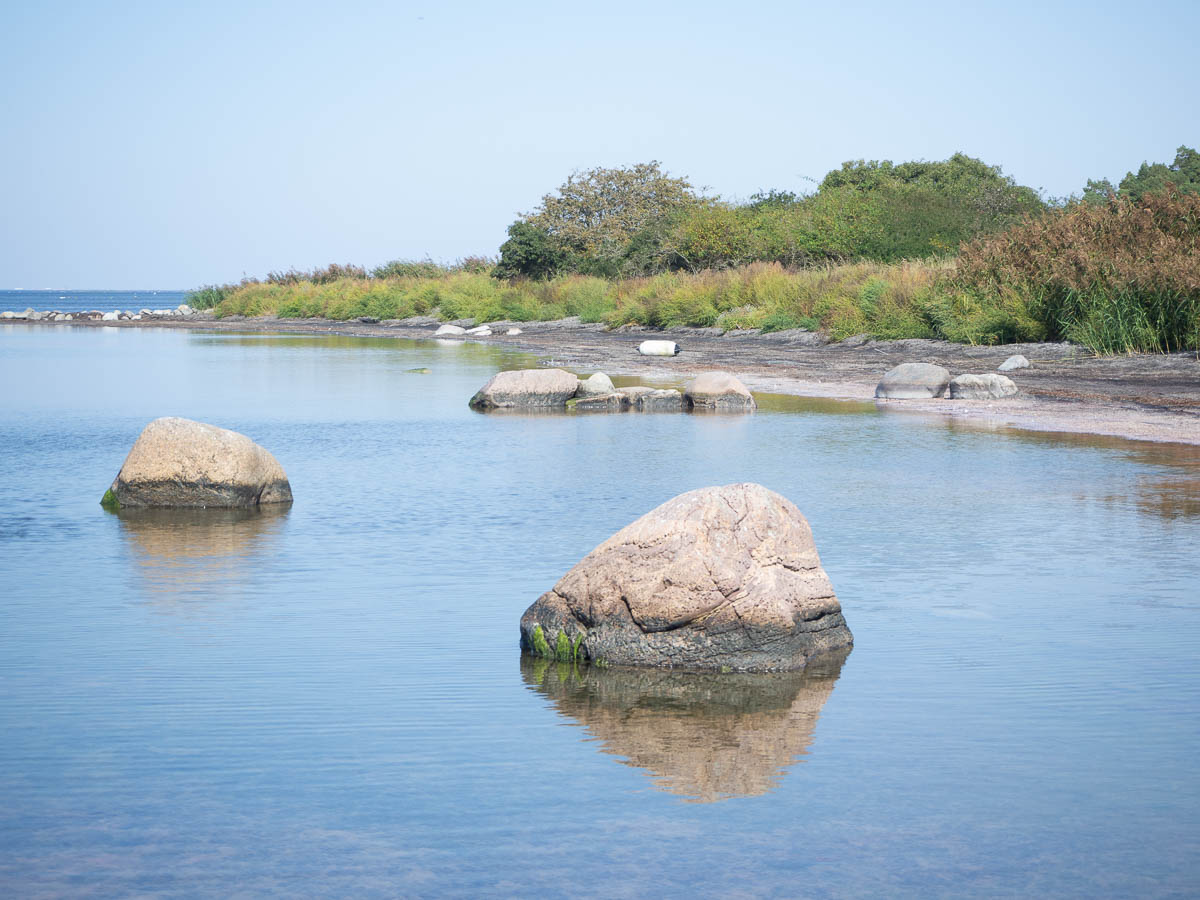
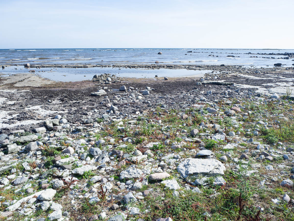
The beach here was fascinating. At first glance, it looked pretty though not spectacular.
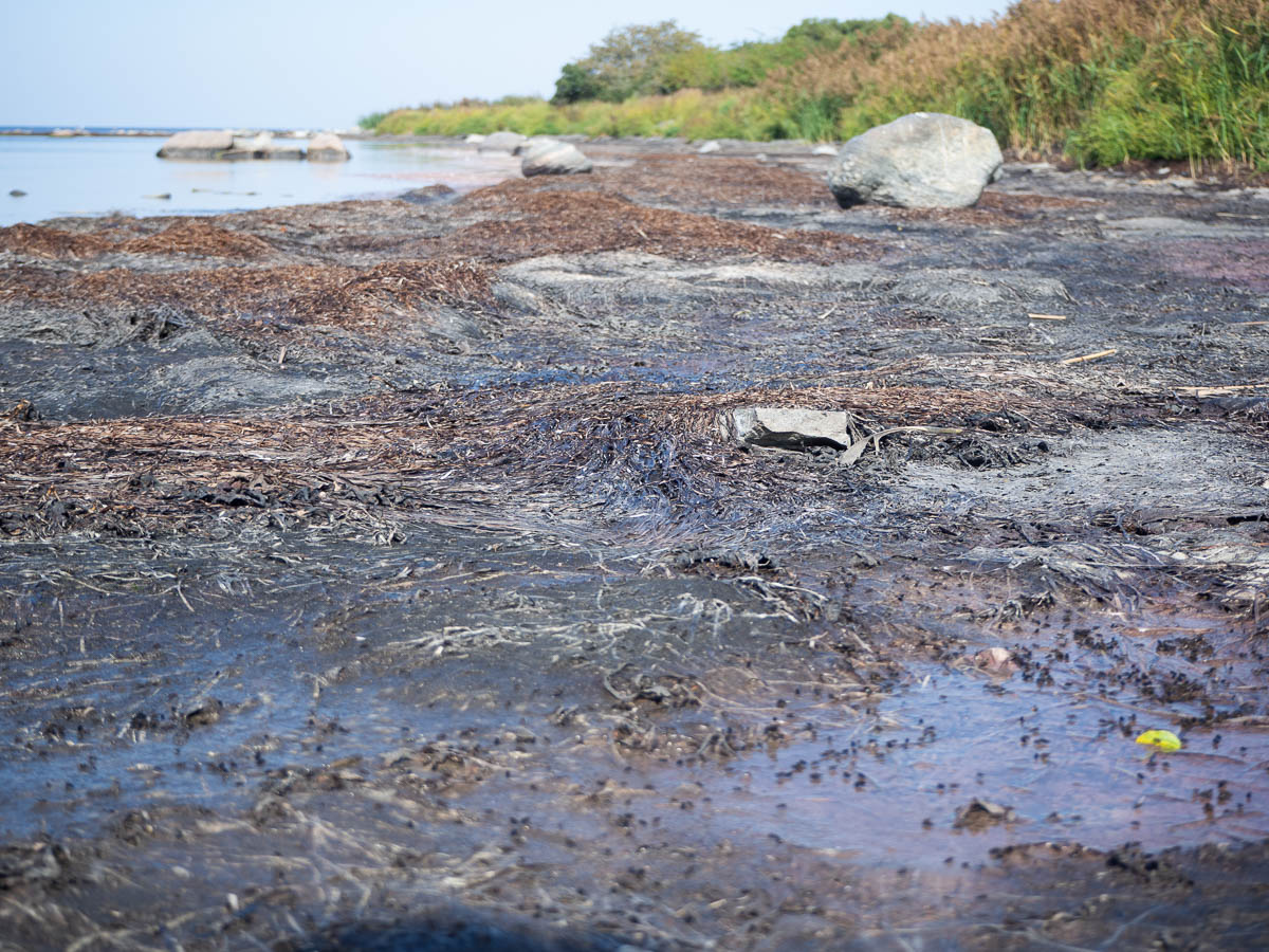
Then I got closer, and it was all mucky, blackened seaweed, with clouds of flies buzzing around.
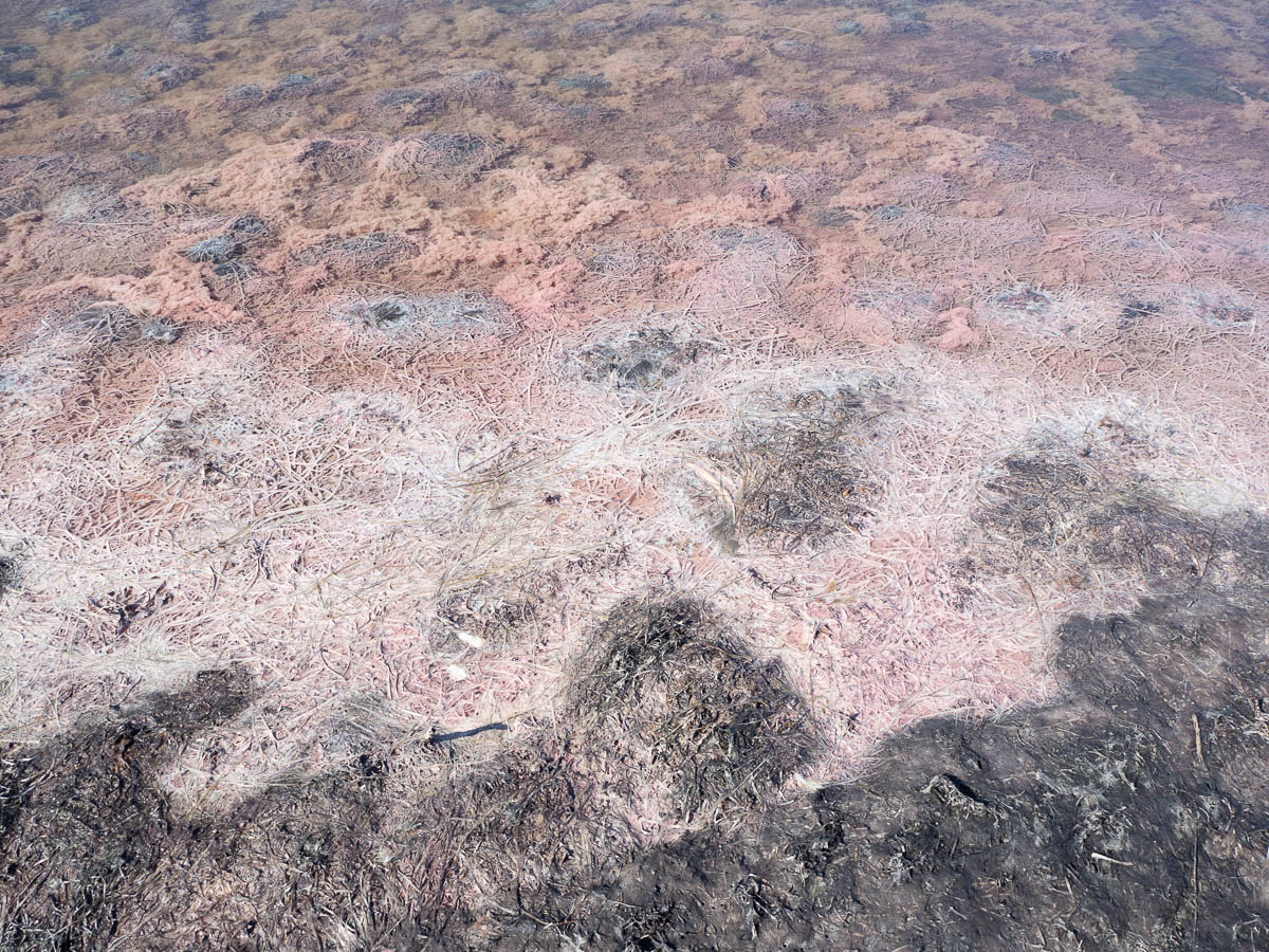
Just beyond the water’s edge, things got a lot more interesting to look at. White and pale pink strands of stuff, floating around together with delicate pinkish fluff. I have no idea what any of it is, or why it’s pink, but it was very pretty and had beautiful colours
I first clambered around on the tufts of dry black stuff, trying to find the firmer ones that wouldn’t give way when I stepped on them. Pretty soon I gave up, took off my boots and waded into the water. The black stuff looked unappealing but didn’t smell, and was not actually sticky or anything – after I stepped out again, my feet were wet but clean.
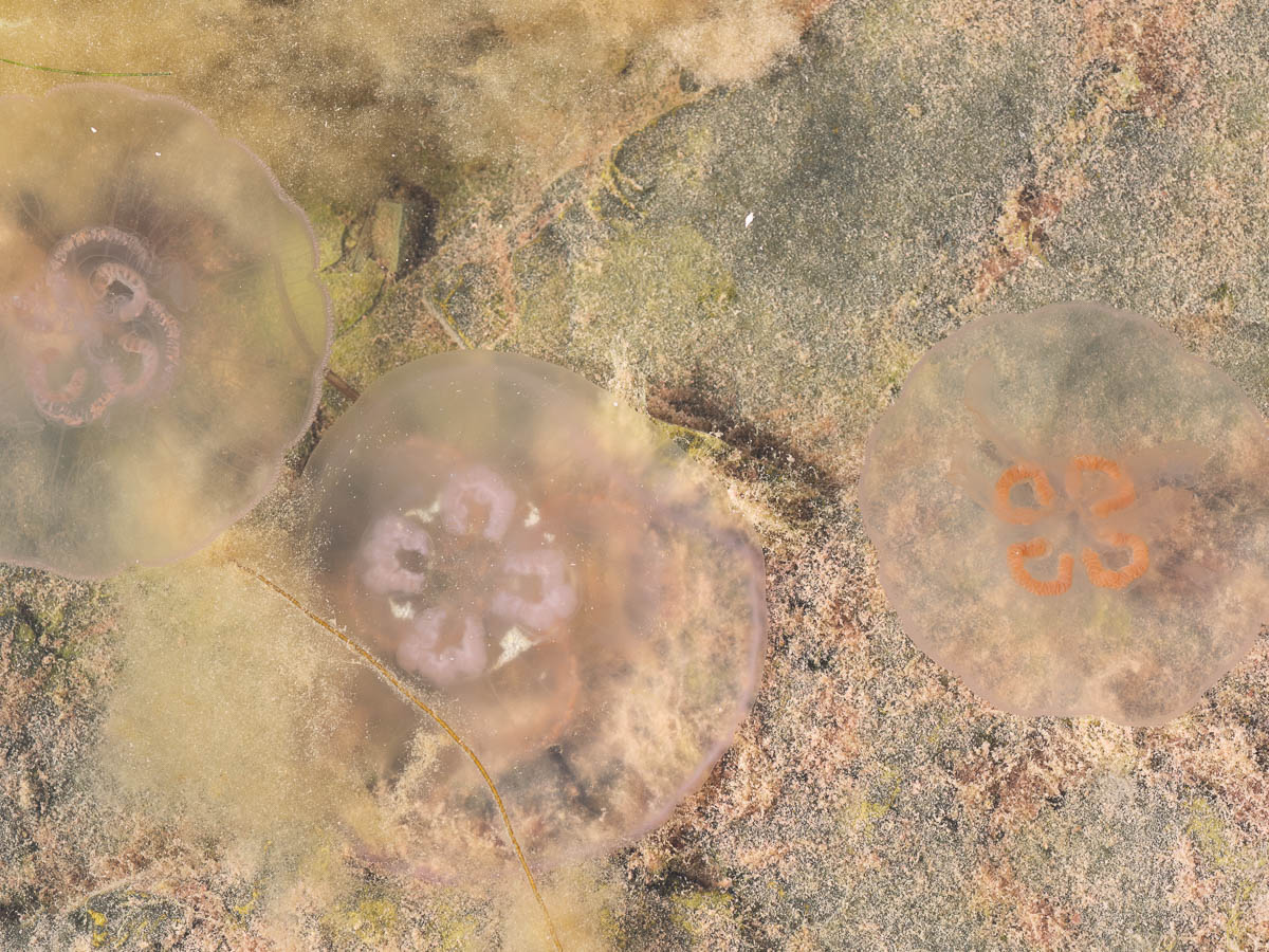
The water was very wader-friendly: shallow, and with a firm, flat limestone bottom. And amazingly hot! Not like a swimming pool but like a bathtub. It was surprisingly pleasant to walk around in.
I soon realized that I wasn’t the only one who enjoyed it. There were jellyfish everywhere.
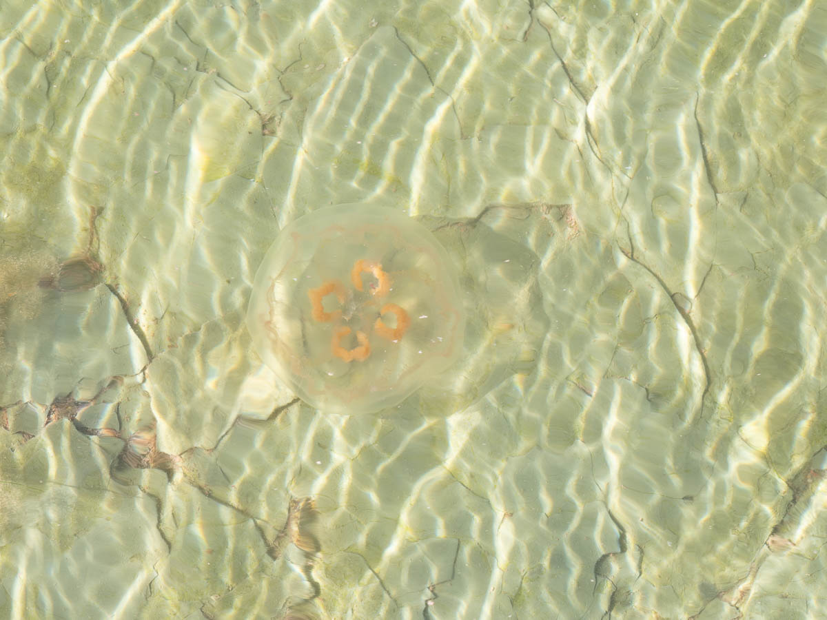
First I saw one, then I saw another, and the more I looked, the more I found.
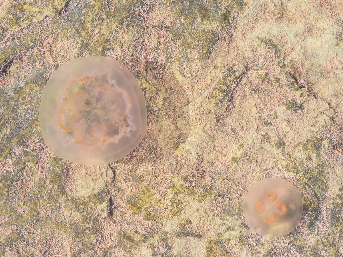
This was their place, not mine, so I left them to it and got out of the water.
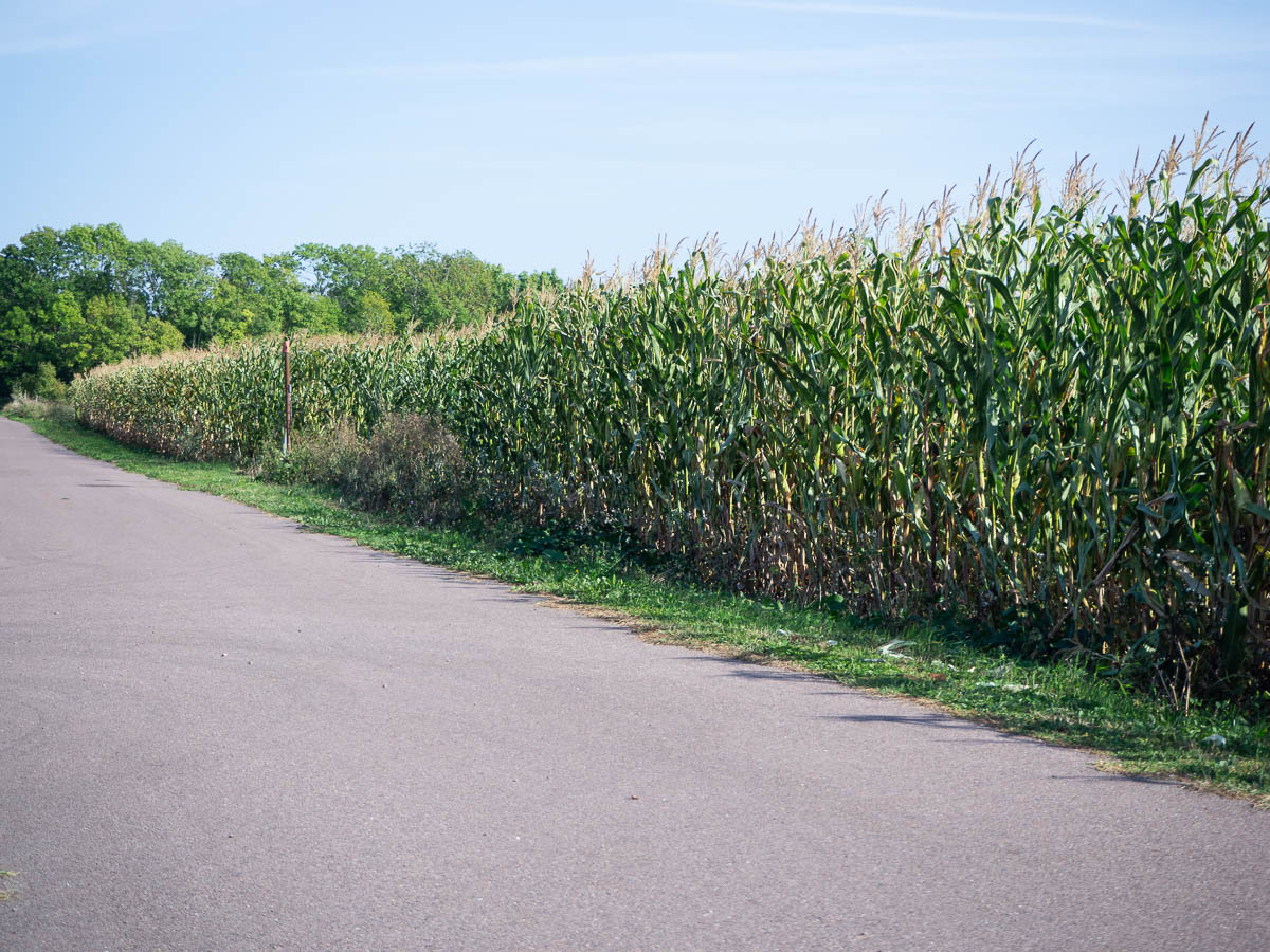
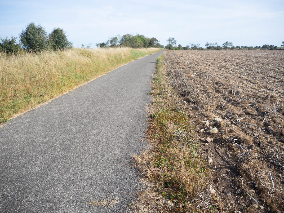
From Risinge to Mörbylånga there was a mixture of small roads, gravel and asphalt, in between fields and small villages of summer cottages.
In the afternoon I reached Mörbylånga. On the minus side: asphalt roads and cars. On the plus side: supermarket! Fresh fruit and vegetables, the season’s last strawberries, local bread. Fruit and vegetables are difficult to carry with me on a hike – they’re heavy and fragile – but I could give a few of them special for the few remaining hours of this day.
Also, ice cream. This stage of the trail is a short one, and I’ve had to make an active effort to walk slowly and take long breaks, so as not to get to the end too early. I had plenty of time to stroll through the small town and sit in the harbour and enjoy my ice cream.
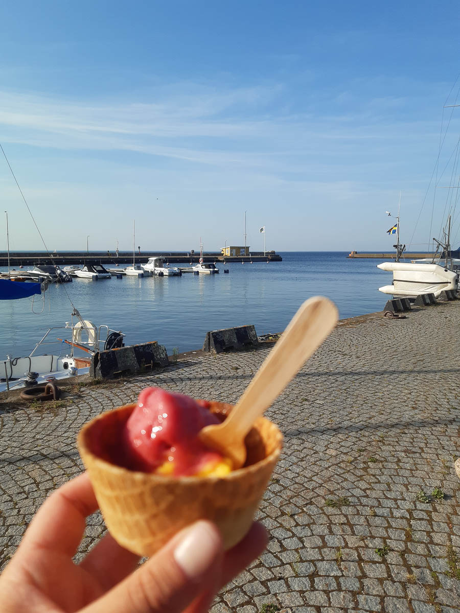
(Crappy phone photo? Yes. I’ve been taking one photo a day on my phone, so that I could share it with the family in the evening, as a sign of life. There was a major national news story just a week before I went on my hike, about a couple of hikers in Sarek who hadn’t returned from their hike as planned, and were being searched for by helicopter. I really wouldn’t want to cause anyone that kind of hassle, so I’m reporting daily on my location. Öland is of course nothing like Sarek in terms of remoteness, but since I’m on my own, stuff could happen.)
The stage ends in Mörbylånga and I guess you’re expected to stay at a hostel or something. Which I had no interest in, so I kept going for another kilometre or so, until my surroundings didn’t feel too urban any more.
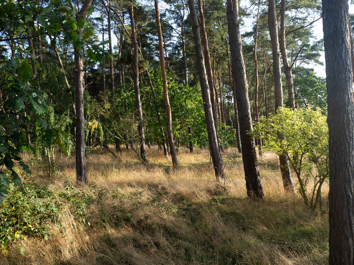
I put up my tent in a little patch of pine wood just north of Mörbylånga.
The trees all slanted towards land, away from the sea.
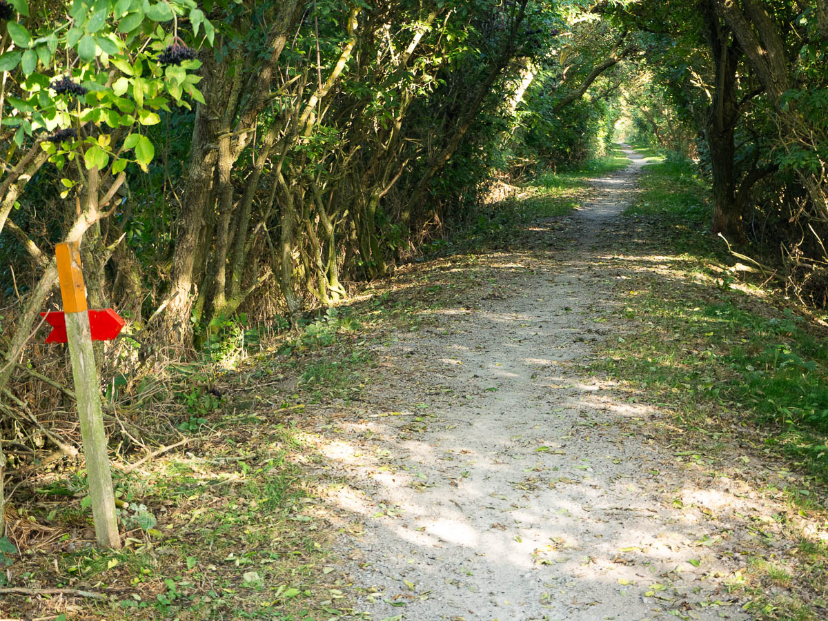
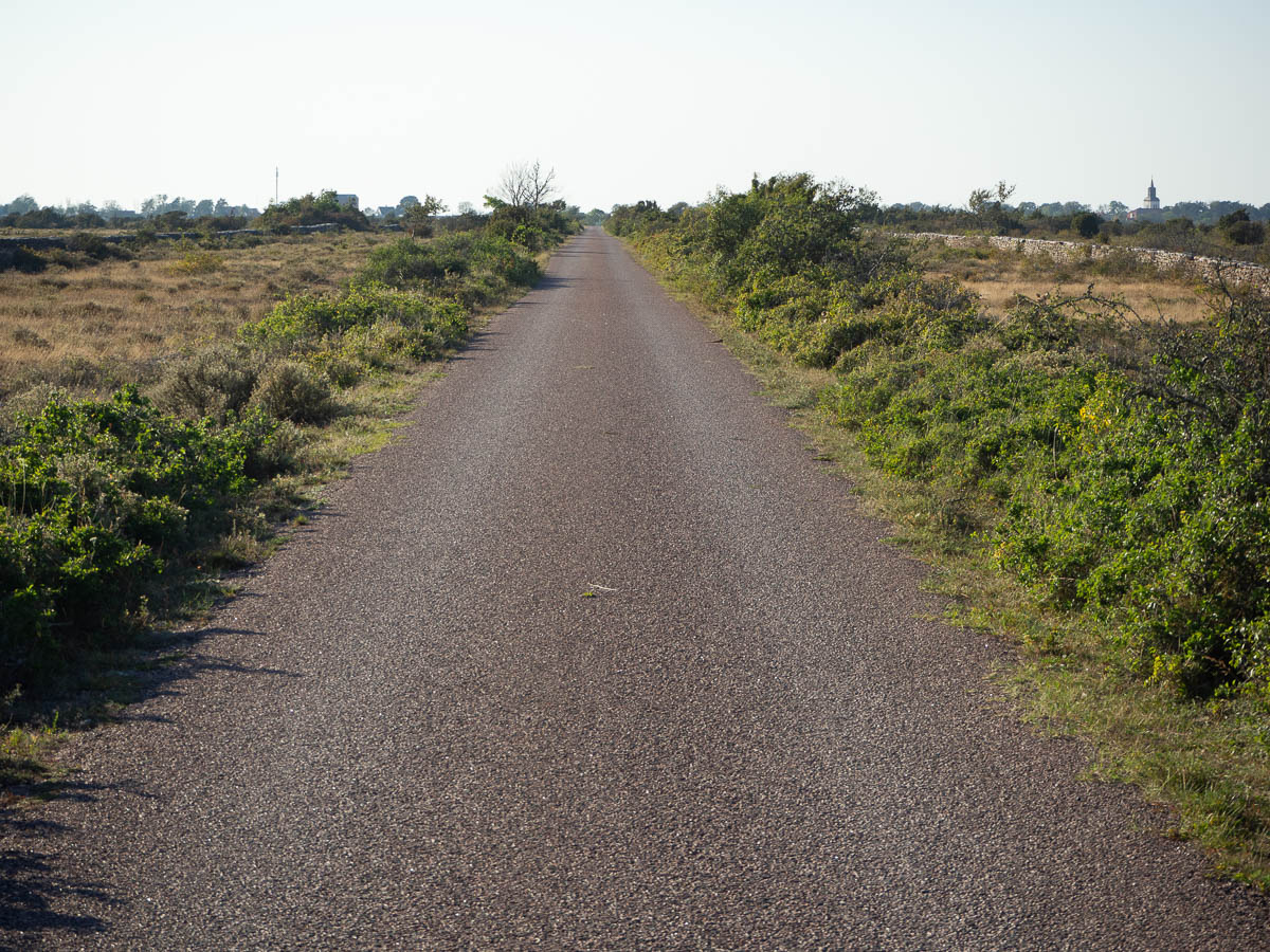
Seby to Kastlösa, around 17 km. Flat and straight.
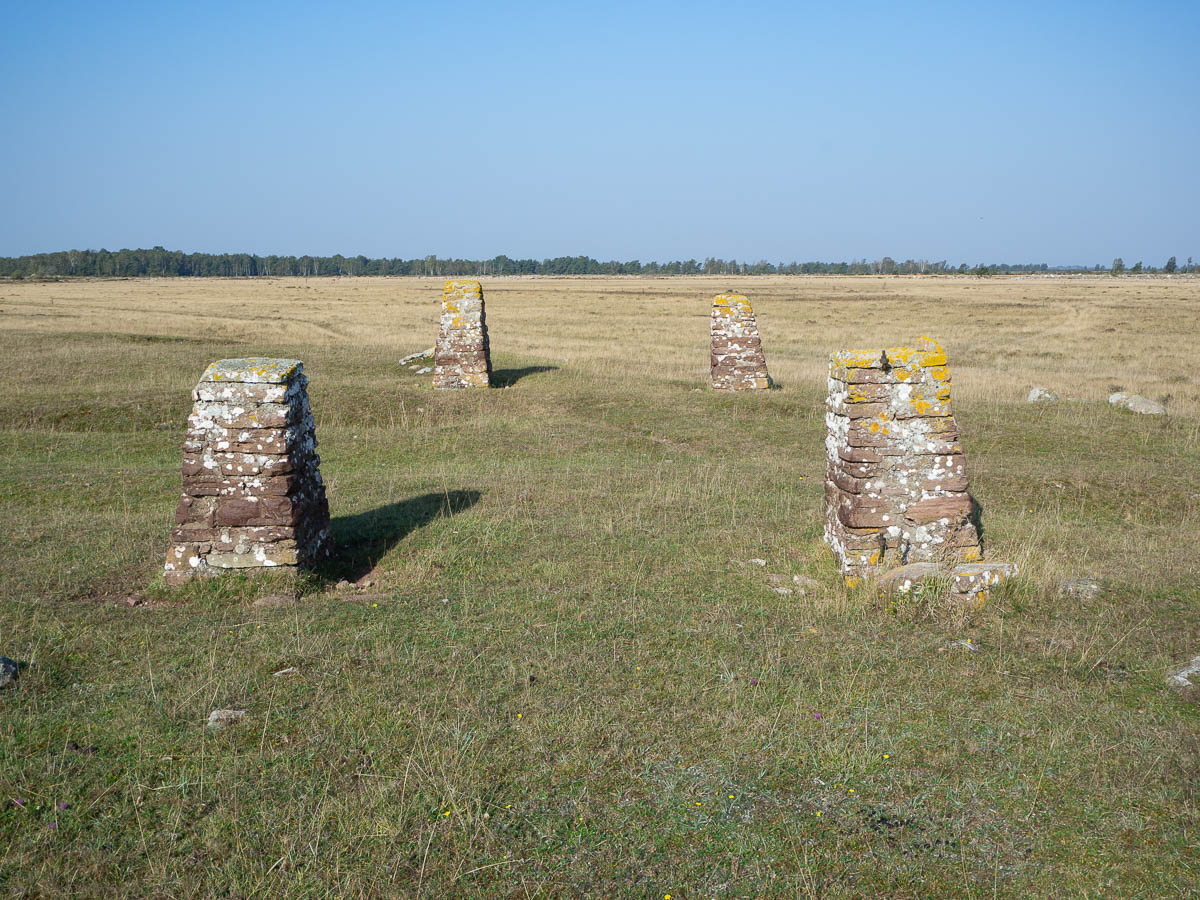
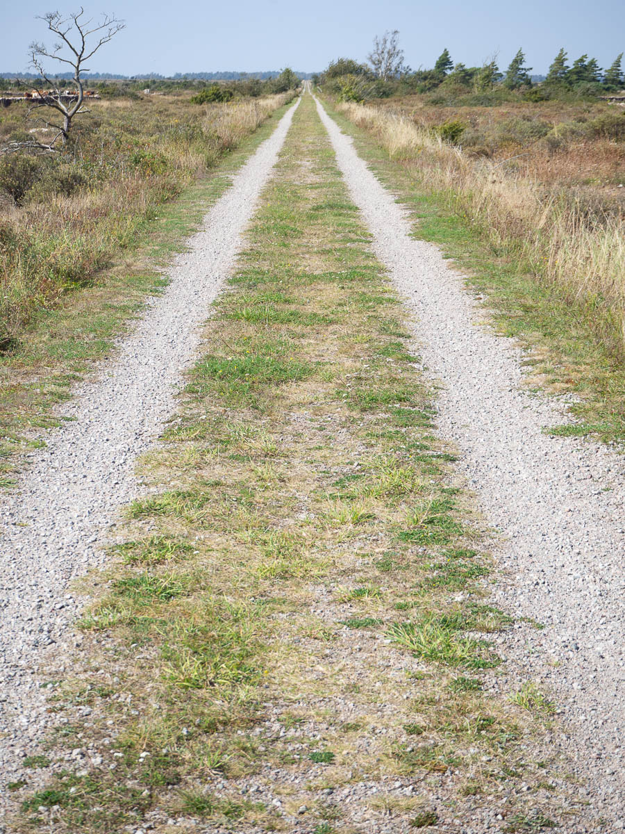
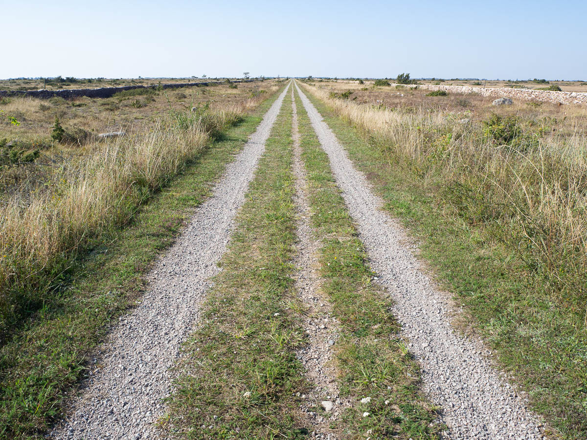
Stage 4 of Mörbylångaleden crosses the Great Alvar along the embankment of an old railway line. Up from Seby to Skärlöv in a straight line for about 9 km, turn a corner, and across the island to Kastlösa in another straight line. As straight as a bunch of engineers with rulers and theodolites could make it.
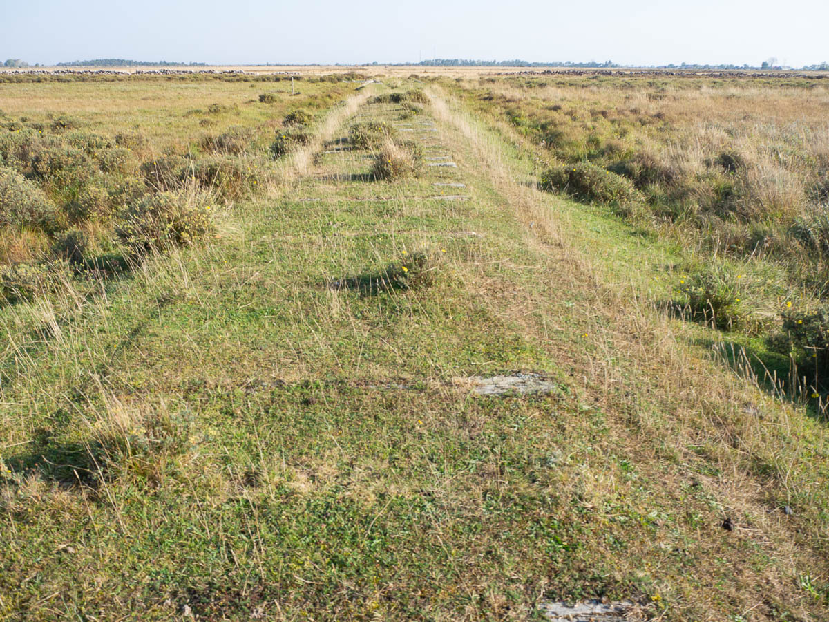
The railroad was opened in 1909 and kept going until 1961, despite economic problems. Mostly it transported beets and other agricultural produce, with only little passenger traffic. Now it’s all gone, except for small traces: the embankment, some pieces of railway sleepers left in the ground, old station buildings converted to private residences. These pillars in a square arrangement I assume are signs of an old railway crossing.
First things first, though: I needed to top up my water supply. The trail passed close to the village of Övra Segerstad, so I left my pack by a cow stile and went off door-knocking. A Wednesday morning in September isn’t the best time, but I was hoping to find retired people. Instead I ran across some kind of AirBnB or some other kind of holiday rental place, where the host was cleaning up after the season.
After that point, there was no more water to be had along the trail all day. And it was a very good thing I filled up, because the day was hot as anything. It must have been 27–28°C, and of course no shade again.
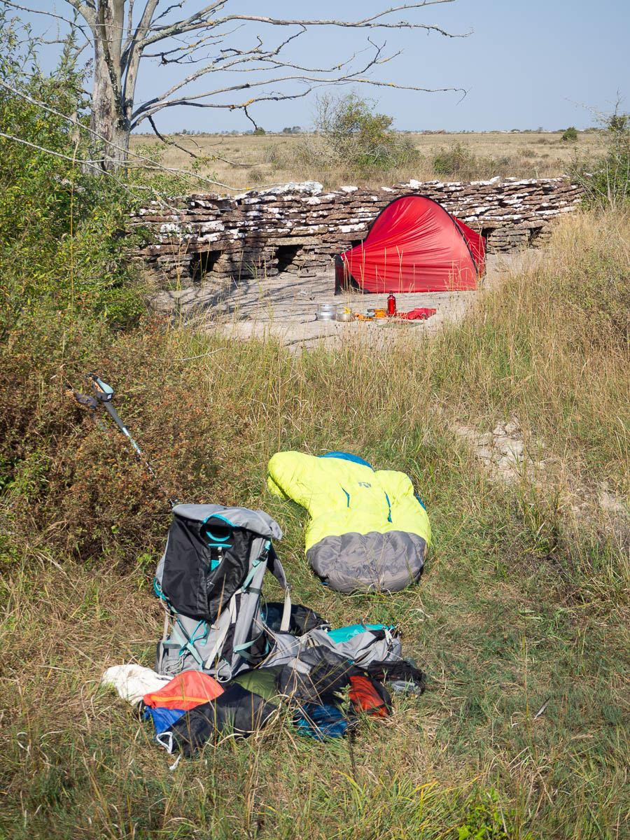
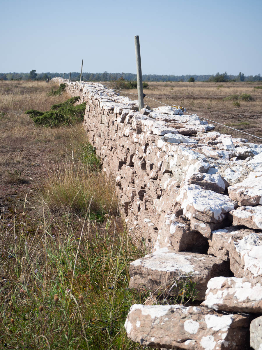
There are no streams here, unlike the Fells, and no lakes, unlike in Sörmland. There are streambeds where there have been seasonal streams, but at this time of the year, they’re dry as dust. Here’s me camped for brunch and tent-drying, literally in the middle of a dry streambed (because it was conveniently flat) – note the openings at the bottom of the wall to let the water run through.
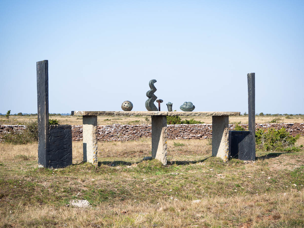
A section of the trail south of Skärlöv had been turned into a sculpture path, with sculptures in steel, bronze, and local limestone. Nothing mind-blowing, but each one was a brief, welcome break in the otherwise very uniform path.
Have I mentioned that it was very hot? It was. I was not enjoying the summer heat at all. It was rather exhausting. And there was no point in stopping because there was no shade, and it wouldn’t have been the least bit restful. As soon as I found a tree that provided some semblance of shade, I aimed straight for it to rest my legs and drink lots of water, even though I had to force my way through a minor thicket of sloe bushes to get there.
South of Skärlöv, the embankment had been partly overgrown and clearly didn’t get much traffic. The section west of Skärlöv, on the other hand, has been converted into a gravel road, and though it’s closed for through traffic, clearly it gets enough usage to remain open and drivable.
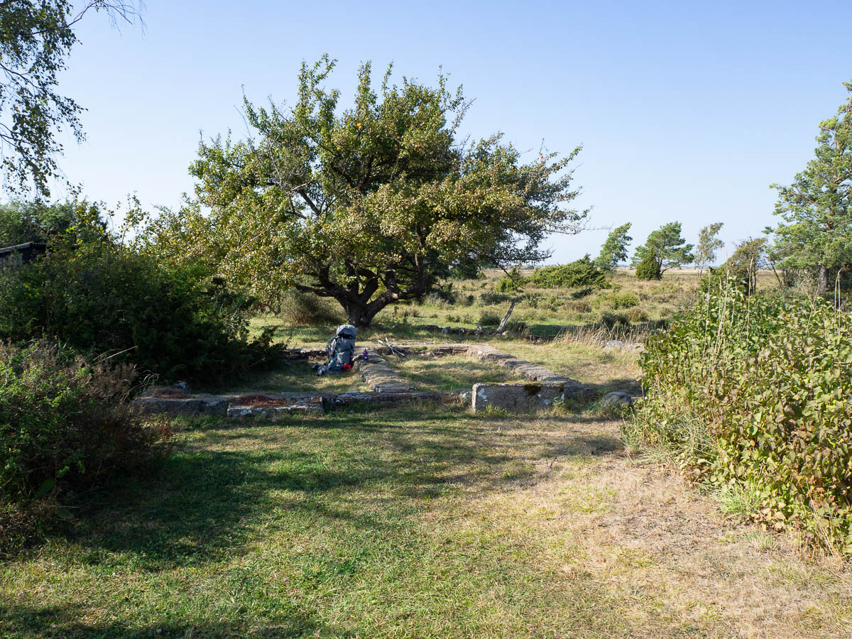
The heat was still exhausting. When I got to a shelter a kilometre after Skärlöv (at the ruins of an old railway attendant’s hut) with proper shade from large trees, I stopped for a long lunch break underneath an old, wild apple tree.
Fed and watered and rested, I set off again along with renewed energy. It could have been boring: the road straight as an arrow, the alvar flat as a pancake, and mostly featureless. Not even cows, mostly – I guess there wasn’t enough for them to drink here. But after lunch I got into the proper frame of mind for it, and found it very meditative. Like listening to minimalist music. Lots of time for thinking my own thoughts.
This may look like a boring hike, but for me it was perfect. Meditative and calming, exactly the kind of break I needed from the turbulence at work. And beautiful! Photos can’t do it justice, because a big part of the beauty of the landscape is the feeling of wide open space, of an endless sky, of being a small speck of a human in a timeless space.
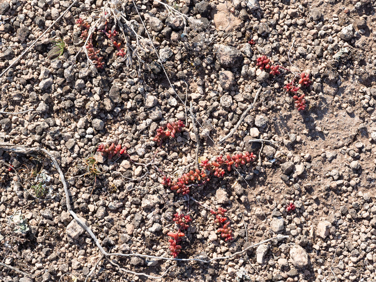
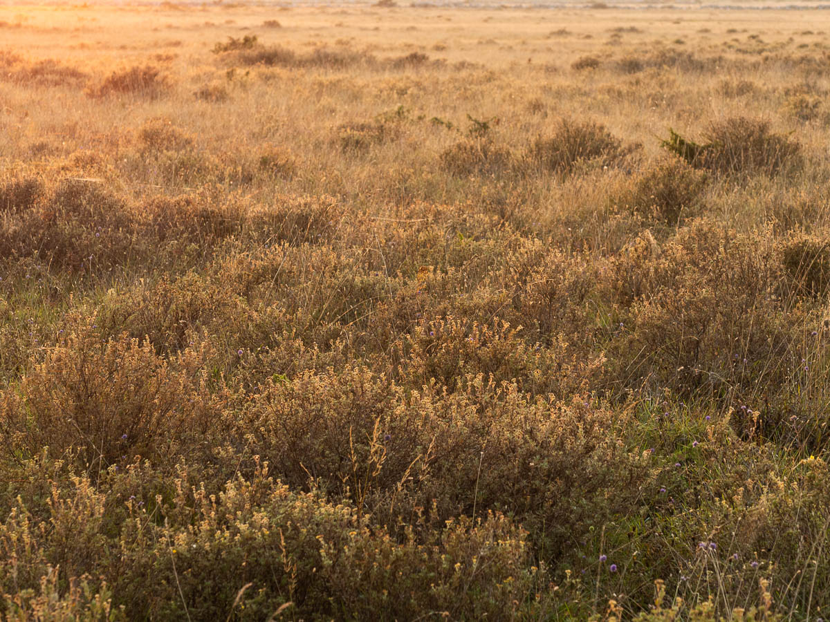
Much of the alvar looks like grassland, but in places there were signs of what were probably seasonal wetlands. At this time of the year, though, they were all dry. Some places were nothing more than bare rock and gravel, with tiny succulents holding on to nothing.
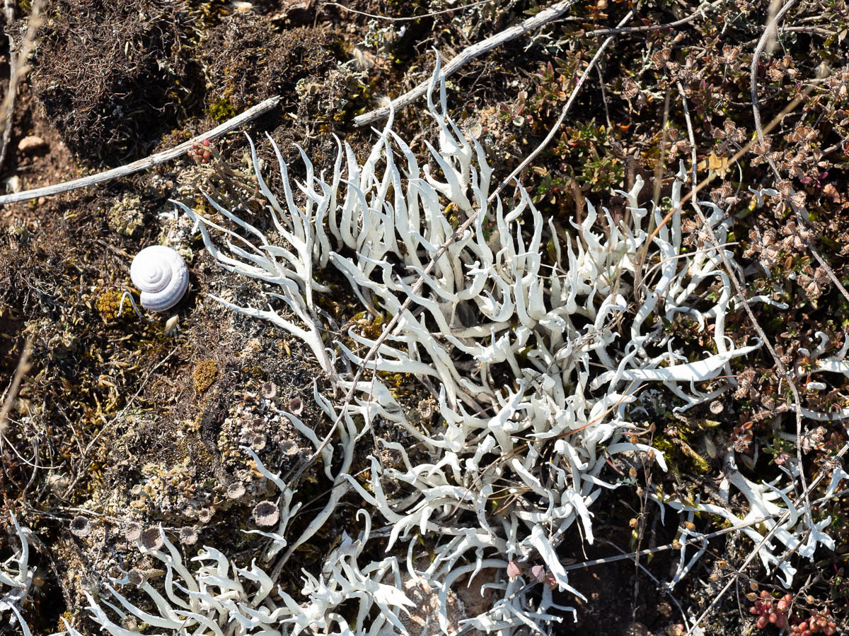
Whiteworm lichens, Thamnolia vermicularis.
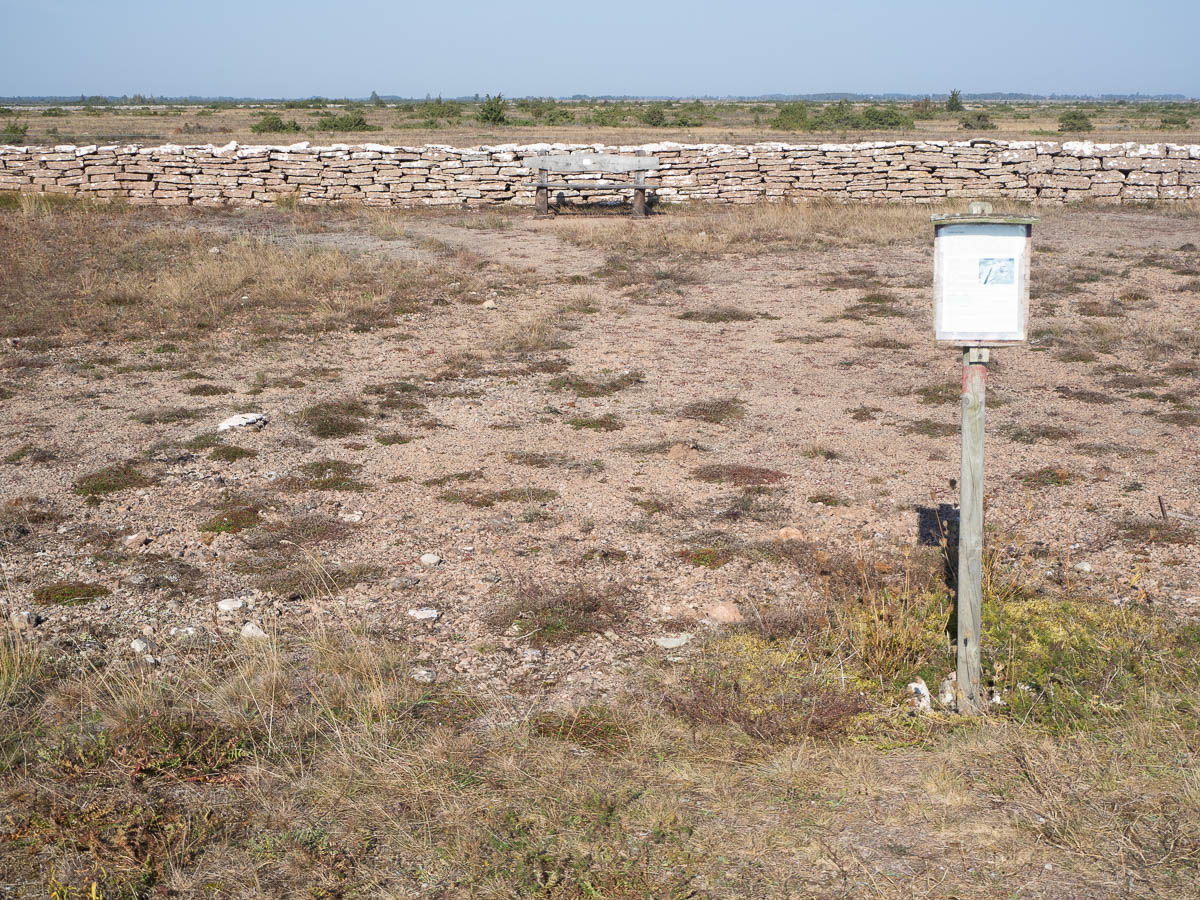
And then, in a random spot, kilometres from everything, with nothing in particular to look at – a bench and a faded information plaque.
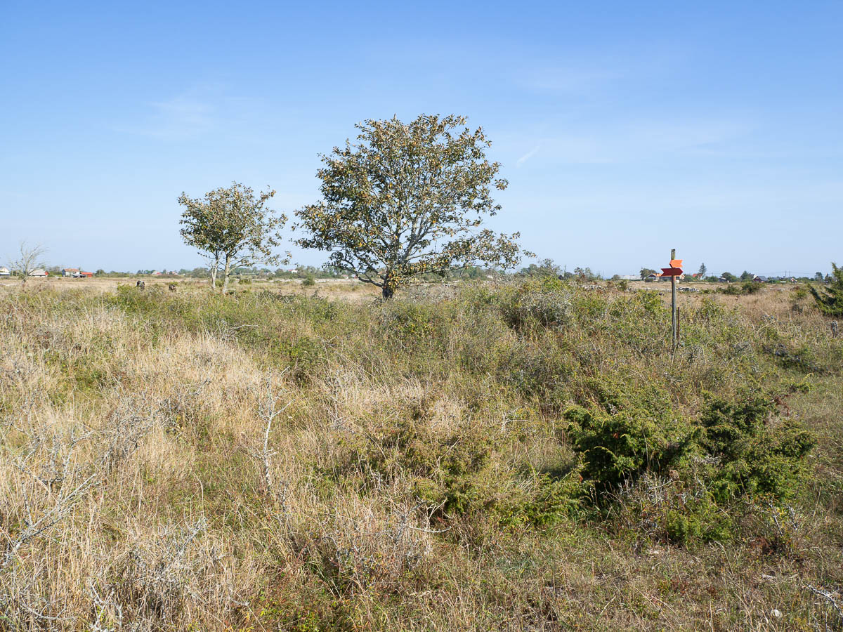
Closer to Kastlösa the landscape got more ordinary again. The alvar was interrupted by small copses of trees.
The last bit was paved road. It may look convenient but isn’t. I find that walking on asphalt with a heavy pack, especially after a full day of walking, is painful and uncomfortable. It especially makes my feet hurt.
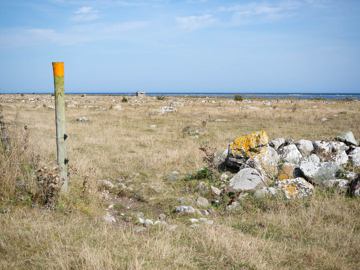
There was no shelter and no camping site in Kastlösa, but I think the meadow where I put up my tent must have been a camping site for camper vans in the past. There were flat, even grassy fields, and lamp posts, and what looked like charging posts. And a path that was very popular with local dog walkers.
From Ottenby to Seby, around 18 km. Sun and sea birds and the sound of the sea. And cattle.
I paid for my stay as soon as the camping reception opened, filled up my water bottles, and was on my way shortly after eight in the morning.
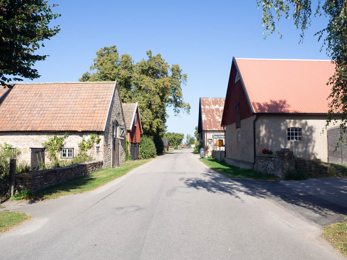
The trail first followed the asphalt road through Näsby village, a medieval-style “row village” with all the dwelling houses arranged ribbon-like along the two sides of the road.
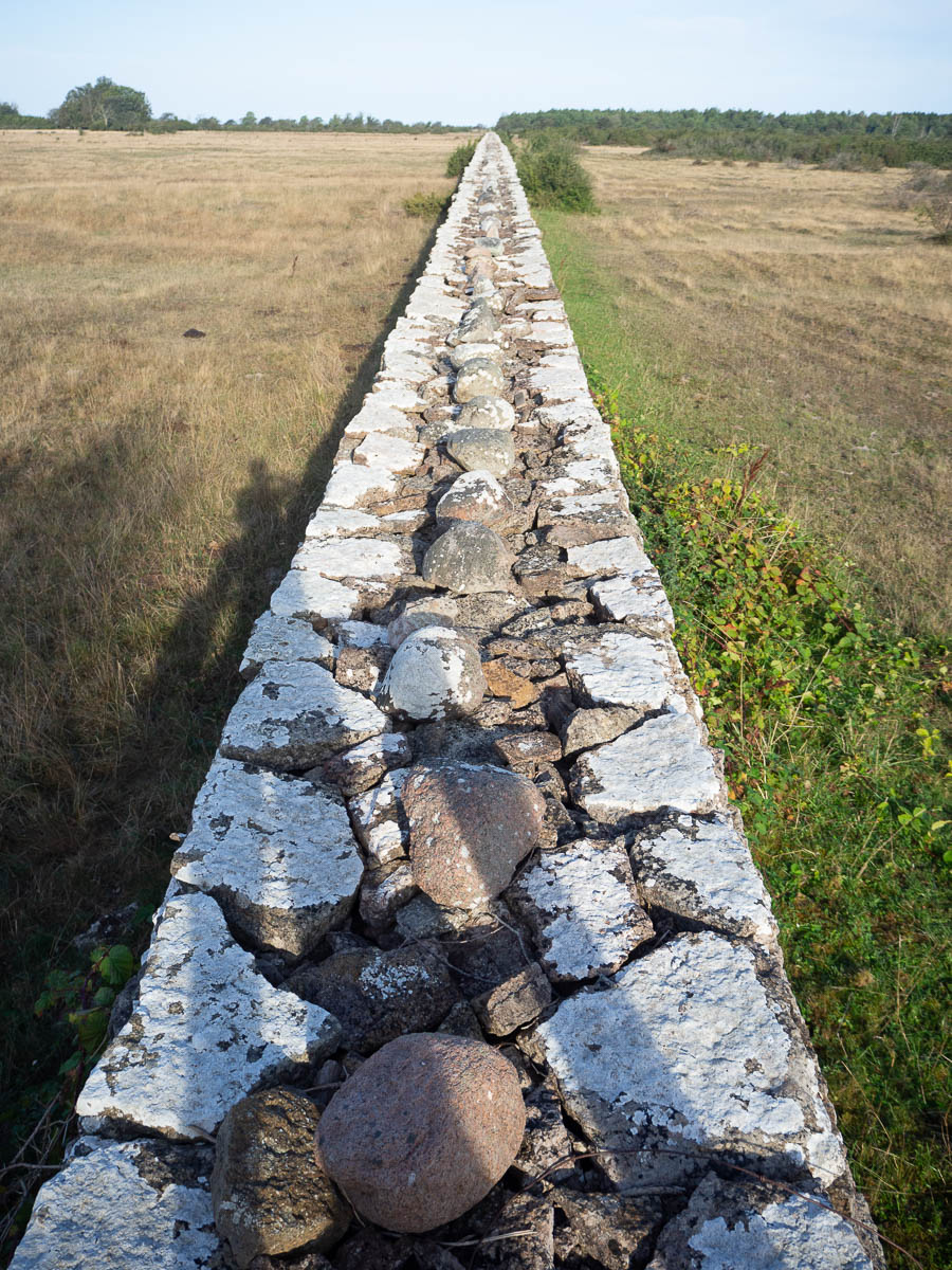
On the edge of Näsby lies “the wall of Karl X Gustav”, built by a 17th-century king to keep the deer herd on one side and the peasants on the other. Originally supposed to be “tall enough that a man on a horse couldn’t see over it”, these days it’s about shoulder-height for me. It wouldn’t stop any deer (and those are kept in place with electric fences instead, anyway) but it’s a pretty impressive sight. Five kilometres long, straight as a ruler, interrupted only in two places by the road (as it goes south on one side of the island and loops back up north on the other).
Soon after Näsby the trail left the main road for paved cycle paths.
I could still hear the road all the time – except after a while I realized that it wasn’t the road but the sea. The road did not have enough traffic to make that constant rushing noise. It was the sea, with the wind from the east making waves crash against the rocky shore all the time, just out of sight but not out of hearing range.
The trail continued gradually onto smaller and smaller footpaths between fields and meadows and cow pastures.
The cow pastures were all bordered by limestone walls, mostly somewhat crumbled. They seemed mostly decorative and symbolic, because the electric fences are doing the actual job of keeping the cows where they’re supposed to be. But I guess the stone walls are much more visible than thin electric wires, and might get more respect from cows. And humans.
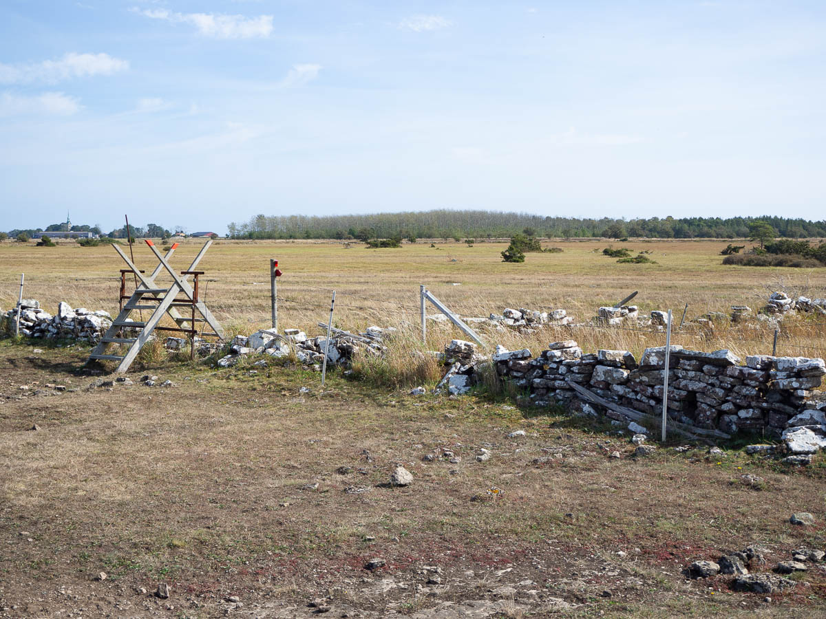
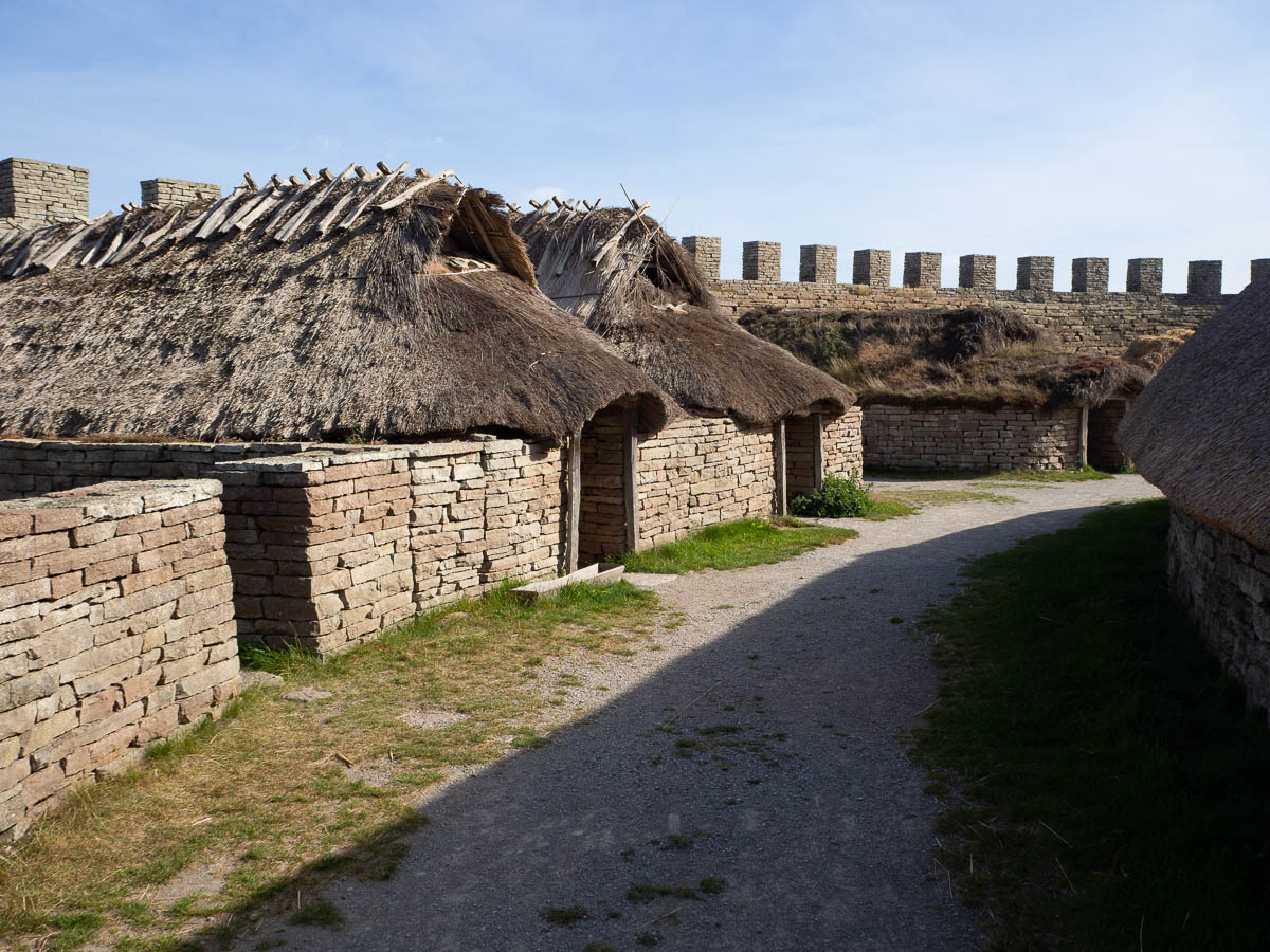
Roughly halfway along, the trail passes Eketorp, a reconstructed Iron Age ring fort. It was technically not open yet for the day (low season again, and the ticket office wouldn’t open until 11) but it also wasn’t closed or locked, so I went wandering around anyway. I probably missed out on some booklets and what not, but it was rather interesting even with just the info plaques that were out there.
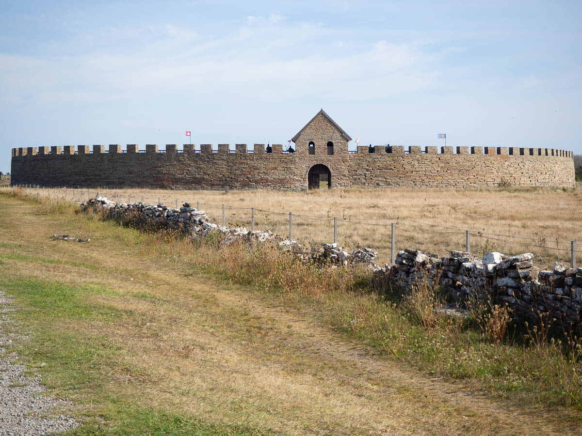
The fort had been put to different uses over centuries of time. The reconstructed version shows several side by side. One part has been left as it was found, with just ground-level traces of stone walls. Another part has been built up as it probably was during the Iron Age, with small densely-packed stone huts. On the other side, timber houses have been rebuilt to mimic the fort in its reincarnation as a medieval garrison.
A few days ago at home I was swapping out my summer dresses for an autumn wardrobe and starting the sock season, and today it was at least 25°C. Judging from the state of the vegetation, uninterrupted sunshine seems to be the standard here.
And there was not much shade to be had along the trail. There were plenty of large trees in the villages, but nothing out among the meadows and fields. When I finally spotted a lone tree – scraggly and sparse – I knew I had found my lunch spot.
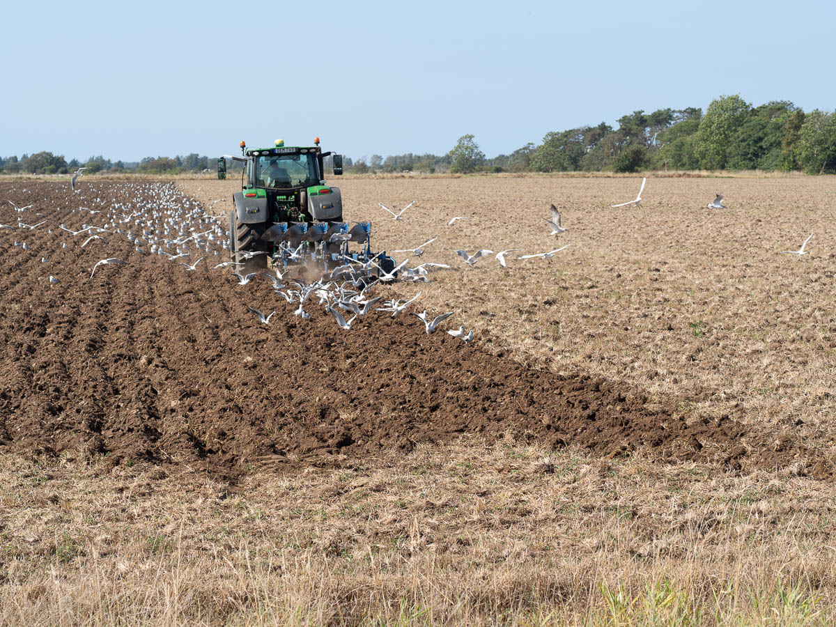
The sea birds were never far away. Large flocks of geese flew noisily overhead every now and again, often 70 or 80 heads strong. Gulls congregated en masse around tractors ploughing the fields. They remained on the ground until (it looked to me) the tractor was a finger’s width away from crushing them, before taking flight, and then immediately landing behind the tractor to get at all juicy the worms.
In the late afternoon the trail turned back to the seashore.
The beach could not in any way be described as pretty. Weeds, churned-up mud, cow pats, bird droppings. And hundreds and hundreds of sea birds, making the sea look like bird soup just fifty metres out.
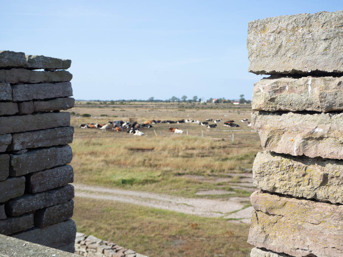
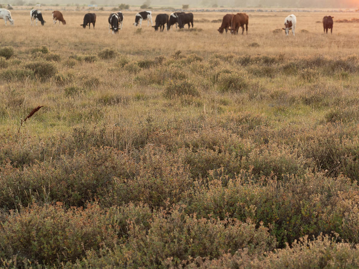
There were cattle everywhere, all the way to the water’s edge. Southern Öland is cattle country, and they roam free and wide.
There are numerous info signs along the hiking trails and at other tourist spots, informing people how to behave around cattle. Keep your distance, close all gates, don’t get between a cow and its calf, don’t feed them, don’t bring any dogs.
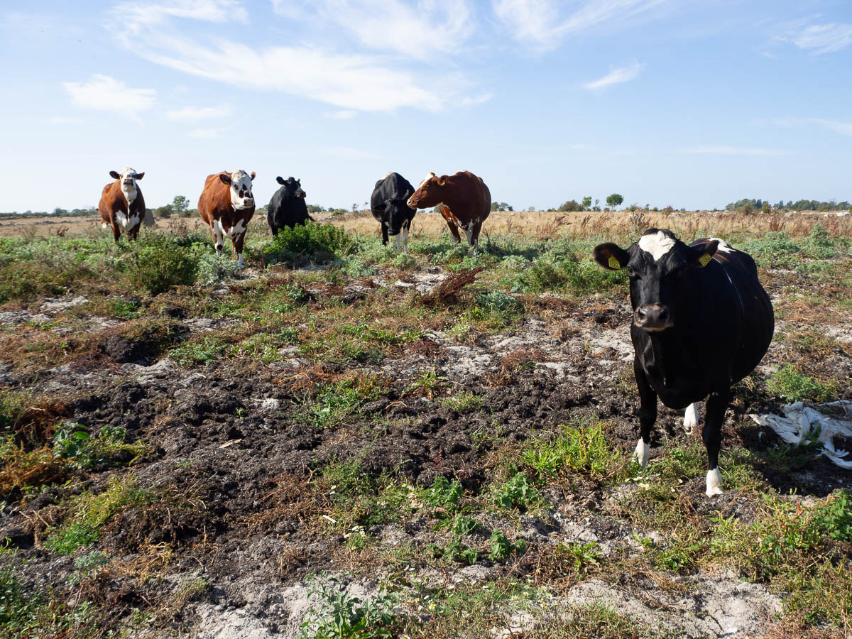
The cattle – mostly young ones, by their looks – were curious and nosy. As long as I walked past them, they didn’t pay me any attention, but whenever I stopped for a while, they noticed me and all decided to come have a look. Poked at my backpack where I had put it down while photographing; nosed at me and my clothes.
This stage of the trail officially ended at Seby boat harbour, where there is a parking lot, but that spot was clearly picked for ease of access and not with tenting in mind. There was, however, a shelter a few kilometres further along the trail, so that’s where I headed for the night. It was in a small copse in the middle of cattle pastures. And of course fully surrounded by electric fencing, because otherwise it would immediately be overrun by cattle.
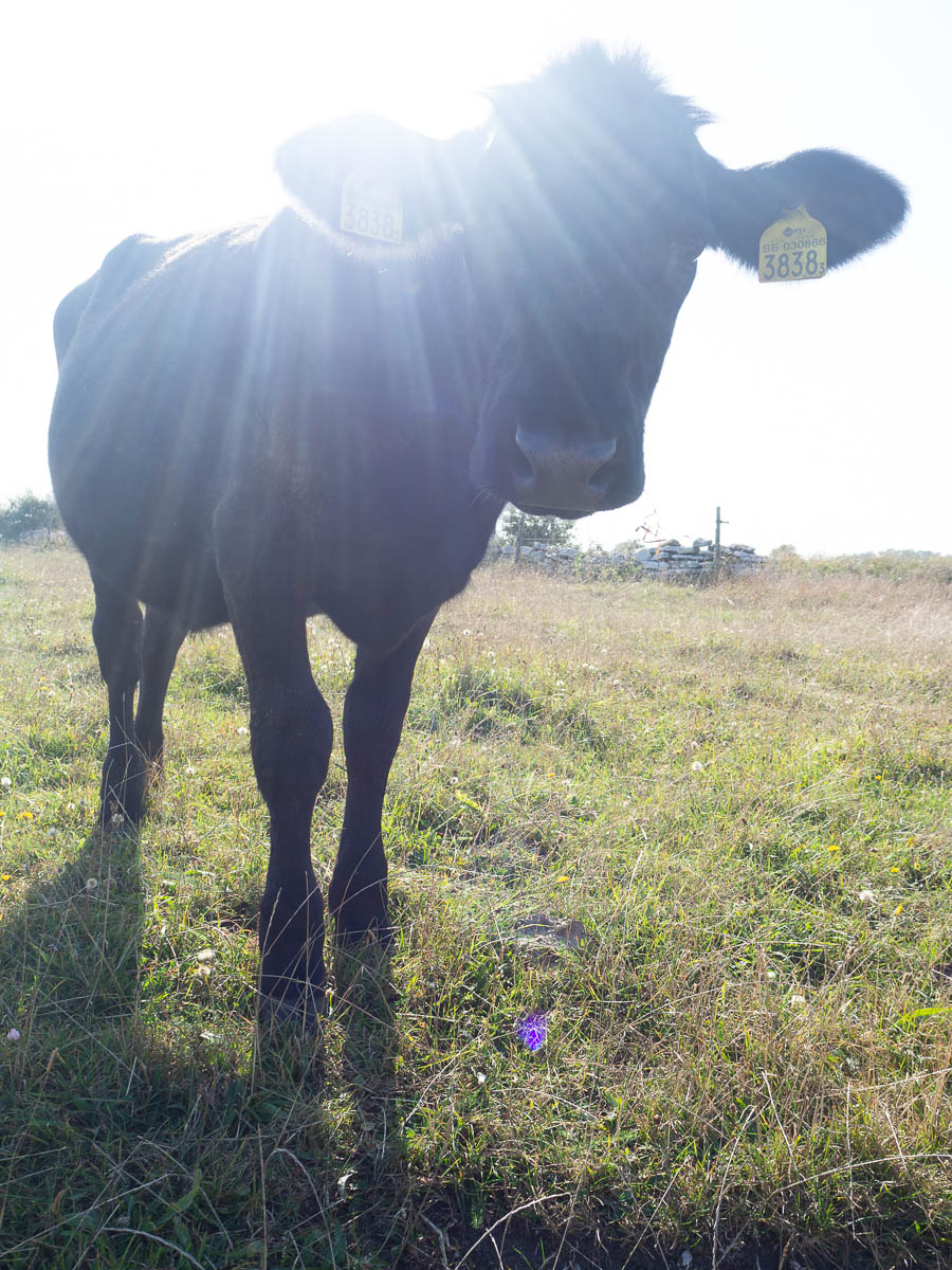
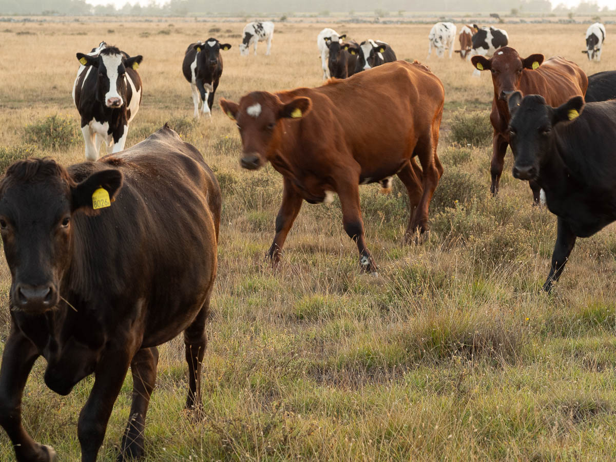
It was a beautiful evening. I went out to take photos in the golden sunset.
And of course I got accosted by cattle. I stayed away from them, but they did not stay away from me. I think this herd hadn’t seen many people recently and were extra curious. Or something. In any case, they first got rather uncomfortably close, and then kind of started rushing me. Not actually aggressively, I believe – they pulled up a metre or two away from me every time – but enough to make me move away very carefully and slowly, without turning my back to them. They are very much bigger and stronger than me, after all. I breathed out in relief when I was back at the shelter, on the other side of the fence again.
The evening sky was clear, and the forecast for the night was the same. I set an alarm for 1 o’clock in the morning and got up to look at the stars. The view was pretty good, but not the best I’ve ever seen. Villages on the west coast of Öland spread hazy light in the west, and a slowly pulsating light in the south must have been Långe Jan, a good 20 km away.
The Milky Way was distinguishable if you knew what to look for, but not bright. As a bonus, I saw three meteors.
| « Older posts | Newer posts » |