Branäs is a smallish resort with a lot of family-friendly blue slopes. It didn’t take long for a few favourites to emerge, mostly based on the availability of chair lifts. Button lifts are cute but take forever to actually get anywhere. And you’re on your own all the way – can’t talk to anyone else. Chair lifts on the other hand turn skiing into much more of a social activity.

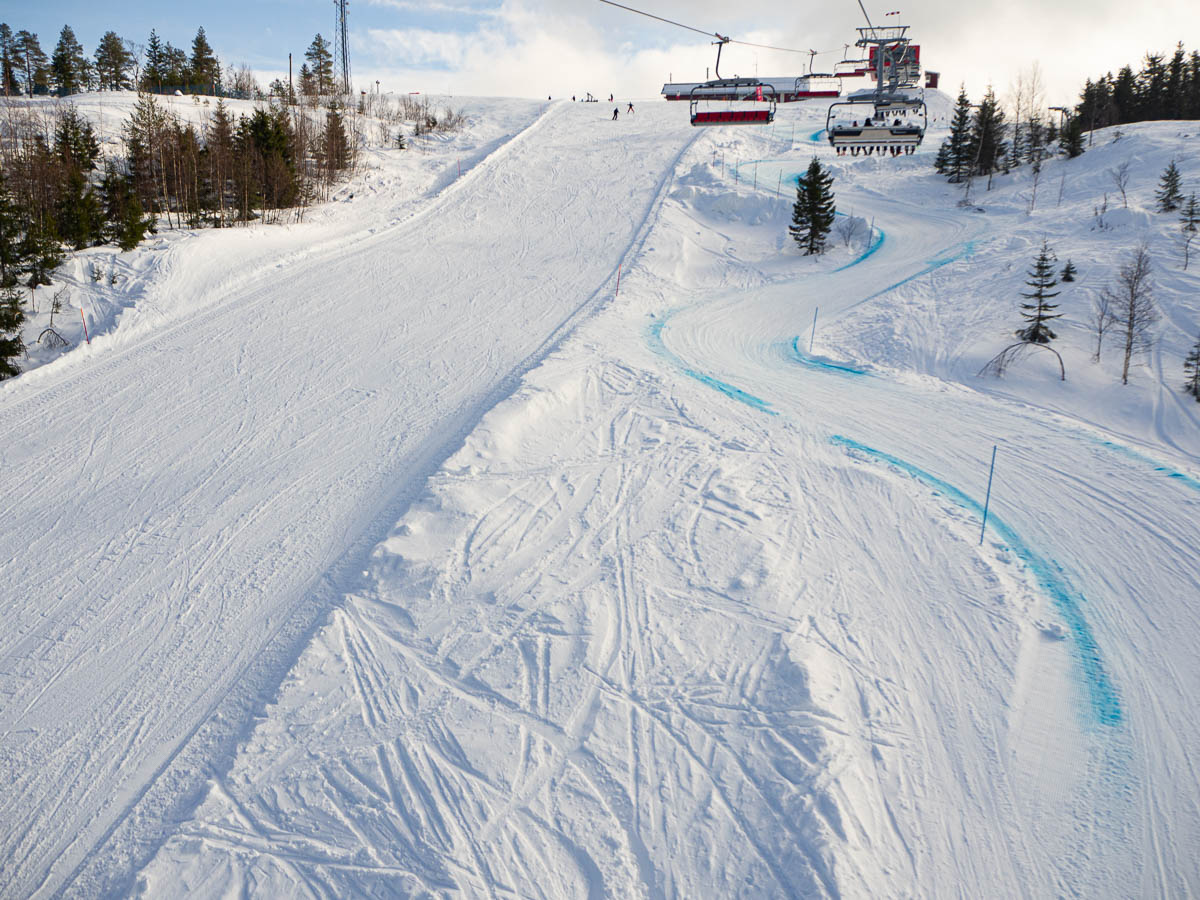
The slopes down in Mattesdalen with its four-seater chair lift were quite long and had some really nice stretches, but also a horrible icy patch in the middle where three slopes met. Every time we got there it was really crowded, with people struggling to get past the ice and the churned-up drifts of snow on top.

When we tired of skiing over there, we spent hours simply going up and down a single slope on the other side. The slope itself was mostly in the sun, in good shape, neither icy nor uneven, and the six-seater lift there seemed brand new and got us up the mountain smoothly and comfortably. After a while we knew the individual features of that piste by heart – keep to the left here at the top, stay away from that icy patch next to the lift queue, watch out for skiers coming in from the side over here.


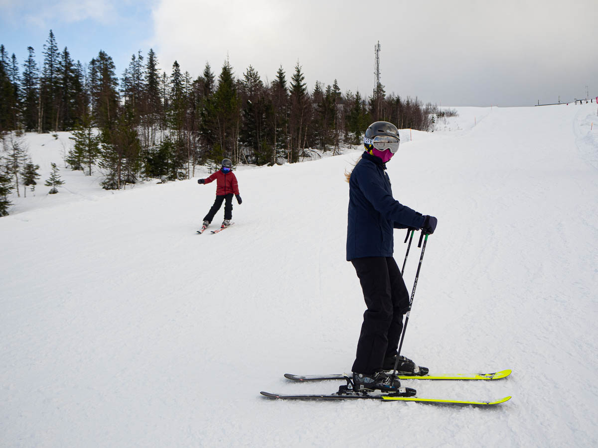
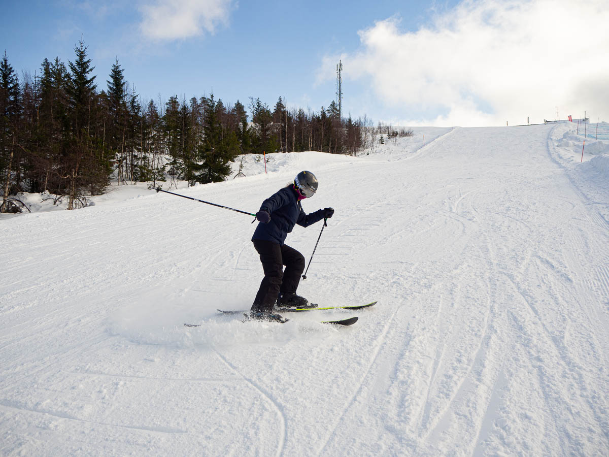
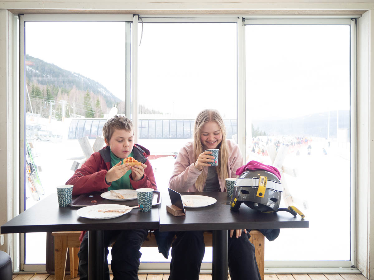
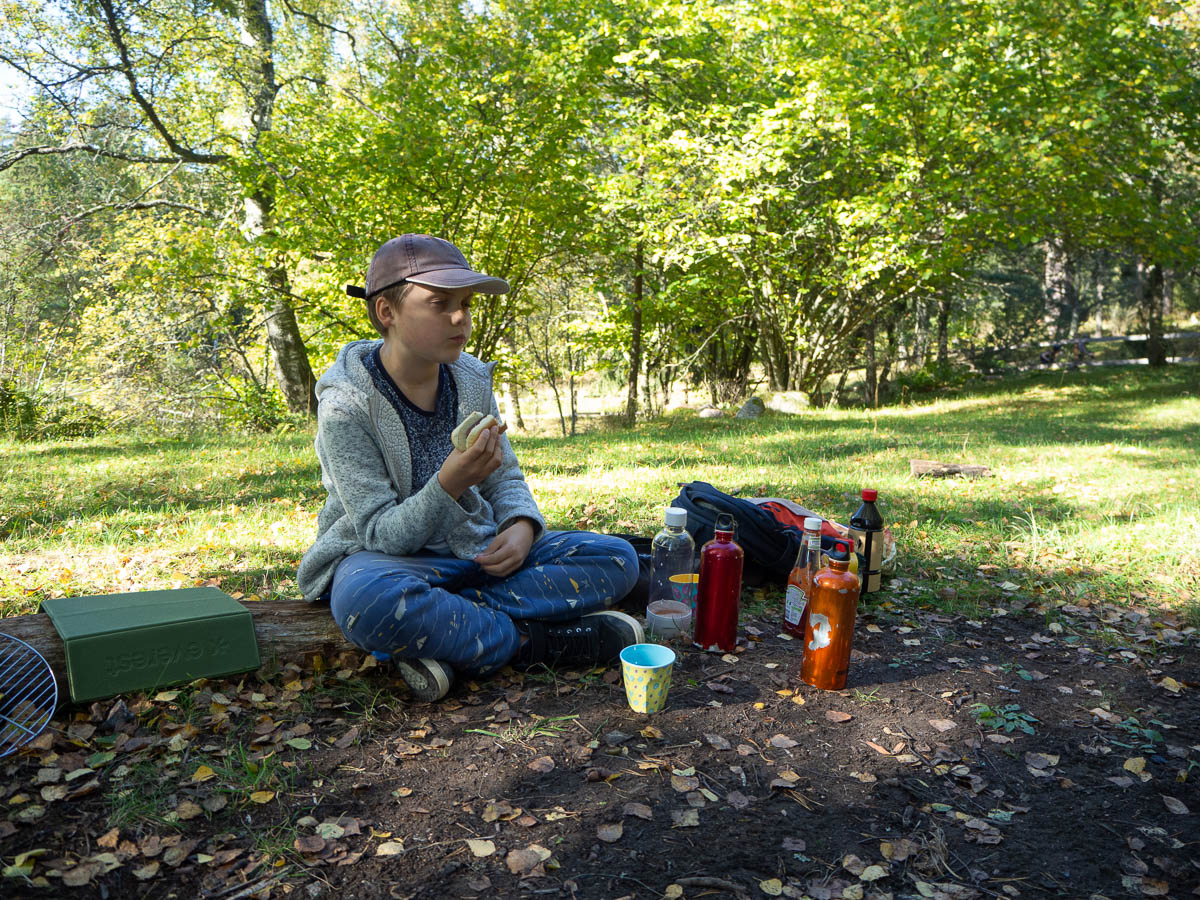
Adrian worked on braking less and getting his turns more parallel. Later in the afternoon he tried out the bumpier ground just off the piste, under the lift. Ingrid challenged herself by dramatic hockey stops, aiming to throw as much snow in the air as possible (or on Adrian’s skis when he’d already stopped before her).

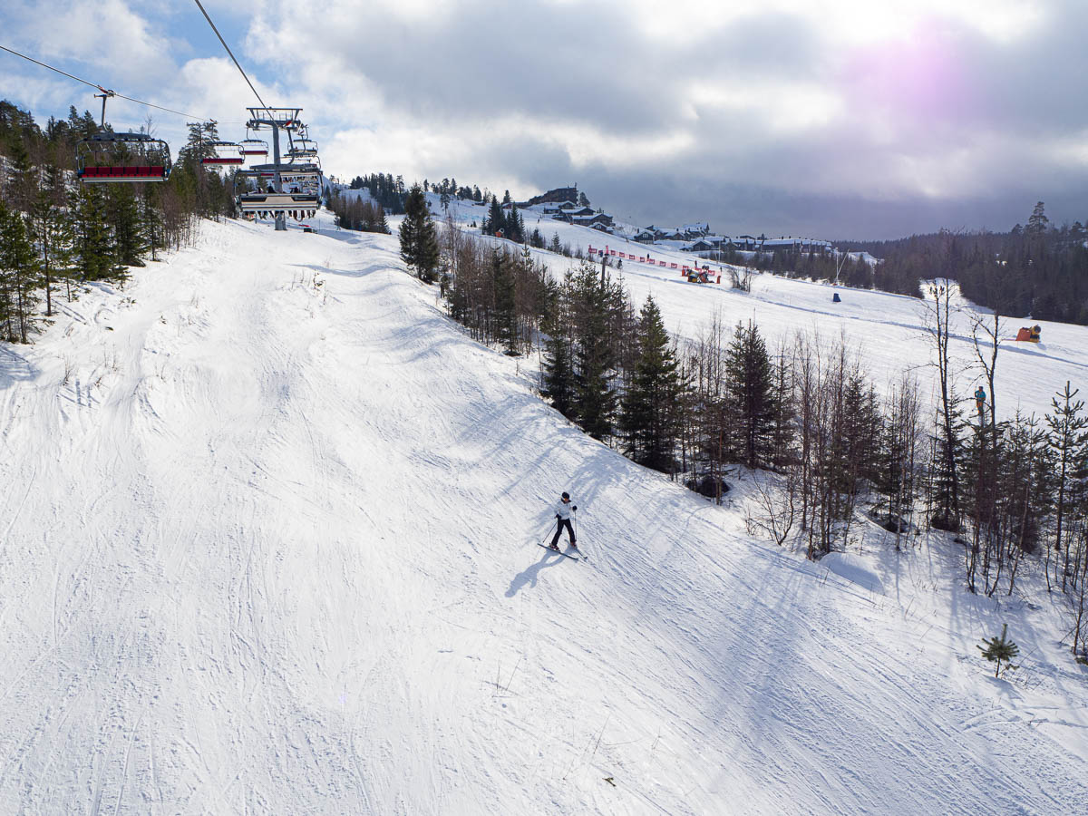
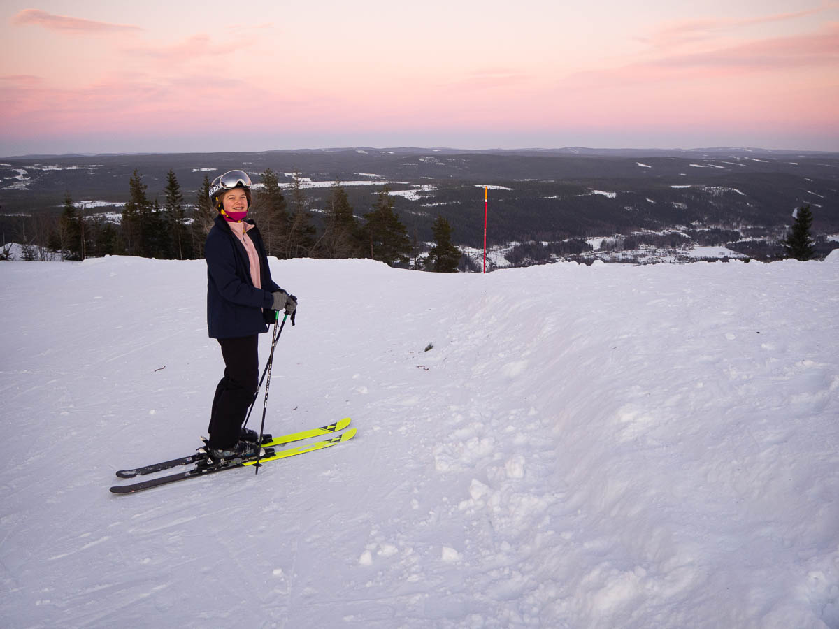
Branäs is situated at a low elevation. Where the peak in, say, Åre or Idre is above the treeline, offering dramatic views of windswept snow and ice, in Branäs you’re never far from civilization. There are trees all the way up to the top of the mountain, and houses everywhere between and around slopes. Very convenient, but I did miss the wide mountainous vistas, and the peace and quiet of skiing through a slope surrounded by nothing but forest.


Eating waffles at the bottom of Mattesdalen in Branäs.

Branäs is a smallish ski resort that we honestly mostly chose because all the other places were fully booked by the time we decided that, yes, we do dare go on a ski trip this year. But it seemed to suit us well: relatively close to Stockholm, with pet-friendly accommodation available, and with plenty of relatively gentle slopes.

(Yes, we brought Nysse with us. He didn’t enjoy the long drive much, but we’re also pretty sure that he wouldn’t have enjoyed being alone for five days either, with some stranger stopping by only to feed and water him and empty the litter box. Now that we’re here, he’s all happy again.)

Mostly Branäs is as expected. Plenty of blue slopes. Small-scale, with lots of button lifts and just two chairlifts.

The restaurants have been truly disappointing, though. They all use app-based ordering, which is practical I guess, but whenever I use these things I feel like I’m doing the staff’s work for them. And our lunches today were just barely on the right side of edible. The pizzas were thick and doughy and barely had any sauce. The “creamy mushroom pasta” I ordered barely had enough sauce to almost coat all of the overcooked pasta, and contained a total of 2 smallish mushrooms (each chopped into quarters). Even school cafeteria lunches are better than that.

We took a waffle break in the afternoon to rest our legs and top up our blood sugar. Here as well the overall impression was cheap and impersonal. Order in the app, get your cardboard plate with a waffle from an overworked staff member, eat it in a room with the blandest possible interior, clean it up yourself.

(Only Ingrid and Adrian are in the picture because Eric took a bad fall and had to cut his snowboarding short for the day.)


We’re in Branäs for a few days of skiing. Arrived in the afternoon, unloaded the car, got our equipment and tried out the slopes closest to us. Branäs has a lot of slopes with artificial lighting which stay open until 19:00, which we like!

Macro photos from the first evening of my hike, of things I found on the tiny crescent of sandy beach just east of Uddevalla bridge.

There were shells, and halves of shells, and shards of shells, everywhere. So different from the rocky beaches on the East coast and the Stockholm archipelago.


Hällesdalen to Stenungsund, 13 km. Only part of today’s walk actually followed the Kuststigen trail – the rest was just to get me to a point where I could hop on a train back to Stockholm.


A chilly, foggy morning, until the sun finally rose above the treetops and banished both the cold and the fog.

Shortly after breakfast I left the marked trail and made my own way south towards Stenungsund and its train station. I rather enjoyed this, because it gave me something to pay attention to. I mostly zig-zagged along small back roads right in sight of the large, numbered road and managed to stay away from that larger one all the way to the outskirts of Stenungsund.

The online map for Kuststigen was most helpful here, because of its impressive level of detail. It’s a real topographical map, down to the level of individual buildings. In fact the map was consistently more useful than the trail markers these past four days. The blue-topped posts marking the trail were often hard to see: too far apart, hidden in bushes, tucked away behind some electrical cabinet, etc. The easiest way to see whether I was on the right track was to compare the shape of my trail in my tracking app to the shape of the trail on the official Kuststigen site. (What a contrast to Sörmslandsleden, where the physical markers are exemplary and the online maps suck.)

The north side of Stenungsund was truly boring to walk through. A straight, flat road past industrial estates. It was a relief to reach the train station.

All in all, this was one of my most boring hikes. I feel no particular desire to visit this trail again. Perhaps the rest of Kuststigen has more inspiring sections, but if that’s the case then I wish that the designers of this trail had not included these boring parts.

I wouldn’t say these four days were wasted but they definitely didn’t deliver what I had hoped: beautiful views, long hours of meditative walking away from houses and roads and civilization.

From Bräcke to Hällesdalen, 20 km.

The morning offered yet more underwhelming hiking. I literally had breakfast on top of a newly clear-cut hill among tractor tracks, because the alternative would have been to stop on the verge of an asphalt road. At least on the hill I got some sunshine. I kept my eyes on my book and pretended my surroundings weren’t there, which is rather the opposite of what I normally want to do during a hike.


If I was three meters tall, then I would have been able to see the sea from here. Now I just saw a tall expanse of reeds.

By mid-morning I reached the outskirts of Ljungskile. I was half expecting the trail to go through some ugly industrial zone. It wasn’t quite that bad, but I did get a good kilometre or so of a cycle path running parallel to the E6 motorway.

The trail section through Ljungskile was actually one of the nicer ones today, with pleasant waterside parks and views of their lovely old church.

Shortly after Ljungskile the trail turned away from the coast. The afternoon was a pleasant, generic rural walk through mostly sunny meadows and forests. Actually giving up the pretence of this being a coastal walk was almost a relief.

In the evening I struggled again to find a good camping spot. The forests were all quite dense and seriously muddy and scruffy. I finally got to some empty pastures and found one that looked like it might have some dryish, flattish parts at the far end. Got to the far end of the pasture, put my pack down and sat down for a minute – and when I stood up again, there were suddenly horses in the pasture. Their arrival did mess up my plans but at least the timing was impeccable: it would have been so much more awkward if they had arrived when I was in the middle of cooking my dinner, for example. Horses are lovely animals but I don’t want to have to worry about them getting too interested in my stove, or my food, or my tent.

I walked back across the whole pasture fast enough to catch up with the owner of the horses, and asked her if she might have another pasture that would be dryish and flattish and also unoccupied by animals. Sure, her neighbour had one, and she was heading that way anyway. I even had a view of the sea.

From the Uddevalla bridge to Bräcke, 17.5 km.

I went to bed early yesterday, tired after a full day of walking and bored of sitting in a cramped little tent for hours. It gets dark at about seven in the evening, and there’s only so much reading I can do.

As a result, I woke up early this morning – early enough to see the sunrise, although it was cloudy and nothing much to look at.

The first half of the day’s walking was disappointingly dull. I had been hoping for lots of coastal views from this walk, or at least picturesque fishing villages or something. Instead I got suburbia. I was literally walking on asphalt roads through modern residential areas. If I want to walk through suburbs, I can get that at home in Spånga, and better than here even, because Spånga is much greener than these modern, newly landscaped gardens.

The asphalt was really hard on my feet. It is just so unyielding and has no give to it. It’s not so noticeable when you’re just walking, but with a heavy pack, I really felt it in my soles. Sore feet combined with disappointing surroundings didn’t make for a fun hike. The few times that I actually got to see the sea, I almost cheered out loud.


Suburbia is not just boring to walk through. It’s also very inconvenient for meals and other breaks. I can’t just put up my stove in someone’s front garden, or in the street! I had fewer breaks than I would have wanted, and had my breakfast much later than I would have preferred, because there was just nowhere to stop.

I wonder if the people who planned this hiking trail have actually tried walking it themselves. Or maybe they’ve just done it in short, easy chunks, with no need for a lunch break, and a car waiting for them each afternoon.

The trail followed this little “Wellspring path” for a short while so I was hoping for fresh spring water, but I didn’t see an actual spring anywhere.

A good thing about walking through built-up areas is that the lack of a spring was not a cause for worry. There are houses everywhere, with water on tap inside them. All I need to do is knock on a few doors.

I stopped for a late lunch at around two o’clock, yet again because there was nowhere to stop among all the houses. Finally I got from suburbia into a slightly more rural area with a small fenced pasture, where I could put down my pack and sit down.

I had a bit of a scare as I checked the map app and it informed me that I had walked less than 8 km. I had planned for about 15 km per day – if I have only walked 8 km by two o’clock, I’m not going to be anywhere near my goal! It turned out that the app had stopped tracking for a while, due some power-saving feature trying to be clever, so it had missed a chunk of my trail. I know I’ve walked more in reality, but this stressed me out a bit.

I didn’t enjoy this afternoon’s walk much at all. My surroundings were OK but nothing special, my feet were sore and the pack felt heavy. And then I struggled yet again to find a place where I could stop for the night, and had to keep walking longer than I had intended. The last kilometre or two were not fun.

I’ve had less enjoyable days outdoors – the slushy gale in Skarvheimen comes to mind – but this takes the prize for sheer plodding boredom.

I thought I’d do something new again this year for my autumn hike. (I’ve gone to Jämtland several times, and hiked the Kinnekulle trail last year.) The coastal trail in Bohuslän (Kuststigen) is supposed to be nice, so I’m trying out the first few stages of it.

Day 1: through Uddevalla to the start of stage 1, then stage 1 and most of stage 2. 15.5 km.

The first bit was pure transportation, getting from my hotel to roughly the starting point of the trail. Though I cheated a little bit and skipped a few hundred metres of asphalted road through an industrial/commercial zone, and cut straight to the point where the trail meets the Bäveån river.

Through Uddevalla the coastal trail wasn’t marked at all as far as I could see, because it overlapped with a “riverside walk”. I’m sure there was actual information about this somewhere, but I was left to just deduce it from the lack of other signs.

I was expecting a riverside walk to be sedate and civilized, but in places it took me up and down quite steep, rocky slopes and was overall more demanding than I had expected. It took me a while to see that at some point the path had split into two, and I had ended up on the one marked “difficult” in tiny, white letters. The people marking this trail sure expect their visitors to read the small print carefully! Still I rather enjoyed these sections and later chose the difficult option intentionally.

The path followed the river all the way from one side of Uddevalla to the other – past waterfalls, through the city centre, and then through a harbour. Along the way I read interesting information plaques, as the tourist I was, about how the river was used to power sawmills and power plants, about the funeral procession of Karl XII passing through Uddevalla, and about the fire that devastated the city in 1806.

Towards the edge of the city, I could see the industrial harbour on the other side of the river, and far off in the distance the Uddevalla bridge.

The path was getting a bit scruffy at this point and I expected it to peter out into a muddy gravel path at any moment. And then all of a sudden, just as I got out of the city for real, it turned into a beautiful boardwalk that hugged the rocky coast and had perfect views in all directions.


I kept following the coast all day. Sometimes the view opened up forward, towards the west and the Uddevalla bridge again. Other times the coast curved back and I had views back toward the harbour again. I passed through the old seaside resort at Gustafsberg, which was rather picturesque, but also newly built suburbia, which was rather less so.

I made camp in a small patch of woods just before the bridge that I had been walking towards all day. It felt appropriate and symbolic, somehow. It also seemed to be the last bit of free ground, according to my maps, before the trail would take me back into more inhabited areas.


This 65-litre pack fits supplies for 4 days and not much more. It’s all that food! If I was walking in the mountains between STF huts where I could buy food, I think I could keep going for weeks with the same-sized pack.


We went for a walk on Järvafältet. Eric wanted to do some recon for their upcoming scout hike. And since we were going out anyway, we might as well grill some sausages, too.

I’m really pleased with the pop-up grill I bought a while back. Easy to pack, lightweight, easy to assemble. The only small problem it has is that the coals end up slightly too far from the food, but that’s easily fixed by propping up the bottom slightly with a rock once the actual fire is finished and the coals are down to a glow.