
Somehow it has become tradition for us to go for fika at Spånga Konditori on the weekends the kids are with me.
Their fancy pastries are delicious, beautiful, interesting, and come in new flavours every week.
Somehow it has become tradition for us to go for fika at Spånga Konditori on the weekends the kids are with me.
Their fancy pastries are delicious, beautiful, interesting, and come in new flavours every week.

Adrian spent the last week of his summer break sorting through the stuff in his room – from outgrown clothes to toys and children’s books. There are some that we never got around to reading, and those will go to a charity shop. The ones we did read will be packed away to the basement. We read each one so many times, and they all have so many memories tied to them, that we can’t part from them.
A lot of the books are in Estonian. Will anyone ever read those again? Unlikely. Though Ingrid and Adrian are more fluent in Estonian than ever before, now that Estonian is the main language in this house, I doubt that they’ll be raising any potential future kids in Estonian. Maybe we’ll bring the boxes of books out at some point and browse through them and exclaim “oh, do you remember this one!” but that’ll probably be the extent of it.

We’re barely in the middle of August and it feels like summer is over. Cloudy days and cool evenings. This is probably the last meal we’re going to have outside this season. Shouldn’t August be a summer month still?

Adrian is off to a week-long scout camp. The scouts gather in an industrial area near Spånga at a quarter past seven, get counted and checked off, and then picked up by buses. By lunchtime they will be at their camping grounds, which is at Kopparbo this year.
The procedure has evolved with time, and the pickup location as well. It used to happen on a green at the side of a road, where the road widened into a spot suitable for temporarily parking a few buses. Easy for the buses, decent for the kids, tricky for the drop-off cars. Then it moved to a different green behind a residential area, with more room for everyone and especially more room for parking for the parents. This latest spot is in an industrial area between two large parking lots with dozens of spots each, which are probably all full on weekdays but completely deserted at seven on a Saturday morning. Great for everyone.
Happy early birthday to me! Adrian will be away at scout camp on my actual birthday, so we celebrated today. A summery salad, the traditional redcurrant cake, and board games.

I’m not an expert baker but the cake came out exactly as it should. Even with the additional challenge of trying to bake it in 28-degree heat. The dough went from “so chilled it’s hard to roll out” to “so warm that it melts” before I managed to fully roll it out. I ended up pressing it in place with my fingers, and then putting it in the fridge again to keep it from melting before it could be baked.
The cake rose like a souffle in the oven, above the edges of the cake tin, but sank down within its walls again as it cooled.

A full day. In the morning, a picnic outing to Taevaskoda. Then bathing at Kiidjärve lakeside beach. In the evening all the children participated in a charity run.
Taevaskoda is mostly as it has always been. A bit more people, I guess – at one point it felt like a whole busload arrived. And it all feels smaller than it used to, when I was a child.

I crossed the river and climbed to the top of the cliff to look down on our picnic site. The wear and tear on the grassy meadow was striking.

The river is shallow but fast-flowing and rather cold.


It’s a very scenic spot, but we’ve been here enough times that most of us barely look around us. Get there, eat picnic, get back. I kind of wish I could spend a bit more time just looking at the surroundings.

After the picnic, we drove to Kiidjärve for bathing. There’s a nice grassy slope down to the water, and it never feels crowded, although there are always people here. The water gets deep quickly, which works out great now that the kids are older and comfortable in deep water.

Somehow they ended up doing yoga poses in water. First just while standing, and then Ingrid and Adrian wanted to do the same also while jumping. The timing was most tricky – both for the two of them to jump at the same moment, and for me to press the trigger at the appropriate time.


In the evening there was a charity run where the audience threw colourful powder at the runners. Adrian and Ingrid came back bright green and pink.


Buying Estonian candy is a necessary part of a trip to Estonia.

Likewise, eating Estonian cake. This was a sea buckthorn cake with cream cheese and chocolate.

We spent the day at Kapsta with my father and his wife.
Made our traditional home-made sushi lunch.

Enjoyed lunch out in the gazebo tent since the weather remains horribly hot.


Went for a walk in the early evening when the temperature had cooled a bit. Still 25 degrees but at least it’s not 29 any more.
My father’s back is in a bad enough shape that he’s probably not going to be taking any more walks in his life.


There are no pea fields this year. Beans and wheat instead.

A hot and rainy day. Had the weather been better, we might have gone to the adventure park in Otepää, like we do must summers. Now we chose indoor climbing instead – or bouldering, to be more precise. “We” here being the next generation (Ingrid, Adrian, and my Estonian friends’ kids) and me. The rest of the older generation were all either working, or not the climbing kind of people. Occasionally I feel a bit weird, being the only mum in a group that’s otherwise mostly teenagers and twenty-somethings and one brave nine-year-old. But I’m young at heart, eh?


The first room had the traditional kind of bouldering wall with colour-coded routes going crossways and sideways. Then we found the other room, which had a series of twenty-odd competition routes. The first couple were easy, the next few were doable, and beyond that they got more and more bizarre. It’s hard to even picture someone climbing some of them.


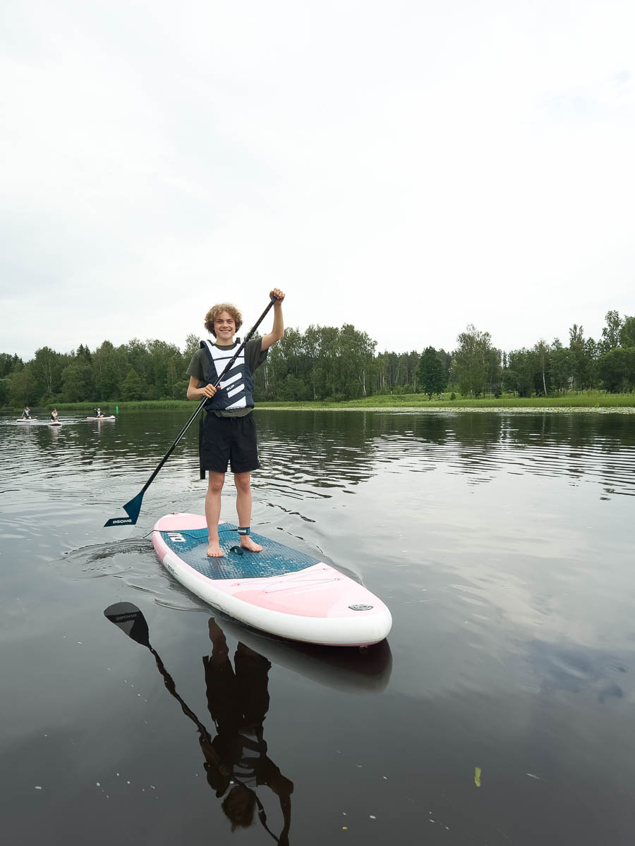
In the evening we went paddleboarding. Or “SUP riding”, which in Estonian sounds identical to “soup riding”.
There were heavy showers earlier in the day and heavy clouds even now; even some warnings of thunder. Thunder would have forced us to cancel; heavy rain would have been unpleasant. In the end we were lucky to get neither.
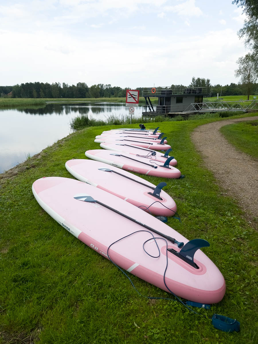
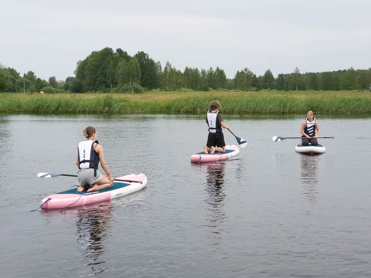
We had a safety and technique lecture on the shore, and then we were allowed on the boards and the water. Initially we were all wobbly and stayed on our knees, while swarming in the little bay we started in.
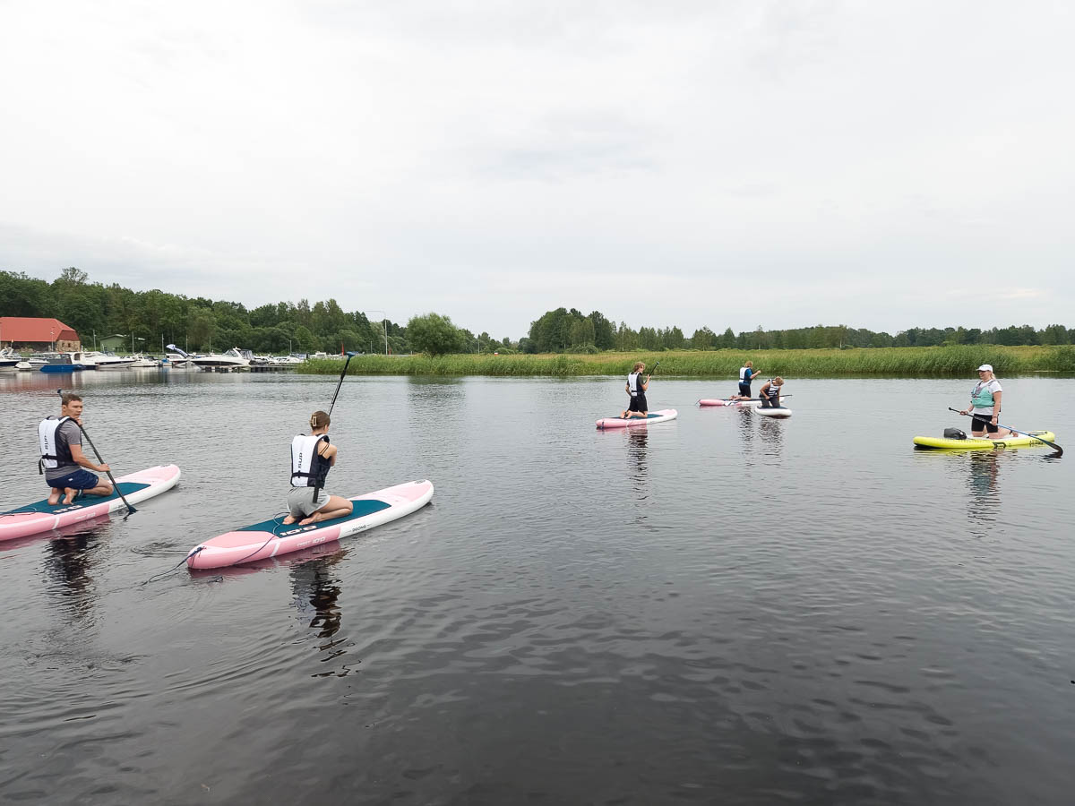
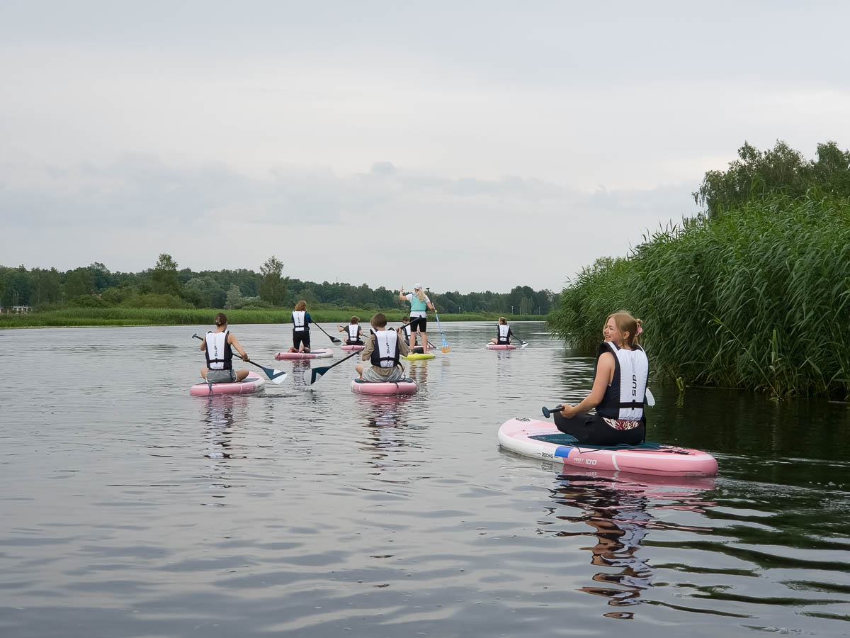
We left the bay and started paddling our way up the Emajõgi river. When we had worked up a little bit of speed, it didn’t take long for us to find our balance and stand up, like the name suggests you’re supposed to. It took longer for the knees and legs to stop shaking slightly from all the balancing that was going on.
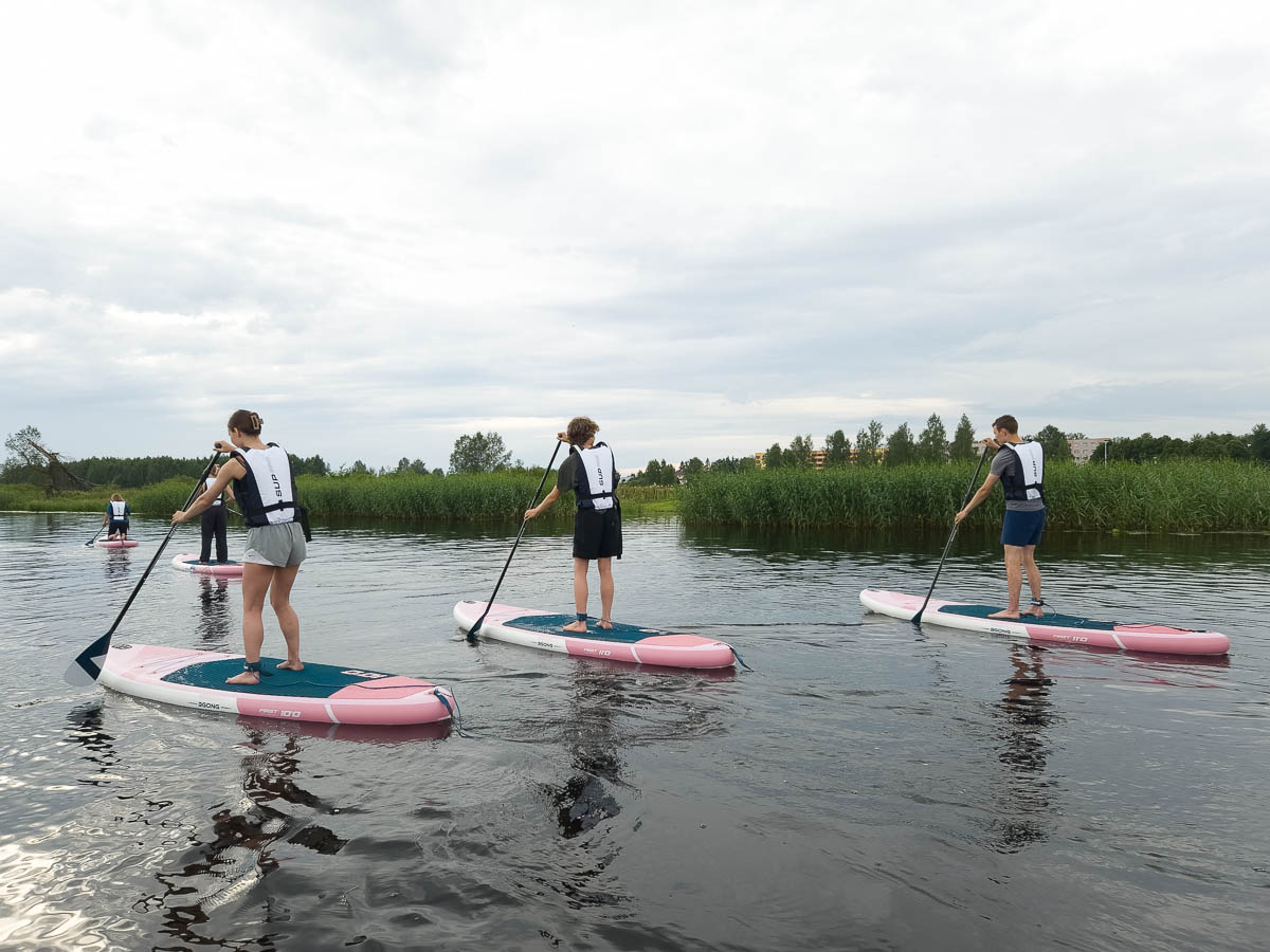
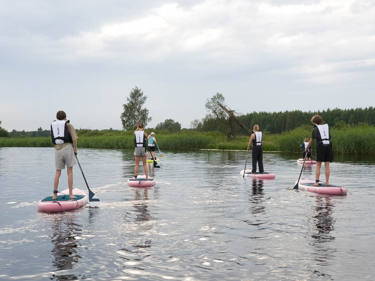
The stand-up paddling was OK, but most of us concluded after a while that the standing-up part was rather unnecessary. You get much more leverage and control when you’re closer to the water. Canoes just make sense. Some of us went back to kneeling; many sat cross-legged.
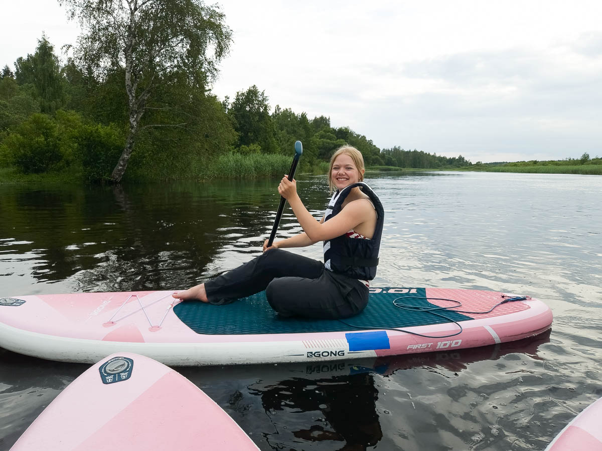
I was all set to be camera-less during this activity, but the life jackets turned out to have a zippered chest pocket which fit my phone, and I had a little waterproof bag that also fit my phone, so I could take photos after all. I struggle to get the exposure right on the phone – in many non-standard lighting situations the photos come out way too dark and I need to adjust them a lot afterwards. But I’m glad I have these.
| « Older posts | Newer posts » |